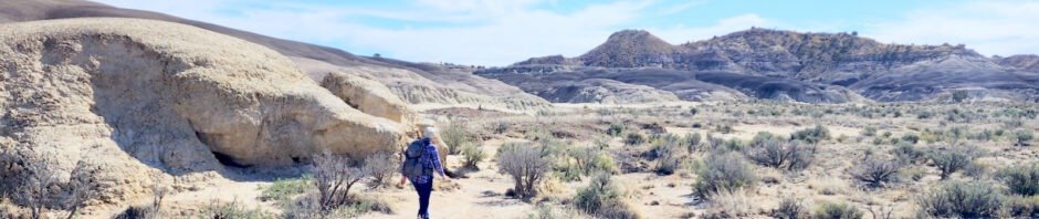
This is the time of year to get out into the open plains, when the temperatures are moderate. After a driveabout the week before into the San Juan Badlands south and west of Cuba, we returned this week with sufficient time to walk among the varied geologic features of the west side of Mesa Penistaja.
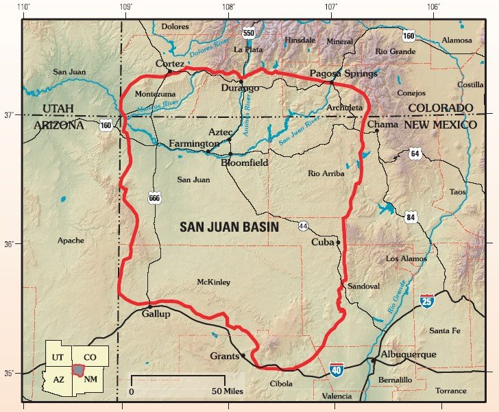 The San Juan Basin covers the northwest quarter of New Mexico and a portion of Colorado along the NM-CO border. There are -many- Badlands including the Ojito (near San Ysido), San Jose (north of Cuba), and going west Lybrook, Bisti/De-Na-Zin, Ah-Shi-Sle-Pah, and several others (see the map at American Southwest).
Plus these five south and west of Cuba: Mesa de Cuba, Mesa Chijuilla, Mesa Penistaja, Ceja Pelon, and Cejita Blanca Mesa.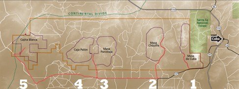 A closeup map of the first 4 of the 5 Cuba Badlands.
The Drive In
US 550 to Cuba, but -at the entrance- to the town turn left onto NM 197. Continue south along the east of the very large Mesa de Cuba (one of the badlands) – the scenery as one reaches the end of Mesa de Cuba is quite interesting. Continue for 9.2 miles from US 550 to where NM 197 takes a sharp turn to the left. Midway around this turn take the road to the right (known as Valle San Ysidro); it is a well used (and graded) dirt road. Continue for 7.2 miles, then turn right onto another graded dirt road (not as well maintained as Valle San Ysidro, but suitable for “city vehicles); continue for 2.2 miles. For this walkabout we parked in an open area just beyond a cattle guard/fence line.
Side Note: On the way out after our walkabout, we explored other roads that go north from the main dirt road. We wanted to get more acquainted with the layout of these Badlands and routes to access the others (Mesa Chijuilla and Mesa de Cuba). We will return – as one can see on GoogleEarth check out the links below: “… Driveout” in the Statistics section and the Related Posts, there is much more to see.
The Hike
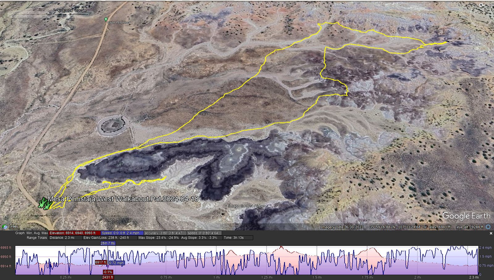
Mesa Penistaja West Walkabout.Pat.2024-04-18
Notes about the Google Earth screenshot: the graph at the bottom shows elevation of the track (pink area) and speed (the blue line).
Highlight
To see the geology, exposed as it in these Badlands, is most fascinating. There are the various colors and textures of the surface: charcoal black, gypsum-like white, browns, tans, some with a hint of red, even pockets of yellow. And there are so many interesting rocks – petrified wood in abundance, dark brown egg-shaped rocks (large globs that have cracked open), and then there is the petrified wood: small slivers, larger sections of a tree’s trunk, many colors and textures, and ….. There is so many interesting things on the ground that it takes a conscious effort to look up, to look around at the terrain let alone the views of mesas nearby.
Statistics
Total Distance: 2.3 miles
Elevation: 6,919 start ft, maximum 6,993 ft, minimum 6,914 ft
Gross gain: 79 ft. Aggregate ascending 238 ft, descending 240 ft
Maximum slope: 23% ascending, 25% descending, 3.3% average
Duration: 3:13 , Average Speed: 0.8 mph
| GPS Track Files for Download | |
156 Downloads | |
|---|---|
141 Downloads | |
140 Downloads | |
130 Downloads | |
If you haven’t explored these hiking tracks with Google Earth, I urge you to try it. With the virtual 3-dimensional presentation, achieved by panning and tilting the view, you can get a much better idea of the hikes and terrain than you can get from the screenshot above. For some ideas, check out Using Google Earth Track Files.
Related Posts
Mesa Penistaja Hikes:
11/09/2014 Mesa de Cuba & Penistaja Driveabout
11/30/2015 Mesa Penistaja East
04/07/2018 Mesa Penistaja West
04/22/2018 Mesa Penistaja West
All San Juan Basin hikes
References and Resources
New Mexico Magazine: Badlands Walkabout
The American Southwest: San Juan Basin Badlands
PhotoTrekNM: San Juan Basin Badlands
AllTrails: Penistaja Mesa


