Returning to hikes we enjoyed in years past, this day to Paliza Canyon and the Goblin Colony in the Jemez Mountains
The Drive In
Driving towards the Jemez Mountains is always pleasant. The scenery heading west on US 550 gets better as White Mesa comes into view on the left, and the red cliffs of Mesa Cuchilla west of San Ysidro and the Jemez River come into view. Then the drive north on NM 4 adds more scenery as one passes through the Jemez Pueblo (Obey the Speed Limits – the Pueblo police “give no quarter”.)
No more than half a mile from leaving the Pueblo, turn right onto NM 290, continue pasts the Ponderosa Valley Vineyards and Winery, through the sparse village of Ponderosa, past the lake providing irrigation water to the Pueblo, and onto FR 10 (where the road changes to gravel). In another 2.5 miles or so is the Paliza Campground (not open yet, but a really nice campground). Turn left across the bridge over Paliza Creek and park at the junction of FR 10, FR 266, and FR 271, about .4 mile from the entrance to the Campground.
This time of year the drive is particularly beautiful. The cottonwood trees are thick along the Jemez River and Vallecito Creek all the way up through the lower Paliza Canyon to the Paliza Family Campground. And they were in their full golden glory with their golden leaves and dark, sinewy trunks and limbs. They are as beautiful as the aspens we saw on our recent trip to Chama.
Jay here: Always a treat to wander (and wonder) the Goblin Colony. Really, it never gets old if you stop and think about the natural forces of heat and cooling due to volcanic activity that happened who knows when.
The Hike
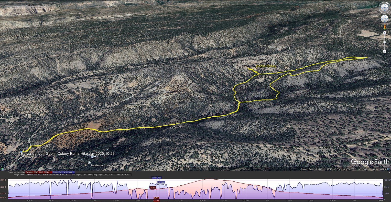
Paliza Canyon-Goblin Colony-Ruins Hike.Jay.2025-10-29<br>Notes about the Google Earth screenshot: the graph at the bottom shows elevation of the track (pink area) and speed (the blue line).

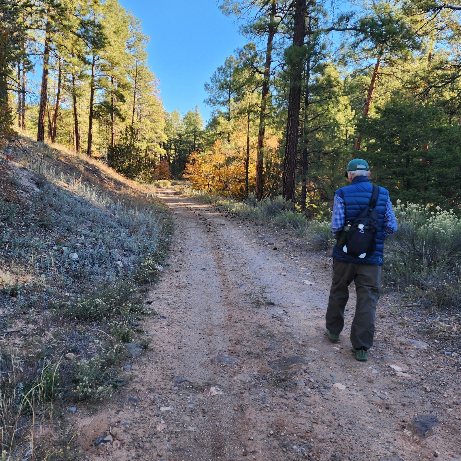
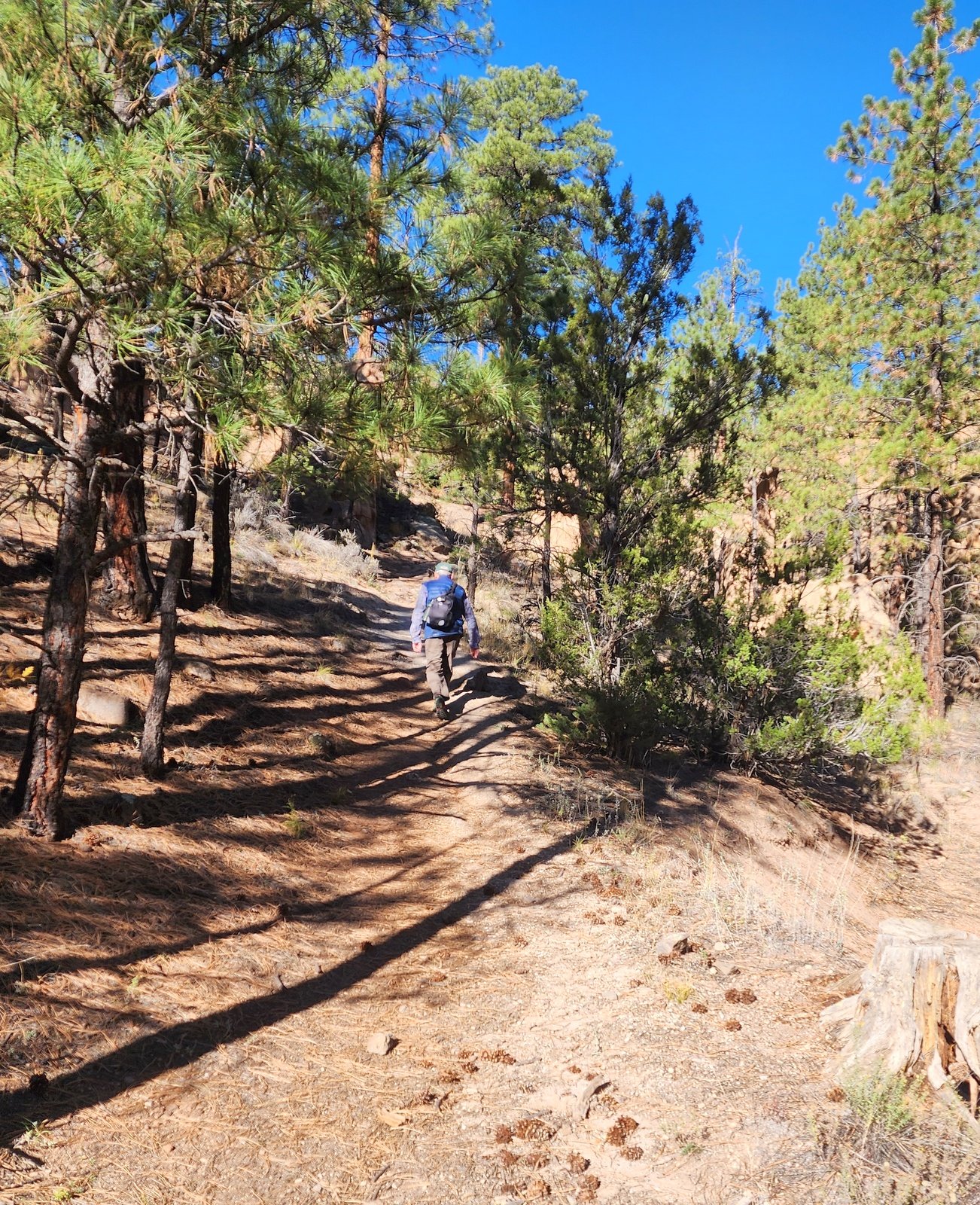
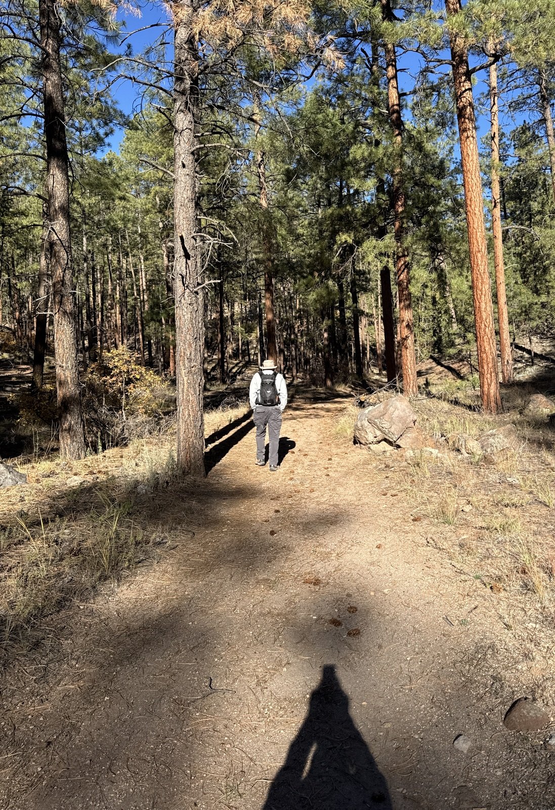
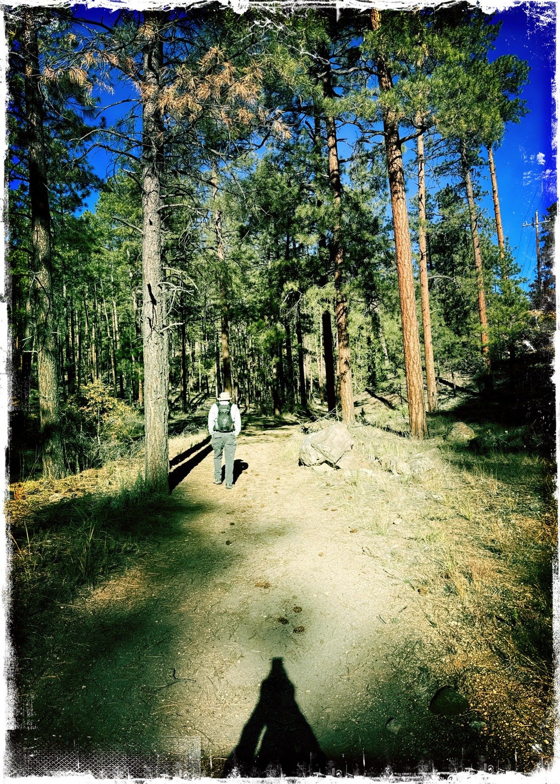
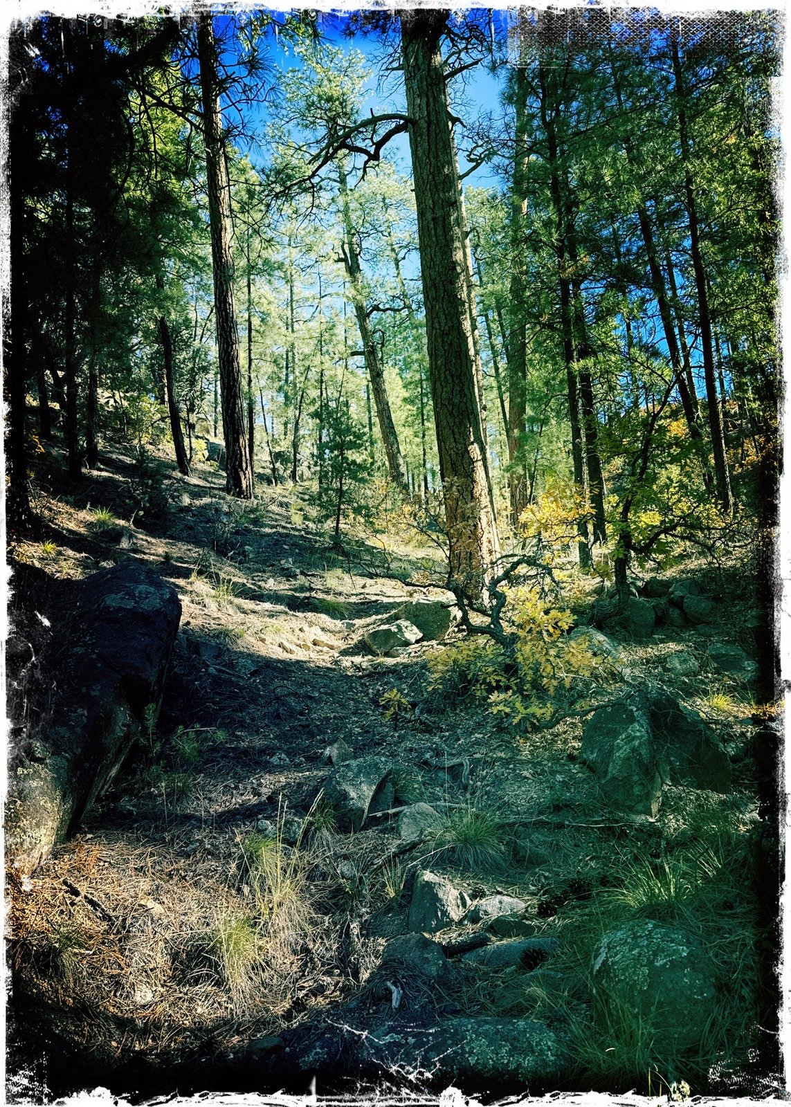
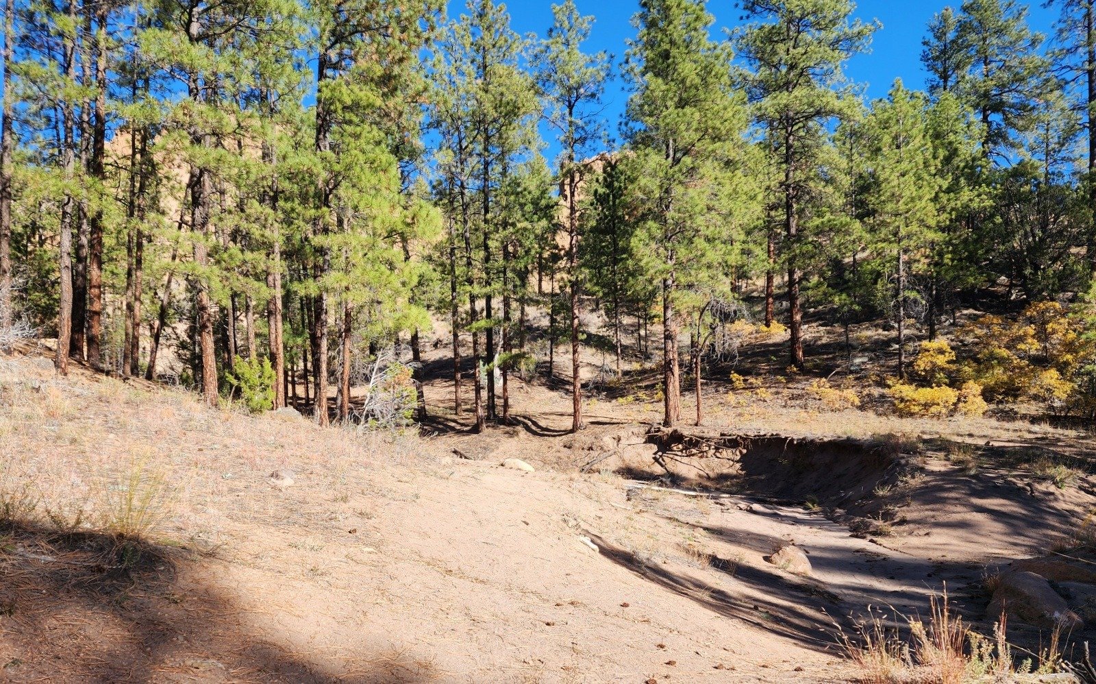 From the parking area, the trail begins with a short uphill stretch of an old, seriously washed out two-track. It soon becomes a more typical two-track with a gentle incline which makes for easy walking. At .94 mile on, we made note a side canyon coming in from the right, with a fence, missing gate, and signboard. That that is >the< Paliza Canyon, but for Goblin Colony we continued ahead still on a tow-track.
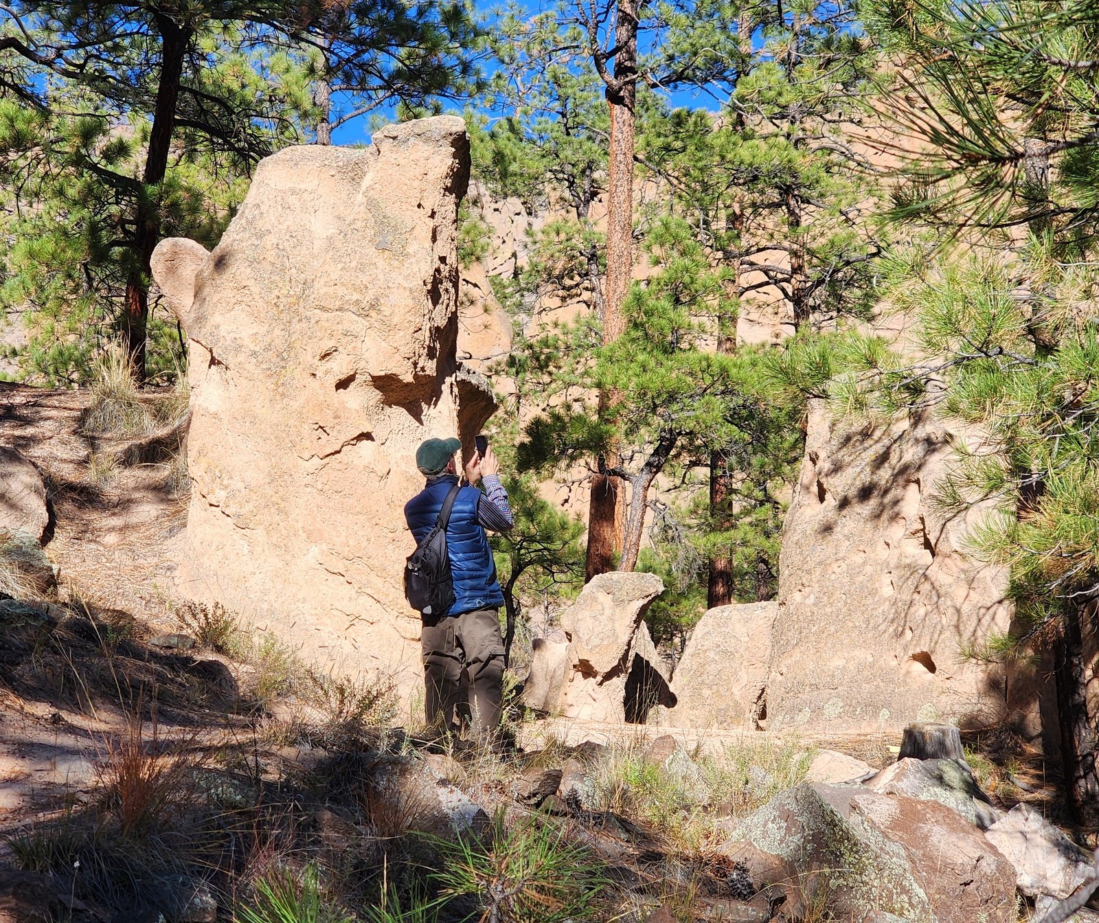
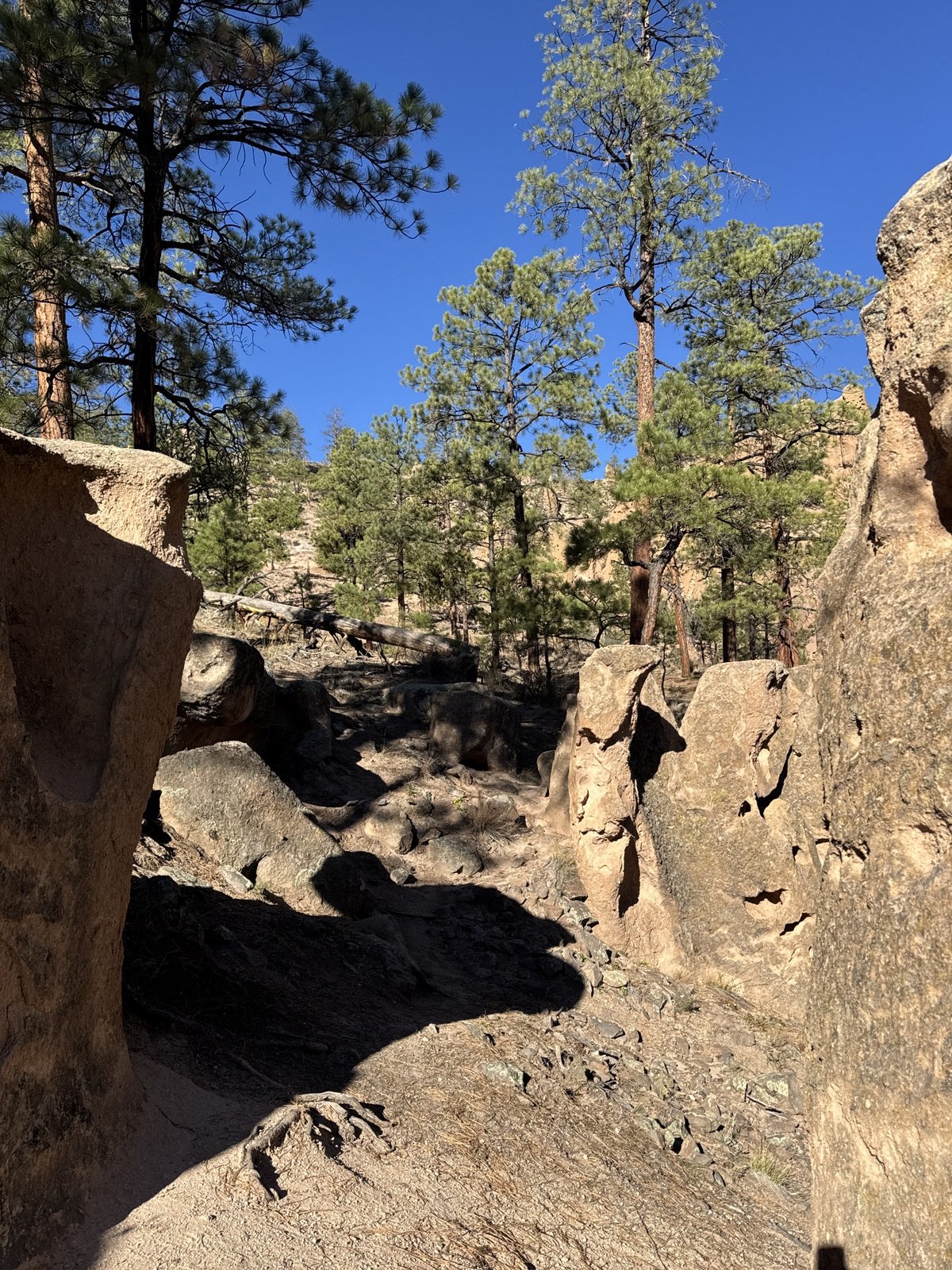
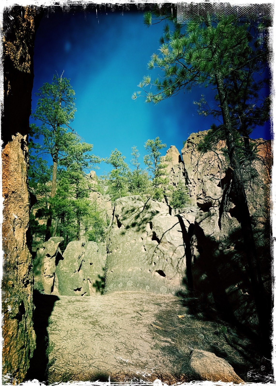
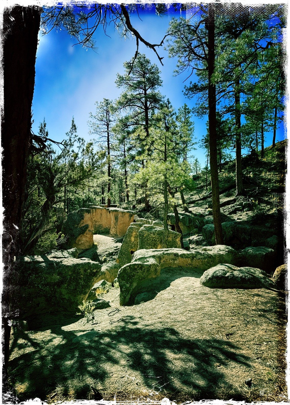
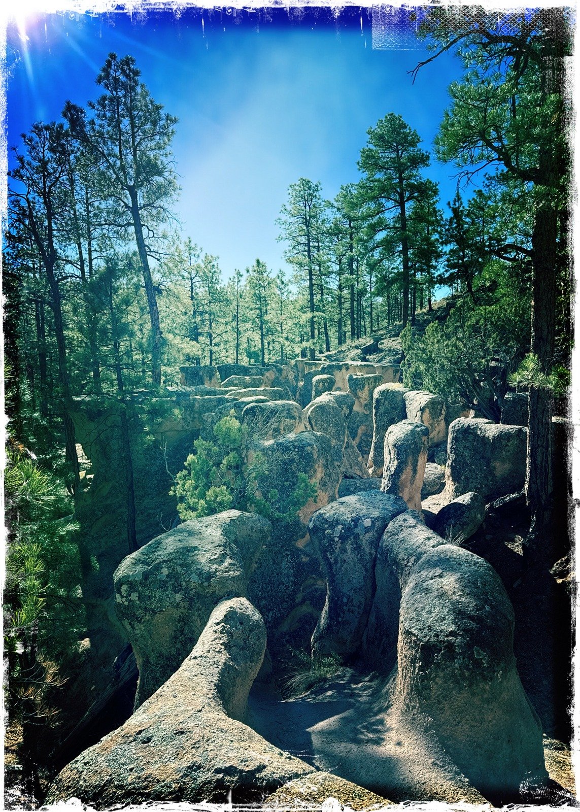
Just short of a half-mile further (1.39 miles from parking) we could see  through the trees the entrance to the Colony. Heading toward them, a bit uphill, in 60 yards were at the edge of the Colony.
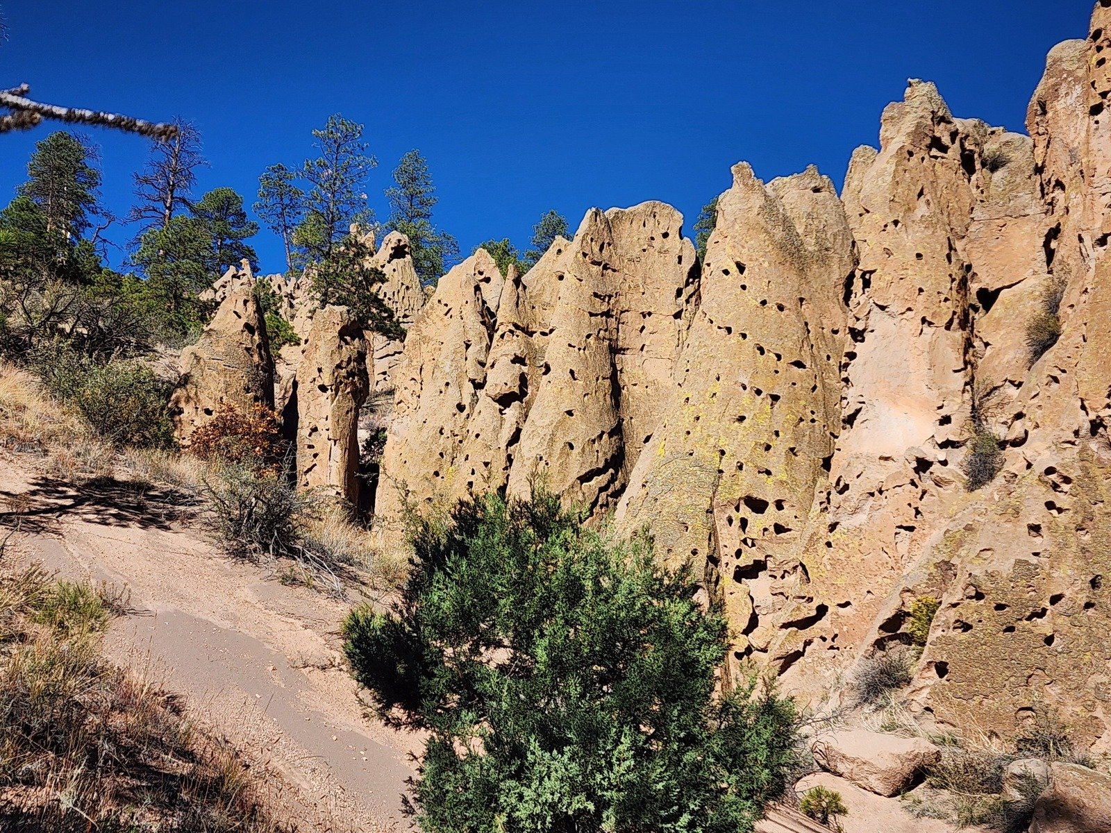
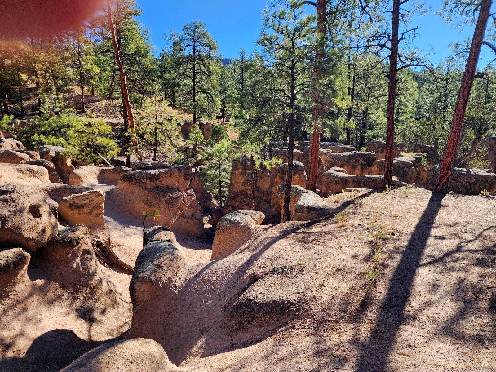
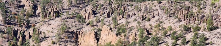
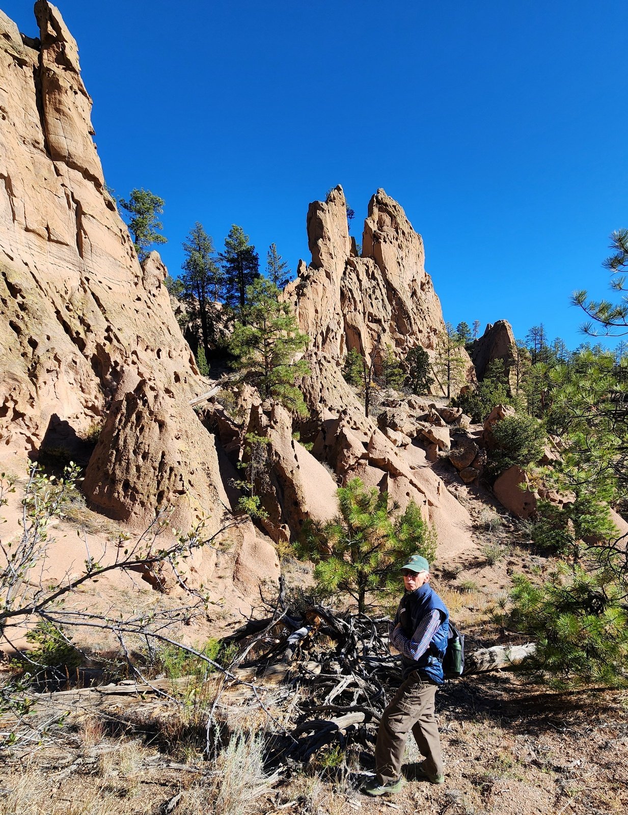
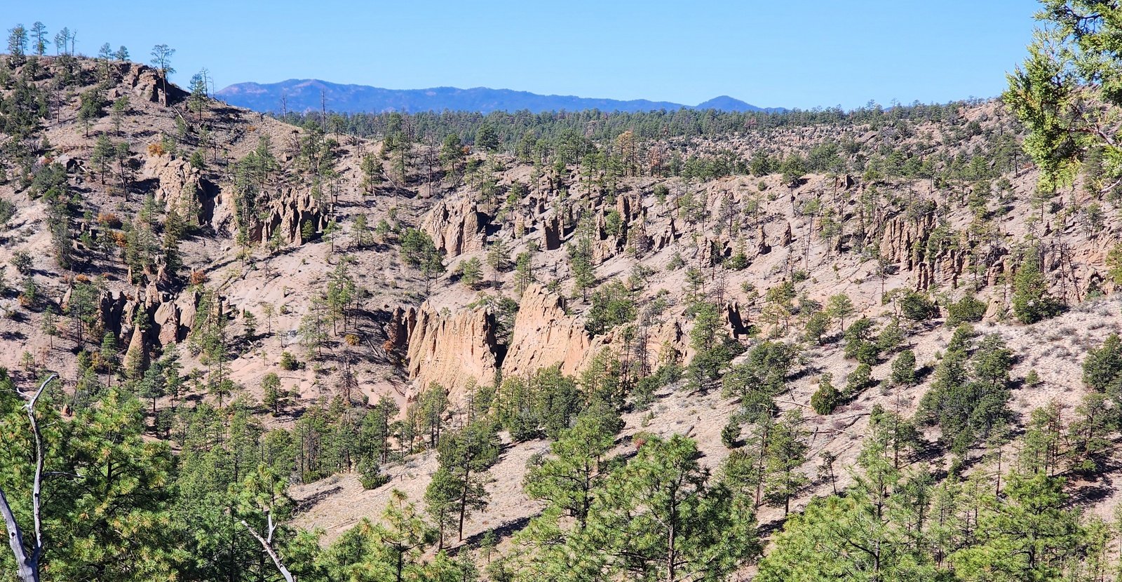
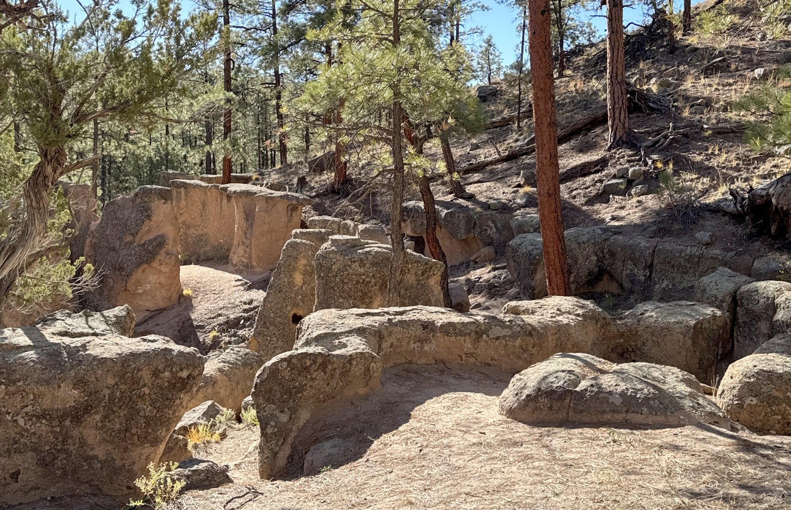
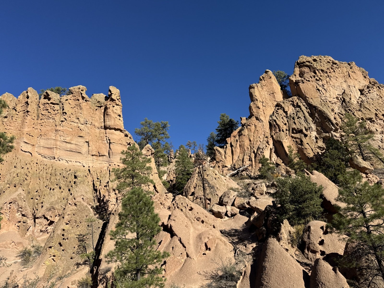
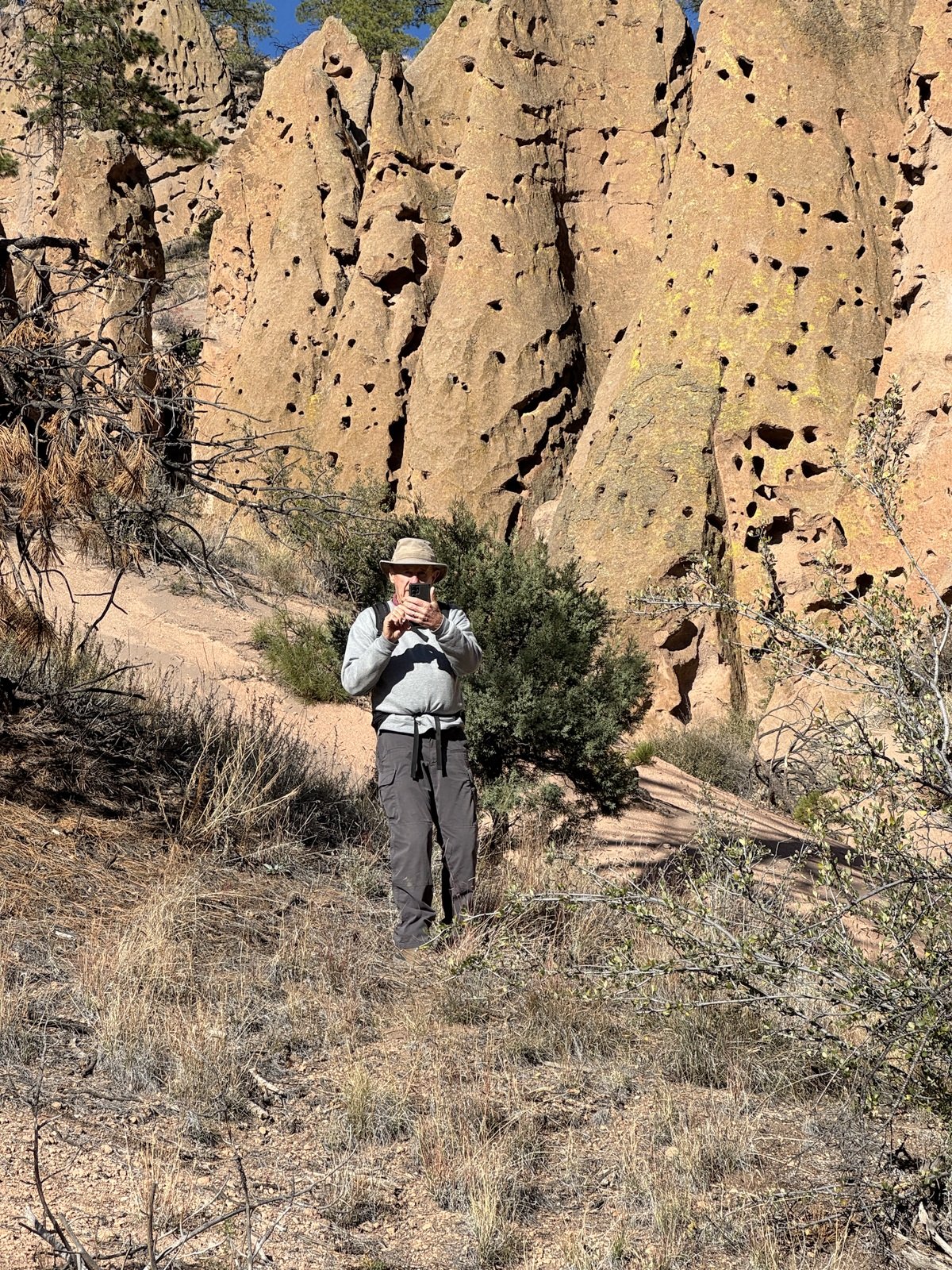
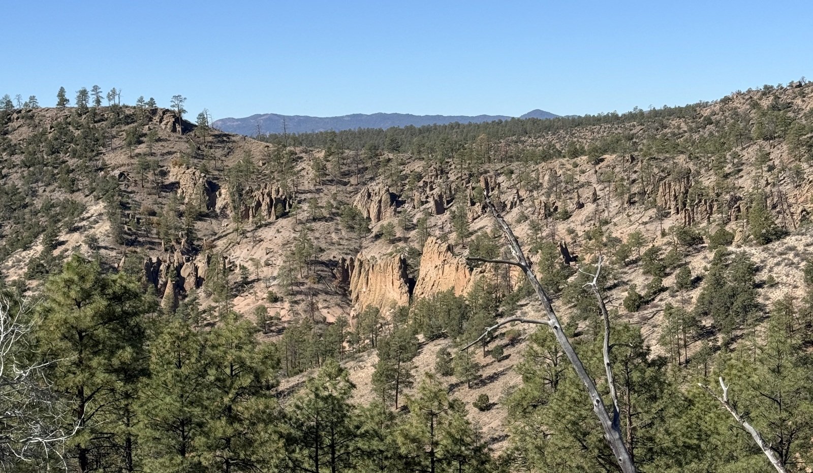
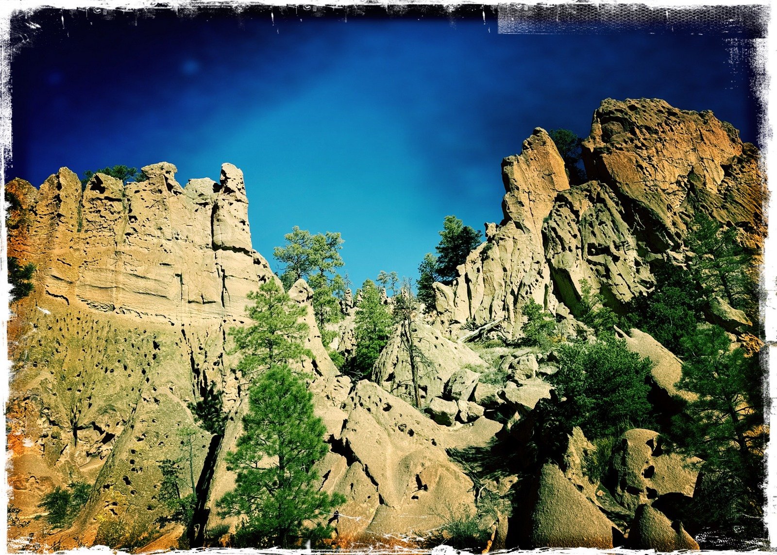
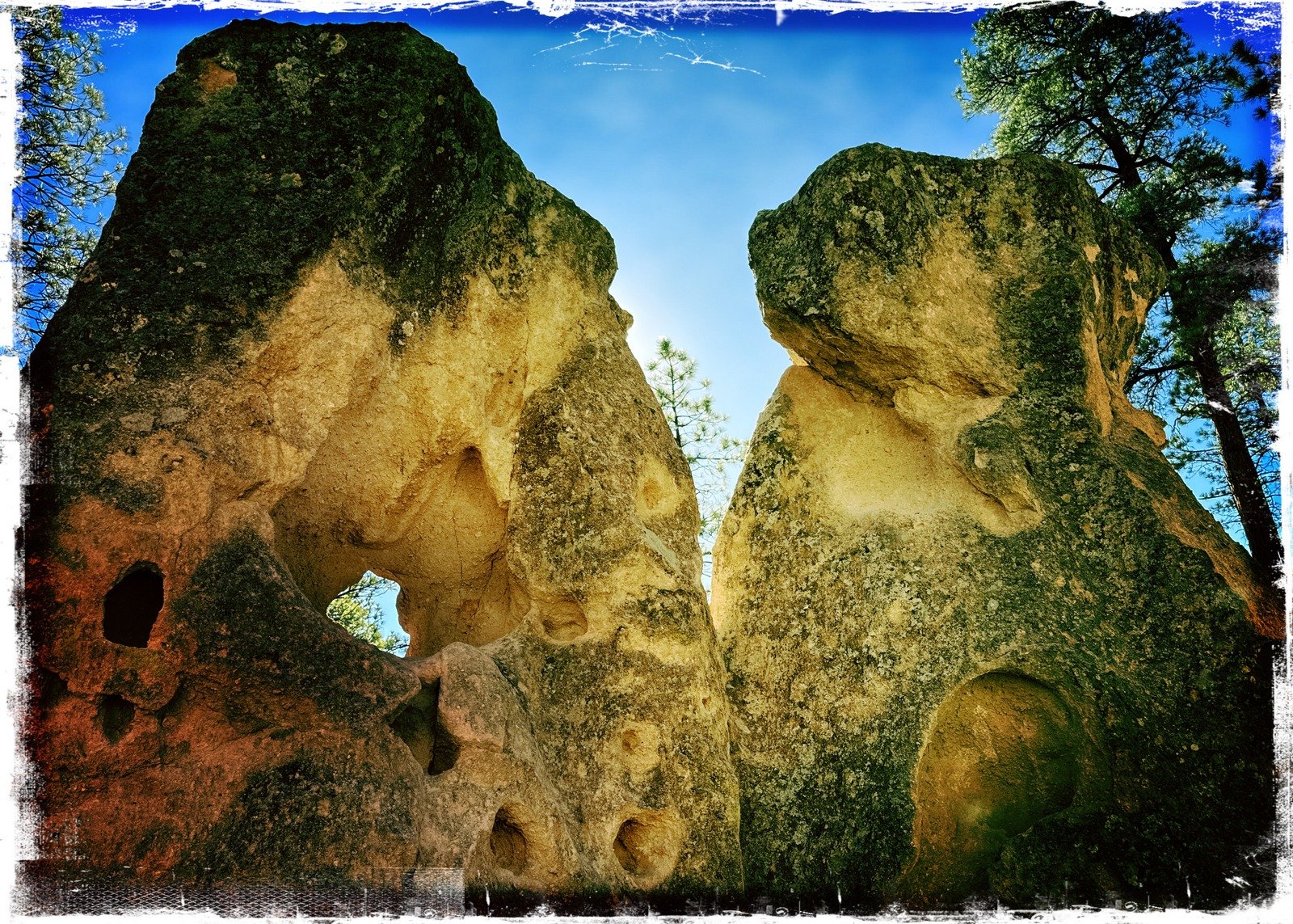
We’ve been here before, but … this place is so amazing that we still stood in awe at the rock formations: their size, their shapes, the pock-marked surface full of holes left by air bubbles when they were formed. And in one area a maze was formed by 10-20 foot tall columns.
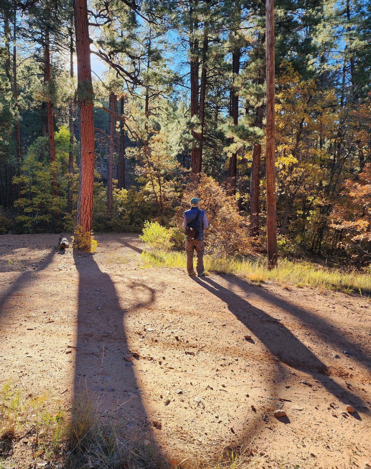
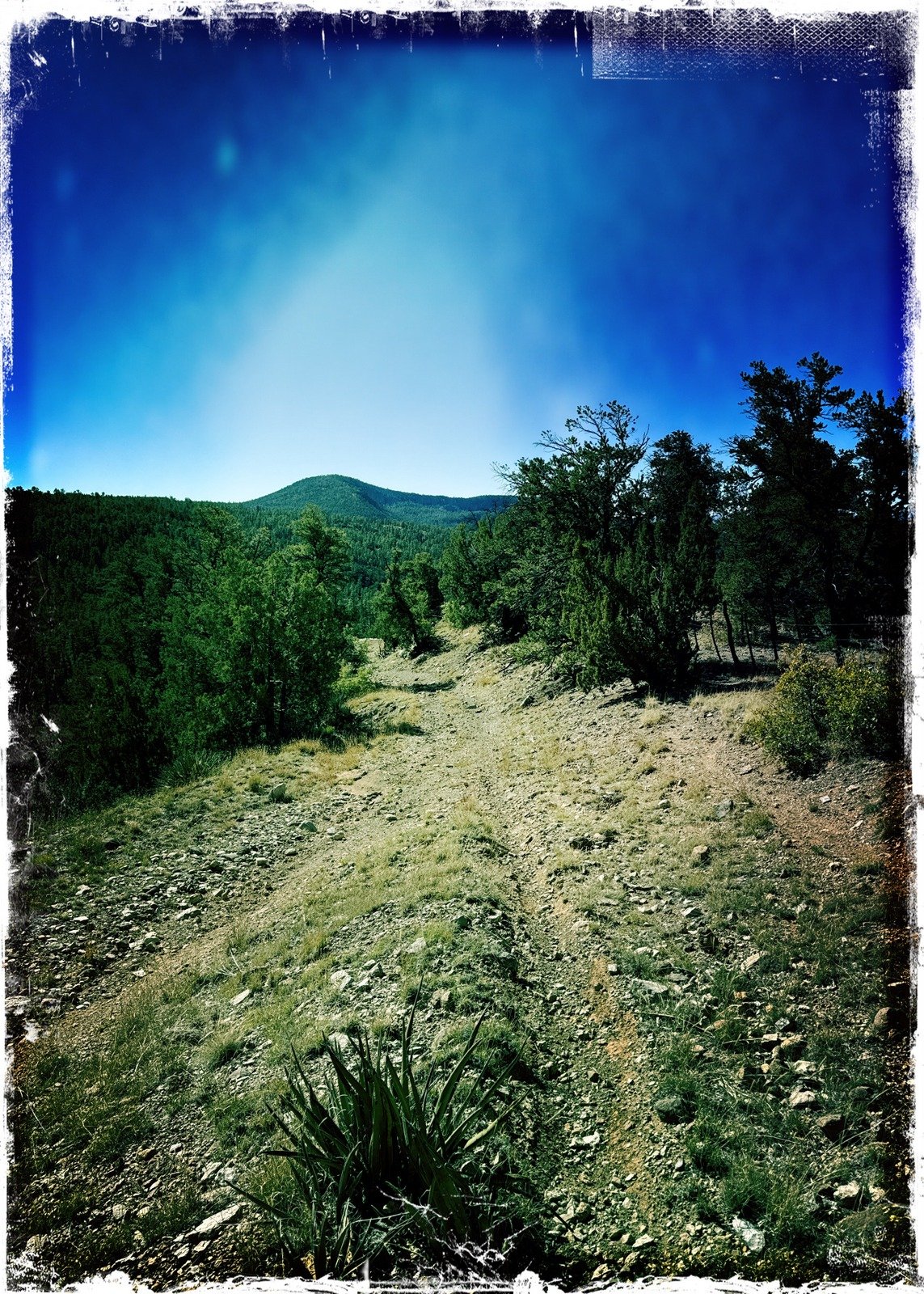
From the Colony, we went exploring by continuing up this “Goblin Colony Canyon”, following a sketch that I made on GAIA GPS to the ridge above it to the east, crossing over into Paliza Canyon and down to parking. I had also made note from previous tracks that we could visit the ruins on that ridge. The hike up the canyon was initially on a old two track – easy going. About .3 mile from the Colony, we came to a hairpin turn to the right, which with GAIA we determined it was a switchback on the way up to the top of the ridge.
I had my sights set on continuing up this canyon, even if it meant bushwhacking.
Highlight
Statistics
Total Distance: 4.34 miles
Elevation: start 6,849 ft, maximum 7,564 ft, minimum 8,848 ft
Gross gain: 716 ft. Aggregate ascending 984 ft, descending 984 ft
Maximum slope: 27% ascending, 29% descending, 7.2% average
Duration: 3:04, Average Speed: 1.4 mph, Shade: 60%
| GPS Track Files for Download | |
85 Downloads | |
|---|---|
69 Downloads | |
| Link to GAIA GPS: “Paliza Canyon-Goblin Colony-Ruins Hike” | |
| If you haven’t explored these hiking tracks with Google Earth, give it a try. With the virtual 3-dimensional presentation, achieved by panning and tilting the view, you can get good idea of the hike and the terrain. For some ideas, check out Using Google Earth Track Files. | |
Related Posts
Past hikes to Goblin Colony
Past hikes to Paliza Canyon
References and Resources
AllTrails: Paliza Goblin Colony
Paliza Canyon
ASCHG: Paliza Canyon – Goblin Colony Hike
Beerhiker: Goblin Colony Hike
TrailGroove: A New Mexican Oddity: Hiking to the Paliza Goblin Colony
Judith Baumann: Paliza Canyon Goblin Colony, January 18, New Mexico
Norm Arnold Photography: Paliza Canyon – Goblin Colony
*** Santa Fe New Mexican: A unique New Mexico wonder: ….
*** Sandia Mountain Natural History Center: Paliza Goblin Colony (video)
Photos


Views to date: 304 views.