This was foremost a reconnoitering trip to San Pedro Parks to check out the two campgrounds for an upcoming 3-day trip. And while there, we took advantage of the cooler temperatures to do a bit of hiking — temperatures at 9,200+ feet that are cooler than in Albuquerque.
The Drive In
The drive to San Pedro Parks: from Bernalillo: US 550 to Cuba; in the middle of town turn right onto NM 126, continue for 10 miles; turn left onto FR 70, continue for 9.9 miles; trailhead parking will be on your left. NM 126 is paved the whole distance; FR 70 is a Class 3 road with some hillside sections; a couple of slick sections on our way back to NM 126 after the showers that occurred during our hike.
Note: We checked out both of the Forest Service campgrounds: Clear Creek and Rio de las Vacas. They are just off of NM 126 beyond the turnoff for FR 70, .8 miles and 2 miles respectively. Each are very clean with paved roads within the campgrounds and paved parking on all the sites. And each has a stream running along a border (namesakes of the campgrounds).
The Hike
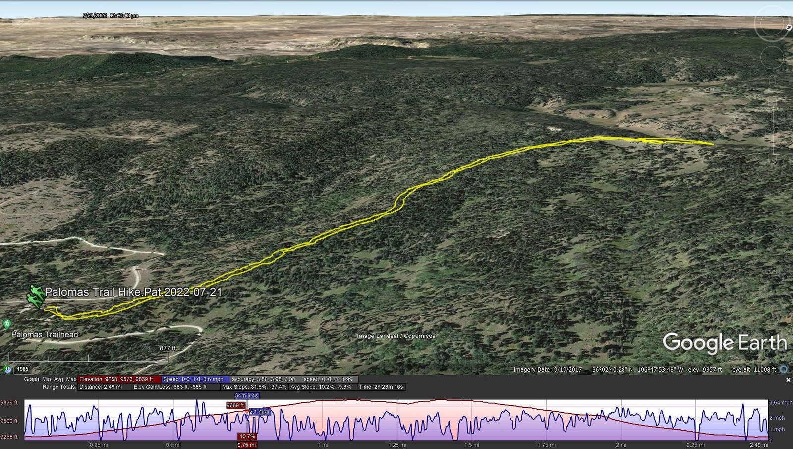
Palomas Trail Hike.Pat.2022-07-21
Notes about the Google Earth screenshot: the graph at the bottom shows elevation of the track (pink area) and speed (the blue line).
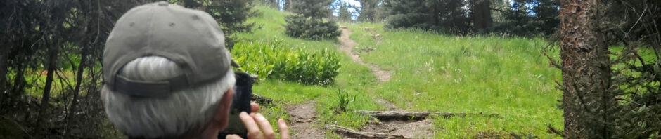
 The trail gets moderate use so it is easy to follow. The surface is dirt with only a few sections with rocks or tree roots; mimimal downfall. For our hike it made a steady climb from 9,258 ft to 9,839 feet; a few hundred yards into the hike we got a glimpse of a handful of elk passing across the trail ahead of us.
Reaching the top of the ridge, we chose to find a spot for lunch with a good view and seating accommodations (rocks on a slope). We did enjoy the view of the open forest around us and views to the east through breaks in the trees of the mountains around Valles Caldera including Redondo. Had we continued on the trail descended 200 feet into the valley for the Rito de las Perchas. However, we decided to return to the traihead for the 2 1/2 hour drive home. There were rain showers in the area during our hike (tho’ we did not get wet); on the way back to NM 126, the well-gravelled road was in ok condition except one section of say 100 yards that was a bit slick.
Note: Trails criss-cross San Pedro Parks. The Palomas Trail is one of two entrance trails off of NM 126 that go into the interior. Check GAIA or other resources for maps of these trails. With the network of trails, the Park is an ideal locale for short backpacking trips or longer day trips.
Statistics
Total Distance: 2.49 miles
Elevation: start 9,264 ft, maximum 9,839 ft, minimum 9,258 ft
Gross gain: 580 ft. Aggregate ascending 683 ft, descending 685 ft
Maximum slope: 32% ascending, 37% descending, 10.0% average
Duration: 2:28
| GPS Track Files for Download | |
181 Downloads | |
|---|---|
219 Downloads | |
164 Downloads | |
157 Downloads | |
If you haven’t explored these hiking tracks with Google Earth, I urge you to try it. With the virtual 3-dimensional presentation, achieved by panning and tilting the view, you can get a much better idea of the hikes and terrain than you can get from the screenshot above. For some ideas, check out Using Google Earth Track Files.
Related Posts
References and Resources
USDA Forest Service: Palomas Trail #50
AllTrails: Palomas Trail
Hiking Trails of the Oachitas & Ozarks: San Pedro Parks Wilderness


