This was a road trip combined with a hike in Northern New Mexico. The road trip component was to drive around the perimeter of the Jemez Mountains – San Ysidro, Cuba, Regina, Abiquiú , Española , Santa Fe, and return to Albuquerque. For the hike component, we intended to visit the Nogales Cliff House, ruins of the Gallina people dating from 1100 AD to about 1275 AD.
The Expedition
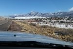
On our way towards Cuba, we enjoyed beautiful scenery – snow from the night before highlighting the Nasciemento Mountains all along US 550 to Cuba. We thought this might not bode well for the intended visit to Nogales Cliff House. Sure enough, after a pleasant drive out of Cuba on NM 96 and NM 112, we found that the dirt road, County Road 5, was still wet from the snow. We gave it a try, but found ourselves nearly stuck in the super-slick wet clay. It was time to back out and find a Plan B for hiking.
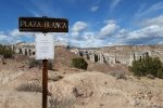
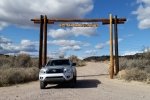
Back to NM 96, then east towards Abiquiú , looking for a place we might hike – nothing. Then north on US 84 to Ghost Ranch, but we weren’t attracted that day. While enjoying our mid-expedition break overlooking Abiquiú Lake, it occurred to us – return to Plaza Blanca. Plaza Blanca is a bit hard to find – no signs point the way. About 3 miles east of the village of Abiquiú, turn north from US 84 onto NM 554. After crossing the river, turn left on County Road 155, follow the road to the entrance to Dar al Islam.
The Hike
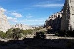
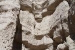
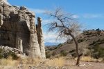
Parking is about .6 miles from County Road 155; you will enjoy some amazing geologic features. So that became our hike.
From there, we headed to Española and El Parasol for really good tacos. Then on towards home, having enjoyed a very nice day in the Land of Enchantment. 
Statistics
Total Distance: 1.66 miles
Elevation: start 6,096 ft, maximum 6,214 ft, minimum 6,049 ft
Gross gain: 265 ft. Aggregate ascending 391 ft, descending 391 ft
Maximum slope: 56% ascending, 54% descending, 7.7% average
Duration: 1:13
| GPS Track Files for Download | |
218 Downloads |
|
|---|---|
155 Downloads |
|
I urge you to explore our hiking tracks with Google Earth. With the virtual 3-dimensional presentation, achieved by panning and tilting the view, you can get a much better idea of the hikes and terrain than you can get from the 2-dimensional screenshot above. For assistance: Using Google Earth Track Files.
Related Posts
Nogales Cliff House Trail Hike – 11/19/2020
Rattlesnake Ridge Trail Hike – 11/19/2020
Plaza Blanca Hike – 3/15/2017
References
AllTrails: Plaza Blanca: Rio Negro Badlands
Trip Advisor: Plaza Blanca
Boarding Pass: Hiking at Plaza Blanca in New Mexico
Narcity: You Can Climb Through Massive White Rock ….


