After spending time in the Jemez Mountains last week, and seeing the colors of autumn begin to appear, we were attracted to return to the Rio Mora. Another inducement: our hike in May was foreshortened because of the high water around a river-side outcropping prevented us from going further (without wading in the swift-flowing water).
The Drive In
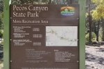
I-25 east from Santa Fe to Glorieta, then NM 50 to the village of Pecos (6 miles). Turn left onto NM 63 to the old mining camp of Tererro (13.5 miles). From here the road becomes more of a forest road (‘tho paved and still NM 63); it is narrow and winds a lot. About a mile on you will pass the now-inoperative Tererro Mine. From Tererro the trailhead is at the Mora Campground/Mora Recreation Area (part of the Pecos CanyonState Park, also known as the Pecos Complex Wildlife Areas).
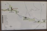
Note: The Campground/Recreation Area was closed when we visited; as I write this it is open only Thursday thru Sunday. We parked off the road outside the Campground; while we were hiking a kind person left a note, sort of a warning that the area is not open and we maybe shouldn’t park there. The ENMRD web site advises that Day Use are open daily; the Park Map (PDF) shows North Mora fishing area about 400 yards north of the Mora Campground, so that may be an alternative for parking.
The Hike

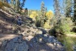
 We were greeted with a most colorful and serene scene, the campground with the yellow colors of fallen leaves against the gray tree trunks and the green of ponderosa pine. And above us, the true blue of New Mexico’s skies.
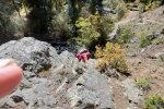
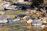
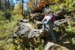
 We passed through the campground and continued on an old two-track which soon turned into a well-used trail. To our right the Rio Mora burbled along, plenty of water even this late in the season. Not quite a half mile into the hike we encountered our first of 3 “rock crawls”, an outcropping at the very edge of the river – the only way forward was to crawl over the rock.
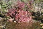
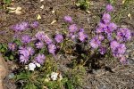
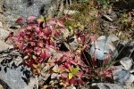
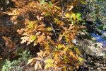
 So it went, a pleasant trail along the river, another rock crawl, meandering through wide areas in the river bottom among willows, scrub oak, river maple, and many kinds of ground cover. Some plants were already showing their autumn colors;
  certainly there will be more to come. We encountered two more “rock crawls”, plus a “log crawl”, getting over a large tree trunk, resting at a very steep angle into the river, that we had to get over.
At 1.6 miles we took our mid-hike break in a very pleasant alcove along the river. Of course, on the return we faced the same “rock and log crawls”, but this time with a bit more confidence arising from experience.
Highlight
New Mexico offers the most amazing array of colors. Perhaps the colors stand out because they are not overwhelmed by so much green, as exists in places where there is more rain and fertile soils. Even this late in the season, flowers abound to brighten the views. As autumn is approaching, leaves are turning colors, on the trees, vines, and other plants. And no doubt the clear air, without the haze of humidity or pollutants, contributes to the colorful scenery. And often the background, such as rocks, further enhances the beauty.
Statistics
Total Distance: 3.3 miles
Elevation: start 7,908 ft, maximum 8,103 ft, minimum 7,907 ft
Gross gain: 196 ft. Aggregate ascending 946 ft, descending 943 ft
Maximum slope: 35% ascending, 34% descending, 07.5% average
Duration: 4:26
| GPS Track Files for Download | |
231 Downloads |
|
|---|---|
297 Downloads |
|
I urge you to explore our hiking tracks with Google Earth. With the virtual 3-dimensional presentation, achieved by panning and tilting the view, you can get a much better idea of the hikes and terrain than you can get from the 2-dimensional screenshot above. For assistance: Using Google Earth Track Files.
Previous Posts
References and Resources
New Mexico State Parks: Pecos Canyon State Park
ReserveAmerica: Pecos Canyon State Park, NM
ExplorNM: Mora (campground)
Stop Tererro Mine.org: Help Protect the Pecos


