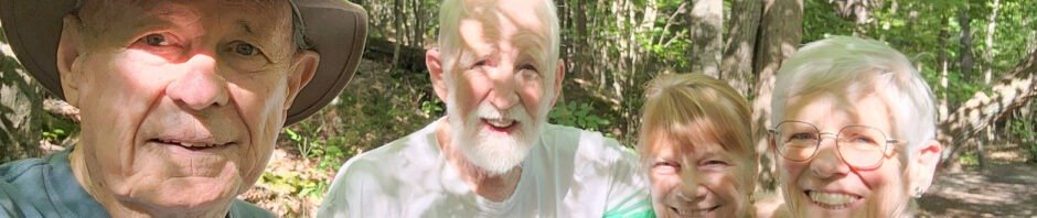
Visiting Pat’s brother Steve and wife Sharon, they took us to one of their favorite places for a Walkabout.
The Drive In
I’m not one to give you directions around Wake Forest, so … check with GoogleEarth: “Sanford Creek Greenway”, or download a link below and let GoogleEarth (.kml) or your favorite mapping program (.gpx or .kml) give you guidance.
The Hike
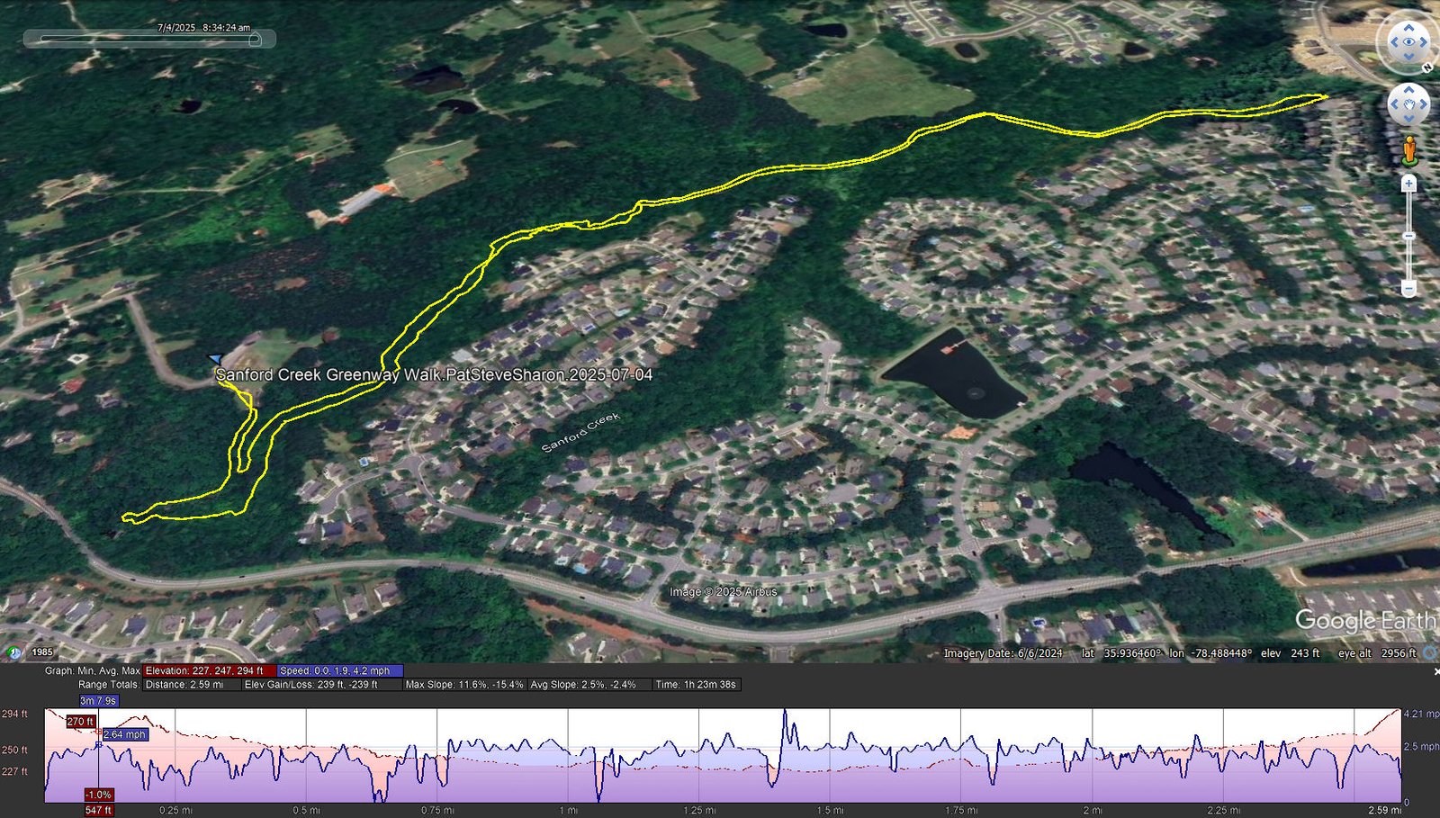
Sanford Creek Greenway Walk.PatSteveSharon.2025-07-04
Notes about the Google Earth screenshot: the graph at the bottom shows elevation of the track (pink area) and speed (the blue line).
A most pleasant walk along a flowing stream through open forest.
Statistics
Total Distance: 2.59 miles
Elevation: start 294 ft, maximum 294 ft, minimum 227 ft
Gross gain: 67 ft. Aggregate ascending 239 ft, descending 239 ft
Maximum slope: 12% ascending, 15% descending, 2.5% average
Duration: 1:24, Average Speed: 1.9 mph
| GPS Track Files for Download | |
128 Downloads | |
|---|---|
105 Downloads | |
| Link to GAIA GPS: “Sanford Creek Greenway Walk” | |
| If you haven’t explored these hiking tracks with Google Earth, give it a try. With the virtual 3-dimensional presentation, achieved by panning and tilting the view, you can get good idea of the hike and the terrain. For some ideas, check out Using Google Earth Track Files. | |
References and Resources
AllTrails: Sanford, Smith, and Dunn Creeks Greenway, North Carolina
Photos


Views to date: 6 views.