Monthly Archives: May 2018

Lybrook Badlands Walkabout – 05/13/2018

After visiting various places in the Ojito Wilderness, then working our way west into the area around Cuba – Mesa de Cuba WestMesa Penistaja, and Ceja Pelon Mesa, I came upon maps of  ‘all’ the badlands, extending all the way to the Chaco River (The American Southwest’s Map of the San Juan Basin Badlands and NM Magazine’s Badlands Walkabout). It only seemed reasonable to next check out Lybrook.  Talking with friends at the Albuquerque Downtown Growers Market, we decided to head out that way on a nice Sunday – before summer sets in here in New Mexico.

The Drive In

Tho’ others had taken a route that brought them in to Lybrook from the west, the maps showed a shorter route – entering from the east.  Well … it is a good road for most of the way, but as one enters the Badlands proper it becomes more challenging.  At mile 42.4 on the Lybrook Badlands DriveInOut track for Google Earth, the road goes down a -very steep- slope (we left the Badlands going out the west road). Otherwise, thanks to the oil and gas industry, the roads are quite good.

The Walkabouts

Lybrook Badlands Walkabout.PatKelleyPatB.2018-05-13

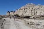
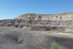
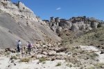
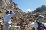
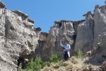
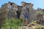
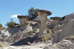
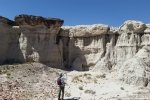
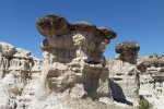
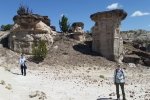
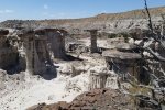
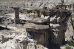
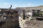
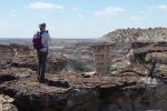
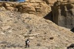
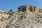
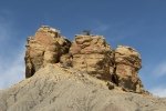
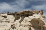
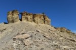
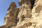
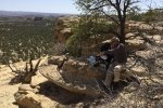
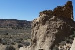
Using ACSHG’s GoogleEarth track, Lybrook Badlands, we followed the two-track to its end, beyond their parking spot.  And there we found the most amazing formations.  I labeled this outing a Walkabout because we just wandered among the hoodoos, into small cañoncitos, up on top of the ridges – everywhere we looked there were fascinating views, shapes, and textures.  There isn’t really much more that I can describe – the photos speak well.

We checked out a second area – it was interesting but I think we may have been saturated by that time.  So we enjoyed our mid-“hike” break, wandered about a bit more, then headed for home.  Tis a bit of a drive (two and a half hours one way) but absolutely well worth it.  Check out the references below for the reports from others who have visited Lybrook Badlands.

The Walkabouts

Walkabout 1
Total Distance:  1.68 miles
Elevation: start  6,977 ft, maximum  7,029 ft,  minimum  6,943 ft
Gross gain:  86 ft.  Aggregate ascending  267 ft, descending  267 ft
Maximum slope: 30% ascending, 28% descending, 6% average
Duration: 2:04

Walkabout 2
Total Distance:  0.79 miles
Elevation: start  6,928 ft, maximum  6,968ft,  minimum  6,928 ft
Gross gain:  40 ft.  Aggregate ascending  95 ft, descending  91 ft
Maximum slope: 27% ascending, 16% descending, 5% average
Duration: 0:48

GPS Track Files for Download
288 Downloads
180 Downloads
465 Downloads
214 Downloads
I urge you to explore our hiking tracks with Google Earth. With the virtual 3-dimensional presentation, achieved by panning and tilting the view, you can get a much better idea of the hikes and terrain than you can get from the 2-dimensional screenshot above. For assistance: Using Google Earth Track Files.

References (roads, features, hikes, great photo collections):

ASCHG: Lybrook Badlands West from South Hike
                .kml file: Lybrook Badlands – ASCHG
Here2Where: Lybrook Badlands
AllTrails:  Lybrook Badlands
AztecNM: Lybrook (Badlands) Fossil Area (brochure, maps, features & formations)
                   Lybrook Badlands (Badlands Features Placemarks, .kml file)
The American Southwest: San Juan Basin Badlands
                                                Map of the San Juan Basin Badlands
New Mexico Magazine: Badlands Walkabout, directory of the 5 badlands near Cuba, NM
Mike Spieth.com: A Lybrook Badlands Project
                                 Badlands of New Mexico
Fox Dreams: The Story of New Mexico: The Lybrook Badlands
Jim Caffrey Images Photo Blog: The Other Badlands
PhotoTrek New Mexico – San Juan Basin Badlands: Lybrook Badlands
Westernlady’s World: Lybrook Badlands (in German, good maps)

Last Updated on December 6, 2024 by George Young
Elena Gallegos Hike – 02/18/2015

Elena Gallegos Hike.Pat.2015-02-18

A delayed entry into the Journal.  Pat and  I hiked the trails in Elena Gallegos regularly, before we struck out further from home.

Statistics

Total Distance:  2.68 miles
Elevation: start  6,475 ft, maximum  6,730 ft,  minimum  6,475 ft
Gross gain:  255 ft.  Aggregate ascending  434 ft, descending  429 ft
Maximum slope: 15% ascending, 15% descending, 6% average
Duration: 1:03

GPS Track Files for Download
106 Downloads
152 Downloads
I urge you to explore our hiking tracks with Google Earth. With the virtual 3-dimensional presentation, achieved by panning and tilting the view, you can get a much better idea of the hikes and terrain than you can get from the 2-dimensional screenshot above. For assistance: Using Google Earth Track Files.

References

City of Albuquerque: Elena Gallegos Open Space
New Mexico History: Elena Gallegos Grant

Last Updated on October 18, 2023 by George Young

Ceja Pelón Mesa Hike – 05/08/2018

This is the next in the string of mesas going west from Mesa de Cuba, after Mesa Chijuilla and Mesa Penistaja.  Various sources have described the area as rife with petrified wood – and we were not disappointed.  Access is via the same road that we use for Mesa Penistaja, except that we turn to the left onto a two-track that leads to an abandoned oil/gas wellhead. 

The Hike

Ceja Pelon Mesa Hike.Pat.2018-05-08

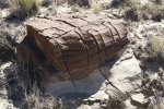
From parking, the first leg is north proceeding up an arroyo towards the edge of Ceja Pelón Mesa.  We proceeded west along the base of the mesa, finding many interesting examples of petrified wood, from small “shavings” up to complete logs.  The latter were typically partially buried, with the exposed log showing signs of gradual disintegration.  About a mile into the hike, we chose to ascend up on top of the Mesa, one of the few places we could get to the top. 

Once on top we had marvelous views in all four directions; particularly interesting were the volcanic necks visible on the horizon to the south, in the Rio Puerco valley.  Prominent was Cabezon, but also Cerro Cuate and others as well as Mesa Prieta; and on the far horizon the Sandia Mountains.  And to the east the Nacimiento and Jemez Mountains.  We found more petrified wood and logs atop the mesa as well as a variety of most interesting rock formations.  We found a nice pinon tree for shade for our mid-hike break, with a fabulous view across the Badlands, the aforementioned Rio Puerco features, and Mesa Chivato & Mount Taylor.

Finishing up, we retraced our route along the top of the Mesa, continuing eastward (following the route from ASCHG) to descend back to the floor of the Badlands and back to the truck.  Simply another wonderful day in the Land of Enchantment.

Statistics

Total Distance:  3.69 miles
Elevation: start  6,919 ft, maximum  7,240 ft,  minimum  6,919 ft
Gross gain:  321 ft.  Aggregate ascending  615 ft, descending  614 ft
Maximum slope: 36% ascending, 25% descending, 5% average
Duration: 5:37

GPS Track Files for Download
181 Downloads
305 Downloads
121 Downloads
264 Downloads
I urge you to explore our hiking tracks with Google Earth. With the virtual 3-dimensional presentation, achieved by panning and tilting the view, you can get a much better idea of the hikes and terrain than you can get from the 2-dimensional screenshot above. For assistance: Using Google Earth Track Files.

References

New Mexico Magazine: Badlands Walkabout
     Directory of the 5 badlands near Cuba, NM
PhotoTrek New Mexico:  San Juan Basin Badlands
The American Southwest:
     San Juan Basin Badlands     
    Map of the San Juan Basin Badlands       
    Ceja Pelón Mesa
AllTrails: Caja Pelón
Living Wonderously: Enchanted Excursion
Two Swiss Hikers: Ceja Pelón Mesa
Jim Caffrey Images Photo Blog: The Other Badlands
Arthouse Photography: New Mexico Badlands: Ceja Pelón in color

Last Updated on March 26, 2023 by George Young

La Luz Trail Hike – 05/06/2018

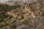
Revisiting the ‘famous’ La Luz trail. We hiked it 4 years ago but went a bit further this time. 

The Hike

La Luz Hike.Jay.2018-05-06

Highlights this day were:

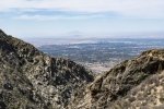
  • Of course the views ..
    • across the Rio Grande Valley and the city, and
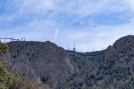
    • -up- to the heights of the northern Sandia Mountains, the Crest as well as other rugged formations on this west side of the mountain. 
  • With guidance from another hiker (who has been hiking the Sandias for 40 years) a cave in a densely wooded, narrow canyon.

Jay here: This hike was a good reminder of what we like and don’t like about hiking in the Sandias, particularly as the weather gets warmer. So the good thing about it is the fantastic views. And the bad thing is that there’s no cover to speak of, so you can end up feeling like a candy bar in a wrapper on the dashboard of a hot car. The shady glade by the hard to find cave was the only relief from the heat.

Statistics

Total Distance:  7.08 miles
Elevation: start  7,022 ft, maximum  8,692 ft,  minimum  7,022 ft
Gross gain:  1,670 ft.  Aggregate ascending  2,104 ft, descending  2,104 ft
Maximum slope: 41% ascending, 40% descending, 10% average
Duration: 4:59

GPS Track Files for Download
190 Downloads
0 Downloads
If you haven’t explored these hiking tracks with Google Earth, I urge you to try it. With the virtual 3-dimensional presentation, achieved by panning and tilting the view, you can get a much better idea of the hikes and terrain than you can get from the screenshot above. For some ideas, check out  Using Google Earth Track Files.

References

USDA Forest Service: La Luz Trailhead and La Luz Trail 137
ASCHG: La Cueva – La Luz Scenic Loop Hike             
Hiking Project: La Luz Trail
SummitPost.org: La Luz Trail
AllTrails: La Luz Trail
Wikipedia: La Luz Trail
Cloudhiking Mountains: Sandia Mountains – La Luz Trail
Backpacker: Albuquerque, NM: La Luz Trail
Backpacker’s Review: La Luz Trail – Cibola National Forest (8 miles)

Last Updated on February 1, 2022 by George Young

La Jara Arroyo Hike – 04/29/2018

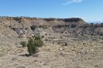
On this hike we explored the south side of Bernalillito Mesa in the Ojito Wilderness, an area that we hadn’t visited before.  I’ve labeled this a Wander rather than Hike – there aren’t any defined trails; the topography lends itself to just exploring.  Like other parts of Ojito, the views are interesting, the geology varies greatly, and this time of year the early flowers are abloom.

The Hike

La Jara Arroyo Hike.Jay.2018-04-29

The first 1.25 miles of our wander allowed us to remain close to the bottom of the edge of Bernalillito Mesa.  But then we faced a deep washed-out arroyo that we chose not to attempt crossing.  So from there we wandered around the bottom of the “sub-mesa”, then back towards the mesa and a bit further for our mid-hike break.  Along the way the geology changed continuously (rocks, outcrops, types of material); always great scenery near and far.

Statistics

Total Distance:  3.87 miles
Elevation: start  5,847 ft, maximum  6,024 ft,  minimum  5,825 ft
Gross gain:  199 ft.  Aggregate ascending  507 ft, descending  508 ft
Maximum slope: 16% ascending, 21% descending, 4% average
Duration: 4:00

GPS Track Files for Download
126 Downloads
173 Downloads
I urge you to explore our hiking tracks with Google Earth. With the virtual 3-dimensional presentation, achieved by panning and tilting the view, you can get a much better idea of the hikes and terrain than you can get from the 2-dimensional screenshot above. For assistance: Using Google Earth Track Files.

Related Posts (in the vicinity)

All Ojito Hikes

References

Hiking in New Mexico: Our hikes in the Ojito WildernessHowdy, George Young
     Descriptions, tracks, references, and photos

Last Updated on March 6, 2022 by George Young

NW New Mexico RoadTrip – 04/25/2018

To extend our travels in New Mexico, we set out for a two-day road trip to the northwest part of the state.  Our goal was to explore back country, spending a night in Farmington.  A bit of research in advance brought to light some interesting places to visit (see the References below).

The Trip

NW New Mexico Road Trip.Pat.2018-04-25

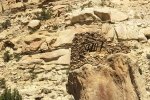
So, it was on US 550 going west, passing through Cuba to Counselor (barely a wide spot in the road), and turning north on NM 403, a 50+ mile unpaved road that runs the length of Largo Canyon.  ‘Tis a two lane, well graded road most of the time, thanks to it’s use by the oil and gas industry (this is ‘their’ territory).  Flanked on both sides with mesas 50′ up to maybe 150′ in height, with many side canyons going off to the left and right.  ‘Twas our plan to visit at least one of the Pueblitos (see reference to GoogleEarth file below); it soon became apparent that most of the Pueblitos are located on the top of the mesas.  We identified one for which it appeared a road ascended to the mesa top not far off or NM 403: Kin-Yazhi Pueblito.  We were able to crest the mesa, but the road towards the Pueblito was blocked, leaving us with a 1.7 mile hike.  Uncertain about details of our plan for the remainder of the trip, we passed on the hike – next time.
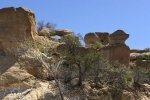
Continuing north on NM 403 we found a Pueblito that was at the base of one of the mesas: Foothold Pueblito.  Taking a 3 mile diversion up Palluche Wash, we then turned onto a two-track that would take us to the Pueblito.  There was a moment of surprise when we looked down the two-track as it descended a -steep- embankment, then crossed 150 yards of sand in the bottom of the Wash.  It was -dry- however, so with 4-wheel drive engaged, we crossed easily.  And found our way to the Foothold Pueblito – quite interesting, as it sits atop a very large, rectangular rock at the base of Superior Mesa. It was then on to Farmington for the night at Casa Blanca Inn & Suites.

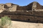
The next morning after breakfast at the Inn, we headed to Aztec to visit the Aztec Ruins National Monument to tour this 900 year old Pueblo. From there we went to check out Navajo Dam and Reservoir.  We will remember mostly that the road crosses the dam; the two lanes are minimal width, no shoulder or guardrail, and it is a very long way down the steep slope of the face of the dam if one should leave the road.  We’ll avoid doing that in the future.

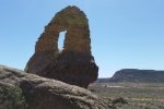
From there we started out for home, but taking a short side trip to check out the miniature Natural Arches that have been located throughout the area (see the link below).  We chose a side road off of NM 173 that led to 3 or 4 arches (according to the map).  Parking at the perimeter of a gas well pad, we wandered around looking up at the rock face, and found them, small bridges over an opening to the sky beyond.  After a small lunch, we hit the road, choosing to go ‘cross country’ on NM 537 through the Jicarilla Apache Indian Reservation.  This road makes for a pleasant drive through forested hills, a change from the desert environment of Largo Canyon.  Then home via US 550 – we’ll return for more exploring, particularly in Largo Canyon.

Statistics

GPS Track Files for Download
146 Downloads
56 Downloads
423 Downloads
302 Downloads
149 Downloads
61 Downloads
I urge you to explore our hiking tracks with Google Earth. With the virtual 3-dimensional presentation, achieved by panning and tilting the view, you can get a much better idea of the hikes and terrain than you can get from the 2-dimensional screenshot above. For assistance: Using Google Earth Track Files.

References

Aztec, New Mexico
   Dinetah Pueblitos & Historic Homesteads in Largo Canyon
   Natural Arches
  Aztec Ruins National Monument
Farmington, NM: Dinetah Rock Art & Pueblitos
National Park Service: Aztec Ruins National Monument

Last Updated on February 18, 2022 by George Young