
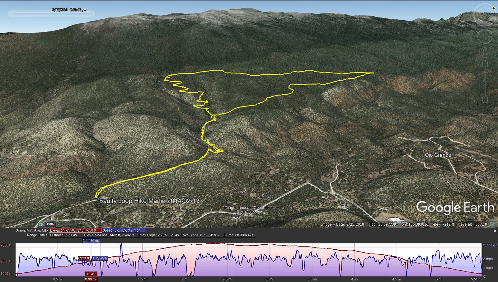
Faulty Loop Hike.Marlin.2014-02-13
Posted in March, 2019. One of our early hikes, checking out trails in Tijeras Canyon, on the souoth end of the Sandia Mountains.
Statistics
Total Distance: 5.51 miles
Elevation: start 6,550 ft, maximum 7,658 ft, minimum 6,550 ft
Gross gain: 1,108 ft. Aggregate ascending 1,482 ft, descending 1,482 ft
Maximum slope: 29% ascending, 29% descending, 8.7% average
Duration: 3:39
| GPS Track Files for Download | |
193 Downloads | |
|---|---|
283 Downloads | |
I urge you to explore our hiking tracks with Google Earth. With the virtual 3-dimensional presentation, achieved by panning and tilting the view, you can get a much better idea of the hikes and terrain than you can get from the 2-dimensional screenshot above. For assistance: Using Google Earth Track Files.
References
USDA Forest Service: Faulty Trail 195
ASCHG:
Armijo Canyon – Faulty – Sulphur Canyon Loop Hike
South Peak Via Forest Park, Faulty, Larry’s and Crest Trails Hike
ondafringe: Day Hike: Canyon Estates Trailhead to Embudito Trailhead
AllTrails: Faulty Trail #195: Route 536 to South Crest Trail #130