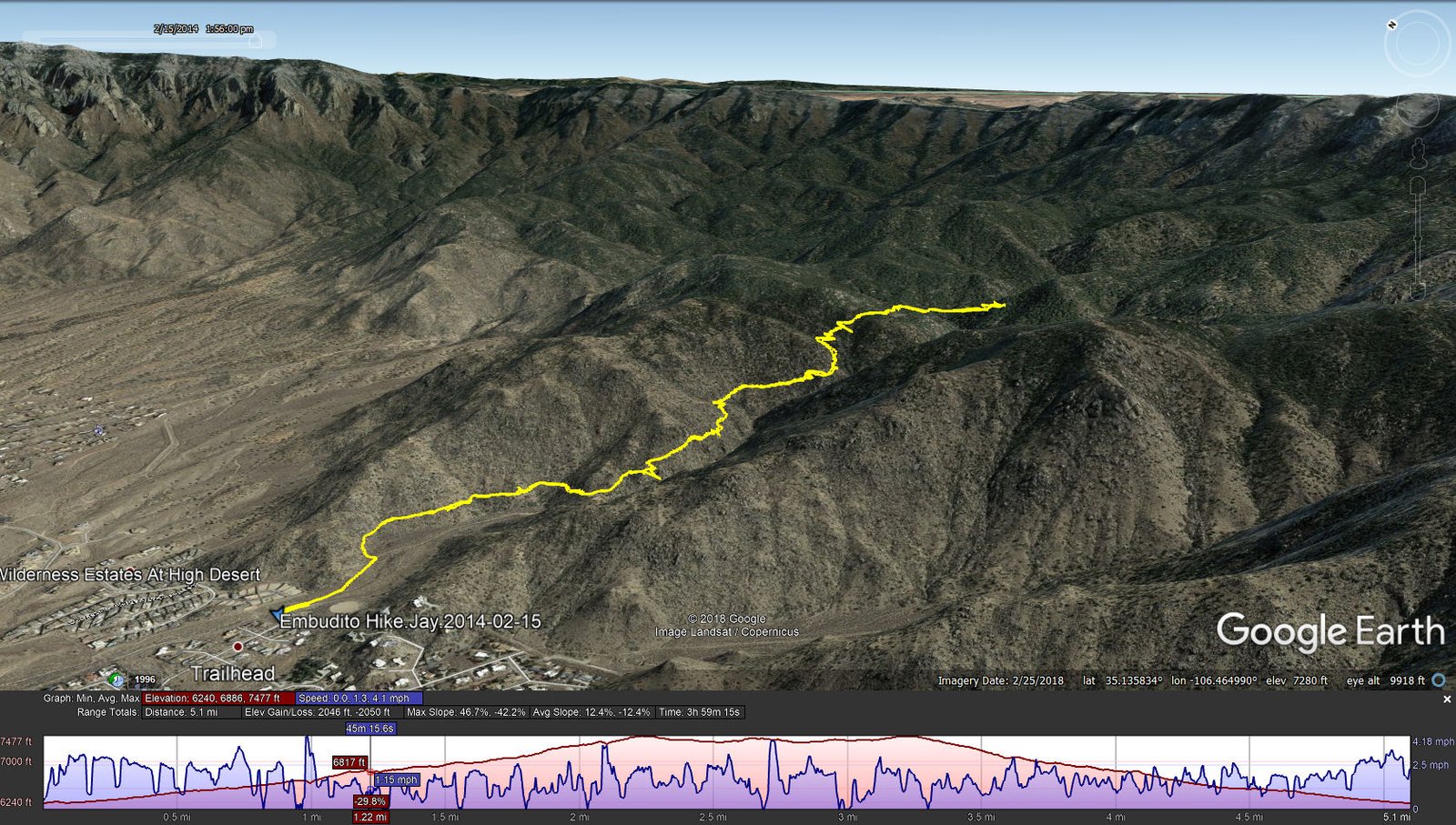
Embudito Hike.Jay.2014-02-15
Posted in March 2019. ‘Twas a long time ago, when we were getting acquainted with the trails in the Sandia Mountains.
Statistics
Total Distance: 5.10 miles
Elevation: start 6,240 ft, maximum 7,477 ft, minimum 6,240 ft
Gross gain: 1,237 ft. Aggregate ascending 2,046 ft, descending 2,050 ft
Maximum slope: 47% ascending, 42% descending, 12.4% average
Duration: 3:59
| GPS Track Files for Download | |
186 Downloads | |
|---|---|
252 Downloads | |
I urge you to explore our hiking tracks with Google Earth. With the virtual 3-dimensional presentation, achieved by panning and tilting the view, you can get a much better idea of the hikes and terrain than you can get from the 2-dimensional screenshot above. For assistance: Using Google Earth Track Files.
References
USDA Forest Service: Embudito Trailhead & Embudito Trail 192
City of Albuquerque, Albuquerque Open Space: Foothills Trail Map – Embudito (pdf)
ASCHG:
Oso Ridge-Embudito Loop Hike
Embudo-Three Gun Spring-Embudito Hike
ondafringe: Day Hike: Embudito Trail to Oso Pass~ …
AllTrails: South Sandia Peak via Embudito Trail #192
For more hikes, and links for this one, visit our Journal – Hiking in New Mexico