 In our previous visits to the Pecos Wilderness we found some areas were closed. We learned the week before that some have been reopened. Prepared with a list of trails as options, we returned to this beautiful area with its many great trails. Our 1st choice, Jack’s Creek, was indeed open which allowed us the trail of our first choice, Beatty’s Trail.
Driving Directions
For those who are headed to this area for the first time, some description may be helpful. Take I-25 east from Santa Fe to the exit for Glorieta and Pecos-NM 50 (this is about 90 miles from Albuquerque). After crossing over I-25, turn right; in about 6 miles, turn left at the stop sign onto NM 63 through the very old village of Pecos. From here it about 20 miles to Cowles, a placename at the end of NM 63 and the entrance to Forest Service campgrounds and hiking trails. This road, paved the whole way, is relatively open at the beginning but gradually narrows and winds more as you ascend the cañon. This will take you 45 minutes or more during which you will climb from 6,900 feet at Pecos to 8,100 feet at Cowles. Along the way you will pass many pullouts and parking areas as well as 3 NM State Parks that provide access to the river for fishing. It’s a beautiful drive; take your time to enjoy it.
At Cowles, continue straight ahead to the Jack’s Creek Campground/Horse Camp and Beatty’s trailhead among others. One may also turn left onto FR 121 for the Panchuela Campground and other trailheads. This is a very popular area for hiking and backpacking, with numerous trails going into the wilderness, into the various river cañons as well as to the peaks in the Sangre de Cristo mountains.
The Hike
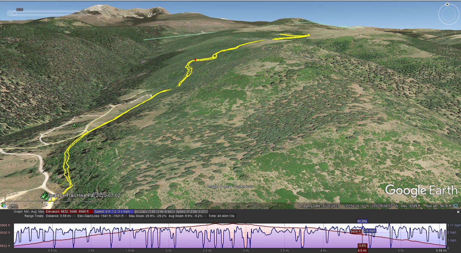
Beatty’s Trail Hike.Pat.2020-07-03
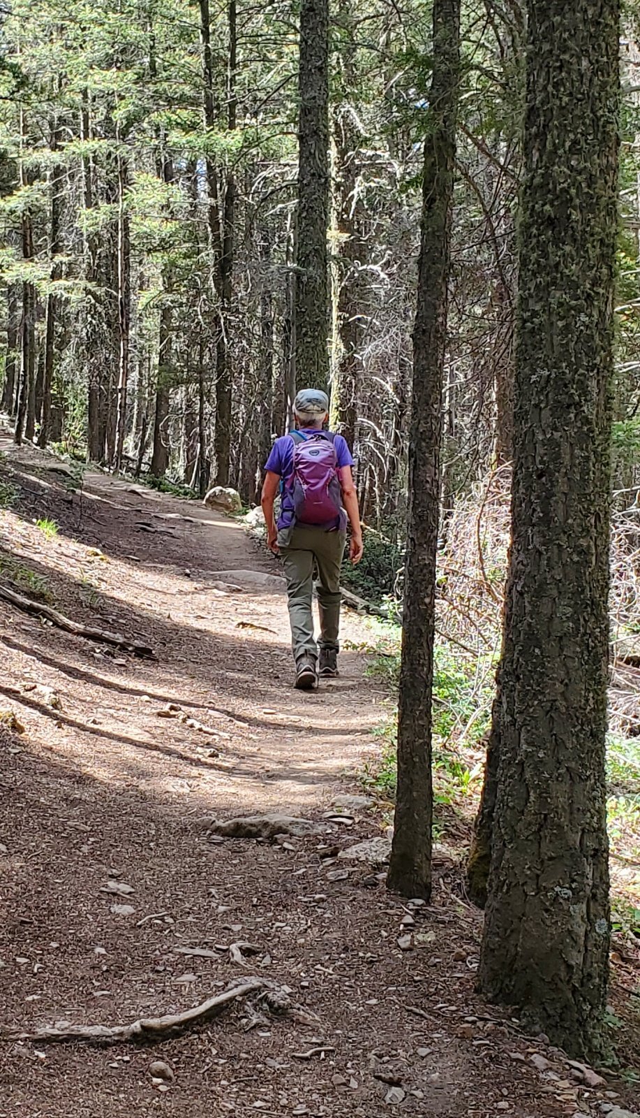
Beatty’s Trail: this is one of the most pleasant trails – it presents a very steady, easy climb from the trailhead for the 1st 1.8 miles, then a half mile slight descent before continuing up to our turnaround point. ‘Tho on a the side of a steep slope its width is ample for people to pass. Except in a few places the surface is free of rocks which makes it easy walking. We hiked through a healthy open forest of fir and aspen (the tallest I’ve seen) with spruce at the higher elevation. At 2.5 miles the trail splits, one leg (to the left) going towards Jack’s Creek and even Pecos Baldy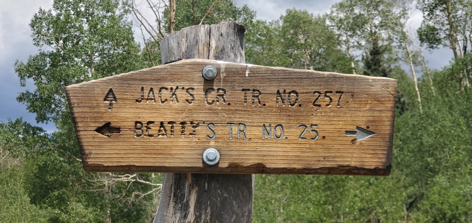 , the other going to Beatty’s Flats. And as for many of the trails, .. beyond – a backpacker’s paradise.
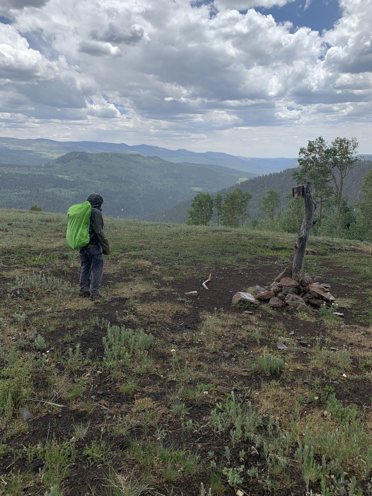
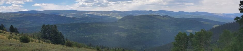
We had planned to go out 2.8 miles, to the edge of the forest and into a large open area the on the approach to the summit of Round Mountain. The objective was to have an open view to the west, to see the highest peaks in this part of the Sangre de Cristo. We discovered that such views were unlikely without another mile or so, further up the slope of Round Mountain, to get above the healthy (and tall) forest between us and the peaks. So we “settled” for a really great view to the east and south for our mid-hike break; we could even see down Jack’s Creek to the Jack’s Valley campgrounds. (For lunch, we sought out some shade from the intense sun at this elevation. While relaxing afterwards, a small shower got us moving again. We quickly wrapped up our lunch paraphernalia, donned raincoats and pack covers, and headed back to the trail. Hardly reaching the trail the shower abated leaving a much cooler temperature for our hike back to the truck.)
Statistics
Total Distance: 5.59 miles
Elevation: start 8,832 ft, maximum 9,966 ft, minimum 8,832 ft
Gross gain: 1,134 ft. Aggregate ascending 1,541 ft, descending 1,541 ft
Maximum slope: 27% ascending, 29% descending, 9.1% average
Duration: 4:40
| GPS Track Files for Download | |
262 Downloads | |
|---|---|
254 Downloads | |
I urge you to explore our hiking tracks with Google Earth. With the virtual 3-dimensional presentation, achieved by panning and tilting the view, you can get a much better idea of the hikes and terrain than you can get from the 2-dimensional screenshot above. For assistance: Using Google Earth Track Files.
References and Resources
USDA Forest Service: Beattys Trail #25
ASCHG: Beatty’s Trail #25 to Mesa View Hike
AllTrails: Beatty’s Trail
Beatty’s Trail #25 to Jack’s Creek Trail
New Mexico Meanders: 2017-06-12 East Pecos Baldy


