This was a reconnoitering trip into the Jemez Mountains, to check out the status of campgrounds and reconnect with Valles Grande, both in advance of a camping trip with friends in September. First the campgrounds: San Antonio is open (reservations only thru Sep 14) ; Redondo is closed until next spring; and Jemez Falls is open (reservations thru Sep 14, First Come after that through November, but check by phone at (575)829-3535).
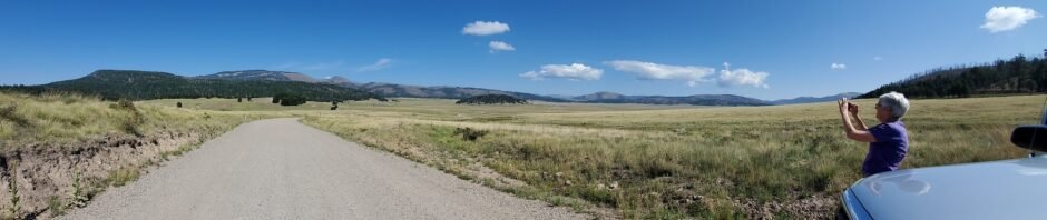
As for hiking? Our first choice was to go to the northeastern part of the reserve, to the Cerro de la Garitas Trail. But .. we’d arrived at the Visitor Center at 11:00, but must return by 4:30. The drive to the northern part of the Caldera takes nearly an hour, which meant we didn’t have time to make Cerro de la Garita hike. So .. we stopped halfway and hiked the Jaramillo Creek Trail.
The Drive In
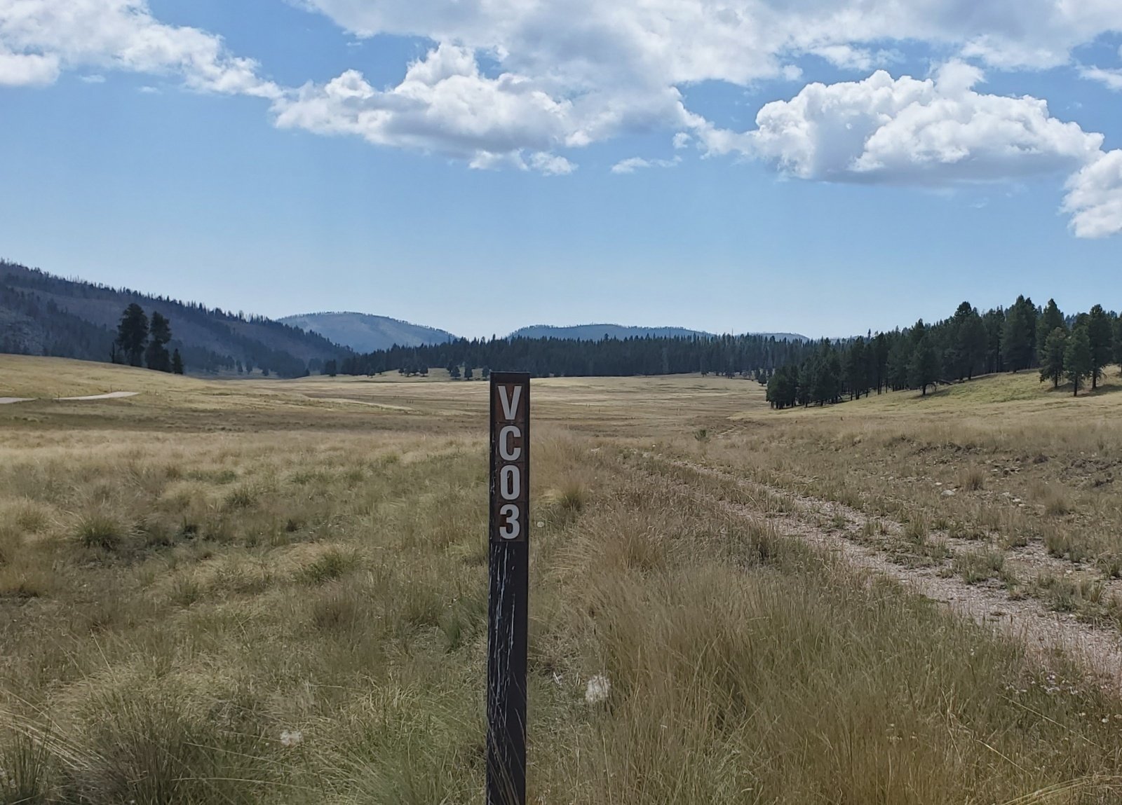 A thorough description of driving to and into Valles Caldera is included in a previous post: Valles Caldera DriveAbout – 07/14/2019. Parking for this hike is near the top of a knoll as one leaves Valley Jaramillo, at the intersection of VC02 (the main road) and VC03.
The Hike
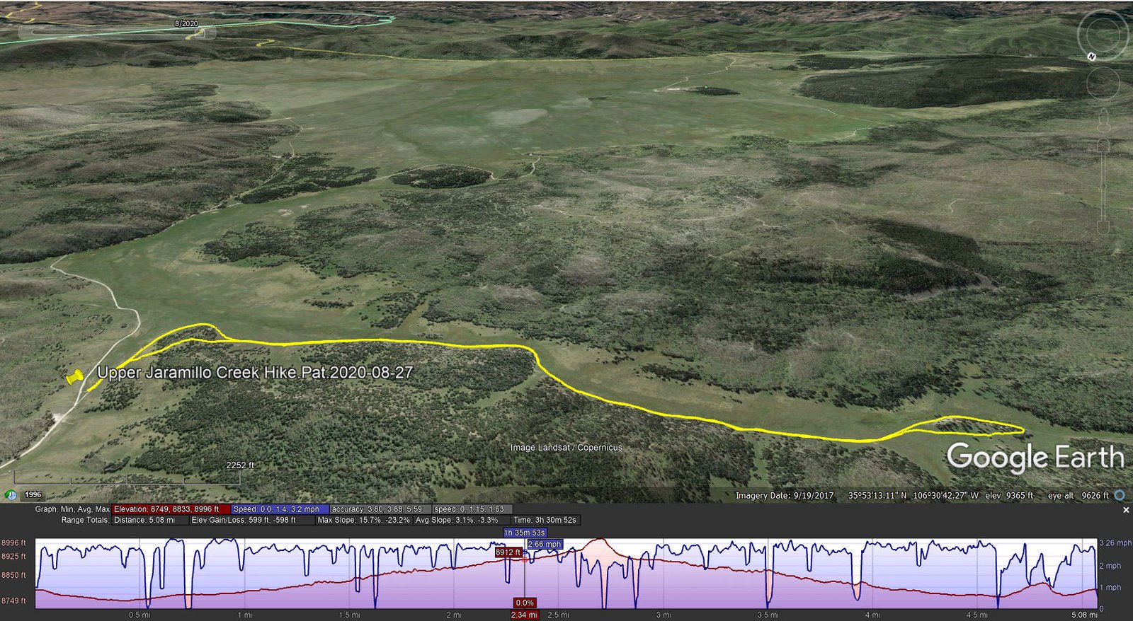
Upper Jaramillo Creek Hike.Pat.2020-08-27
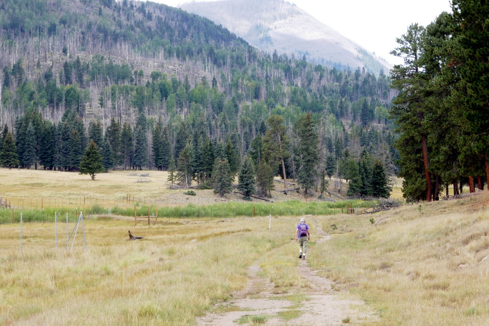 The trail is a two-track that runs above Jaramillo Creek, in open grassland that is so characteristic of Valle Grande and the other valleys in the Valles Caldera National Preserve. Much of the Creek itself has been fenced in to protect the new growth of willow and other native plants from elk that are so prevalent in the area. The Preserve has an intense effort to restore the wildland to the condition before extensive logging and cattle grazing changed the environment.
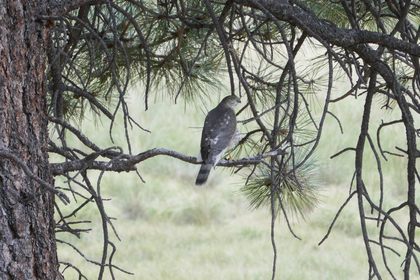 We hiked out about 2.5 miles, then climbed onto a hill for the view and our mid-hike break. The weather was a bit on the warm side with almost no shade, but occasional clouds and breezes allowed us to stay cool most of the time. On the return we watched a red tail hawk ride a thermal above the valley and we came upon this Northern Goshawk that posed for us.
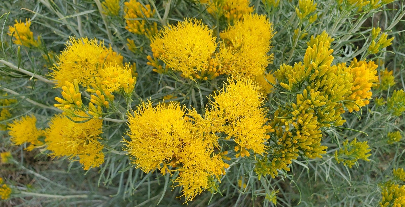
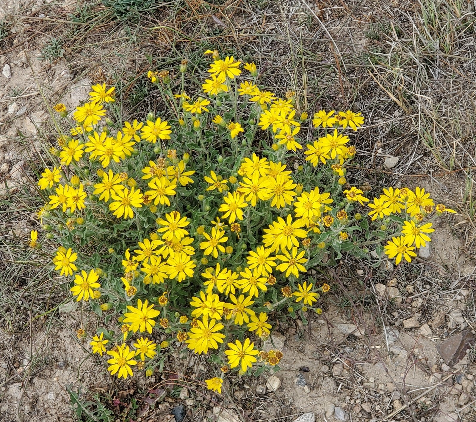 And as on nearly all our hikes around New Mexico, colors in abundance.
Highlight
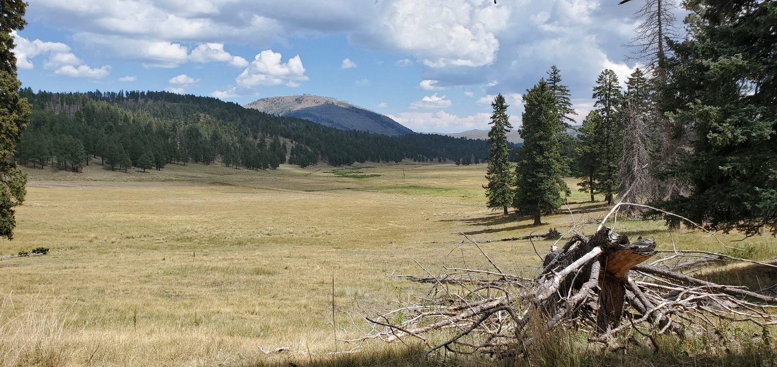
A signature feature of Valles Caldera is the sheer immensity of the place. The valleys, like Valle Jaramillo above, are large open grasslands bordered by slopes of volcanic domes with ponderosa and fir forests. The central valley, Valle Grande, is even more immense, 5 miles of unobstructed view from west to east. And ever present are the -big- domes like Redondo Peak in the background.
Wildlife abounds as well. As mentioned above, we watched a red tail hawk ride a thermal and came upon a Northern Goshawk perched in a tree alongside the trail. We also saw flickers with their white backs, a form of bluebird, chipmunks of course, and on the drive out a small herd of elk in the distance. ‘Tis such an amazing place.
Statistics
Total Distance: 5.08 miles
Elevation: start 8,792 ft, maximum 8,996 ft, minimum 8,749 ft
Gross gain: 247 ft. Aggregate ascending 599 ft, descending 598 ft
Maximum slope: 16% ascending, 23% descending, 03.2% average
Duration: 3:31
| GPS Track Files for Download | |
169 Downloads | |
|---|---|
384 Downloads | |
I urge you to explore our hiking tracks with Google Earth. With the virtual 3-dimensional presentation, achieved by panning and tilting the view, you can get a much better idea of the hikes and terrain than you can get from the 2-dimensional screenshot above. For assistance: Using Google Earth Track Files.
References and Resources:
Previous posts for Valles Caldera and vicinity.
New Mexico Meanders: 2020-06-23 Valle Caldera (Jemez Mts, exploratory)