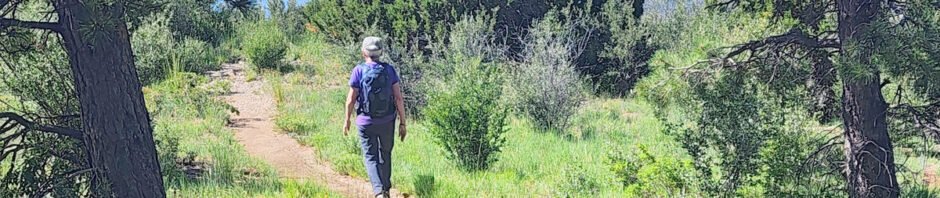
Pat & I are working ourselves back into hiking, after nearly a year off-trail, me with issues with stenosis. We’re rebuilding our hiking muscles with lots of walking along the Rio Grande (in the bosque) and getting out on a trail each week., each week a bit more challenging.
The Drive In
From downtown Albuquerque: east on I-40 to the Tijeras turnoff, then north on NM 14 through Cedar Crest to Antonito and the turnoff for NM 536, Sandia Crest Road (also known as the Sandia Scenic Highway). The Tecolote Trailhead is not far up the Crest Road: six miles from San Antonio/NM 14 to the Dry Camp Picnic Ground – parking and a pit toilet.
The Hike
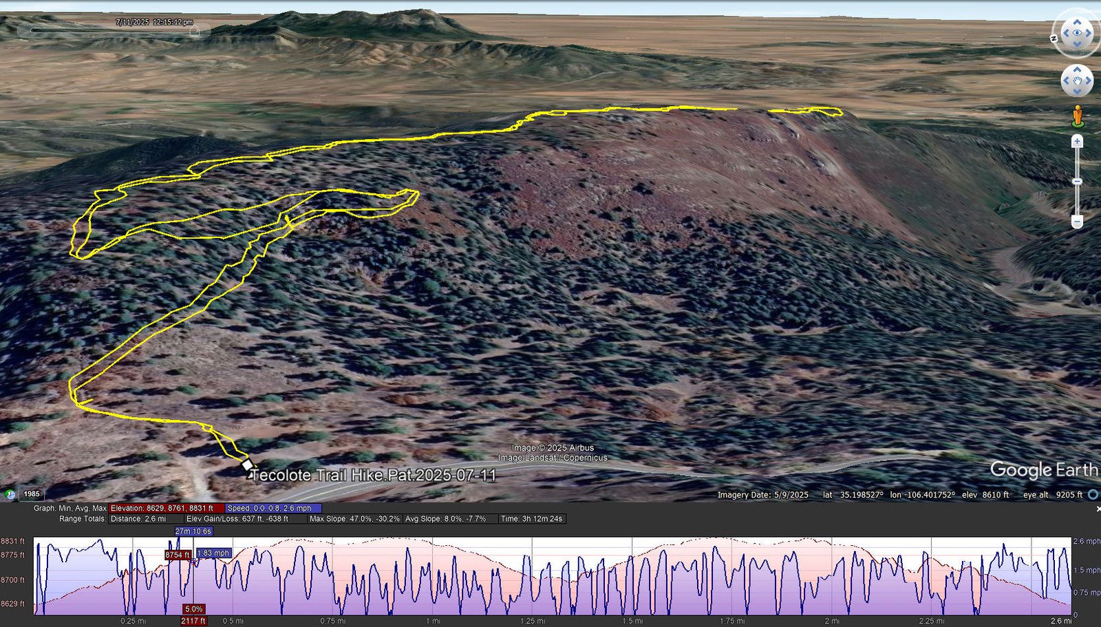
Tecolote Trail Hike.Pat.2025-07-11
Notes about the Google Earth screenshot: the graph at the bottom shows elevation of the track (pink area) and speed (the blue line).
We haven’t done much hiking on the east slopes of the Sandia Mountains. This trail fit our current criteria – reasonable length and elevation change.
- The trail starts out with an easy climb (10% slope) from 8,620 to 8,820 feet in 2/3rd of a mile. It remains at that elevation for 1/3rd of a mile, then makes again an easy descent to the end of the ridge on which the trail is situated (another 1/3rd of a mile).
- Generally the trail is a smooth surface; there are a few sections that are a bit rocky.
- The trail proceeds through a juniper and piñon “forest” (this type “forest” is never very tall) with some sections of oak bushes flanking the trail. Thus there isn’t a lot of shade, ‘tho the elevation of close to 9,000 moderates the summertime temperatures (but none-the-less we start early).
- Midway on the ridge, we came across this interesting .. relic of some unknown activity?
- At the end of the ridge, as the trail makes a small loop, one enjoys a great view of the territory east of the Sandias – the valley across to the San Pedro mountains and on the horizon to the northeast, the Sangre de Cristo mountains.


Highlight
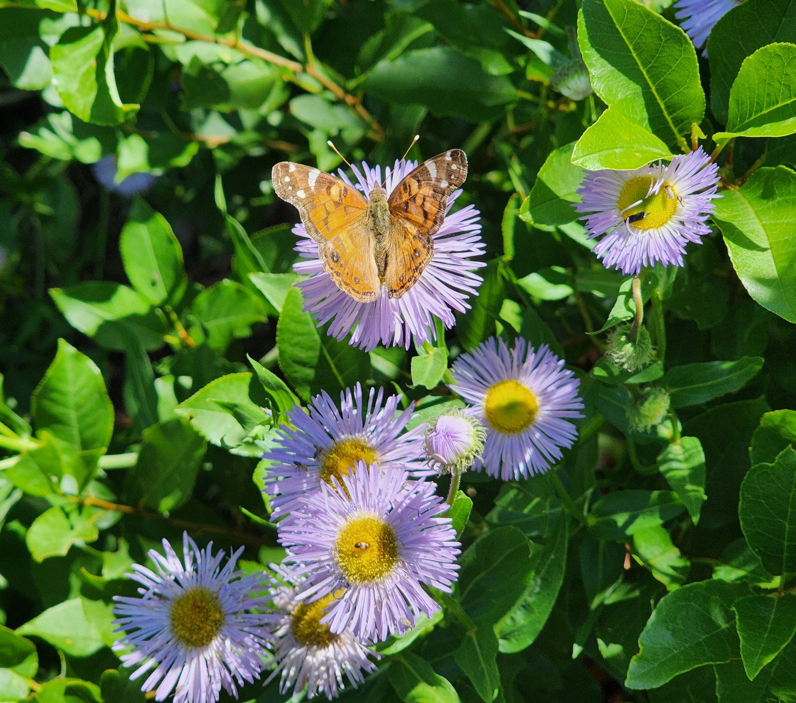
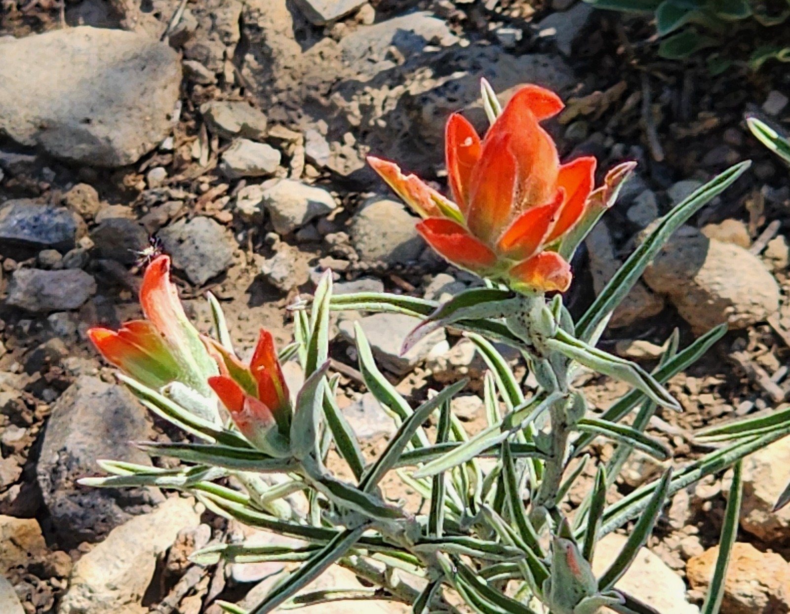
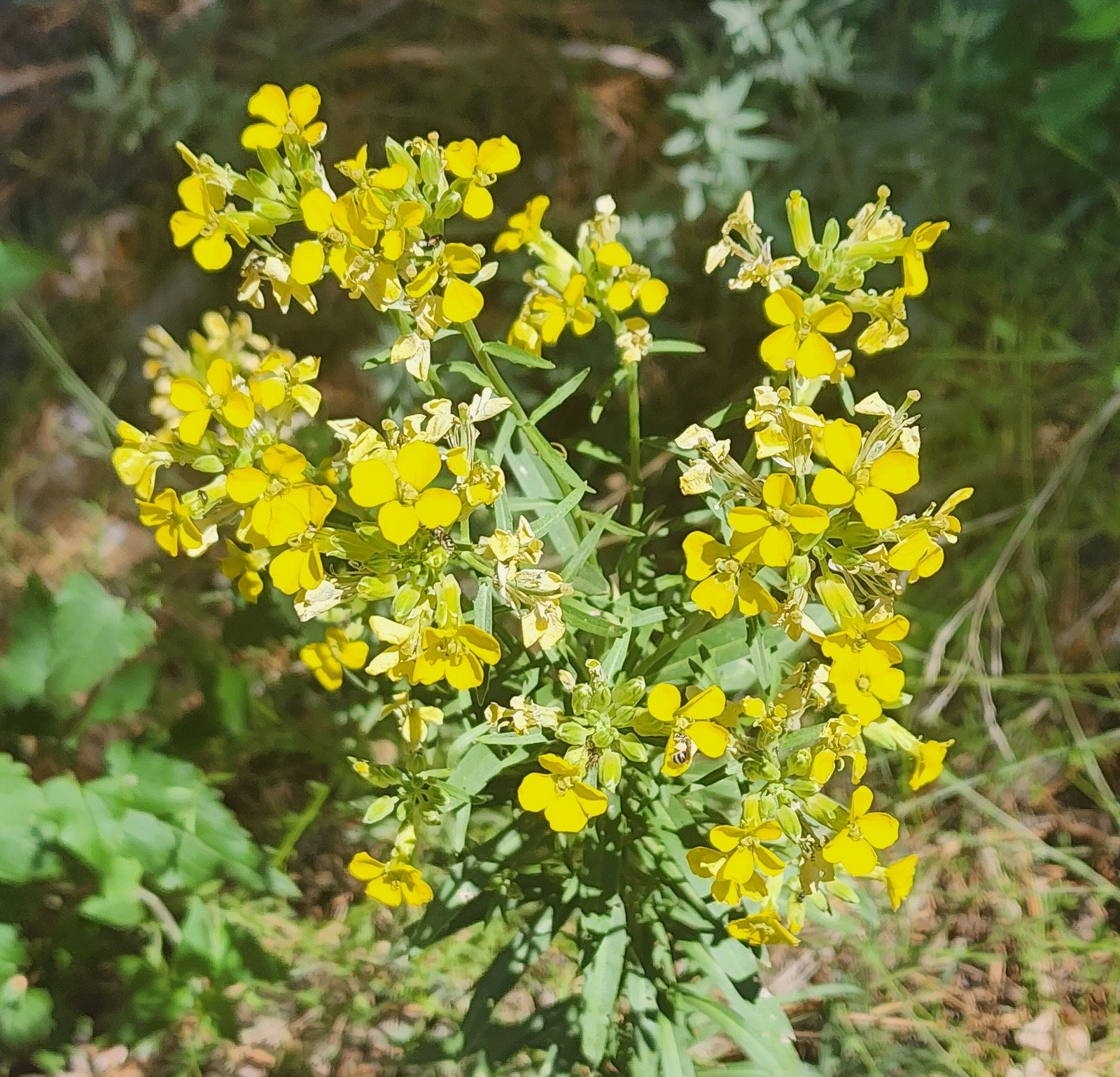
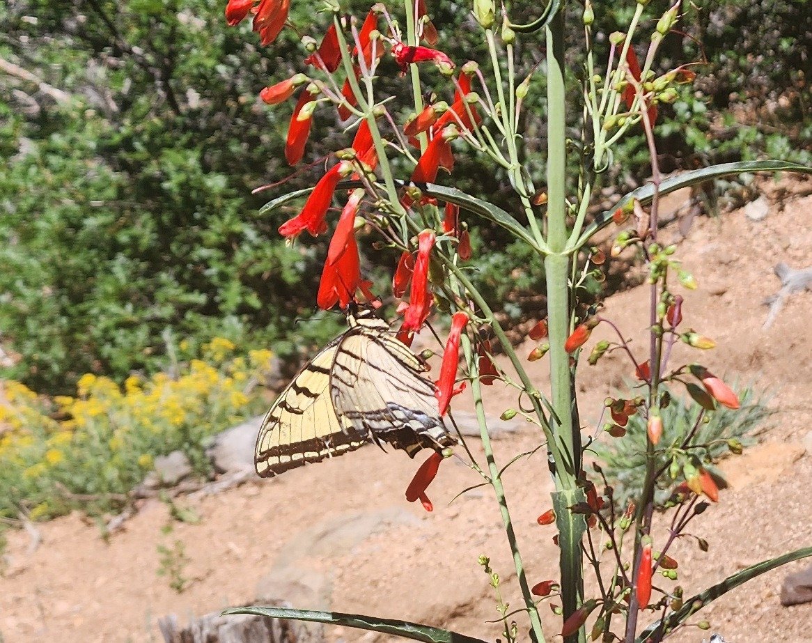
It seems that on nearly all the trails on which we hike, there are flowers in blossom. And I’m invariably drawn to take photos and share them with readers of my Posts. So here are photos that I collected on this hike.
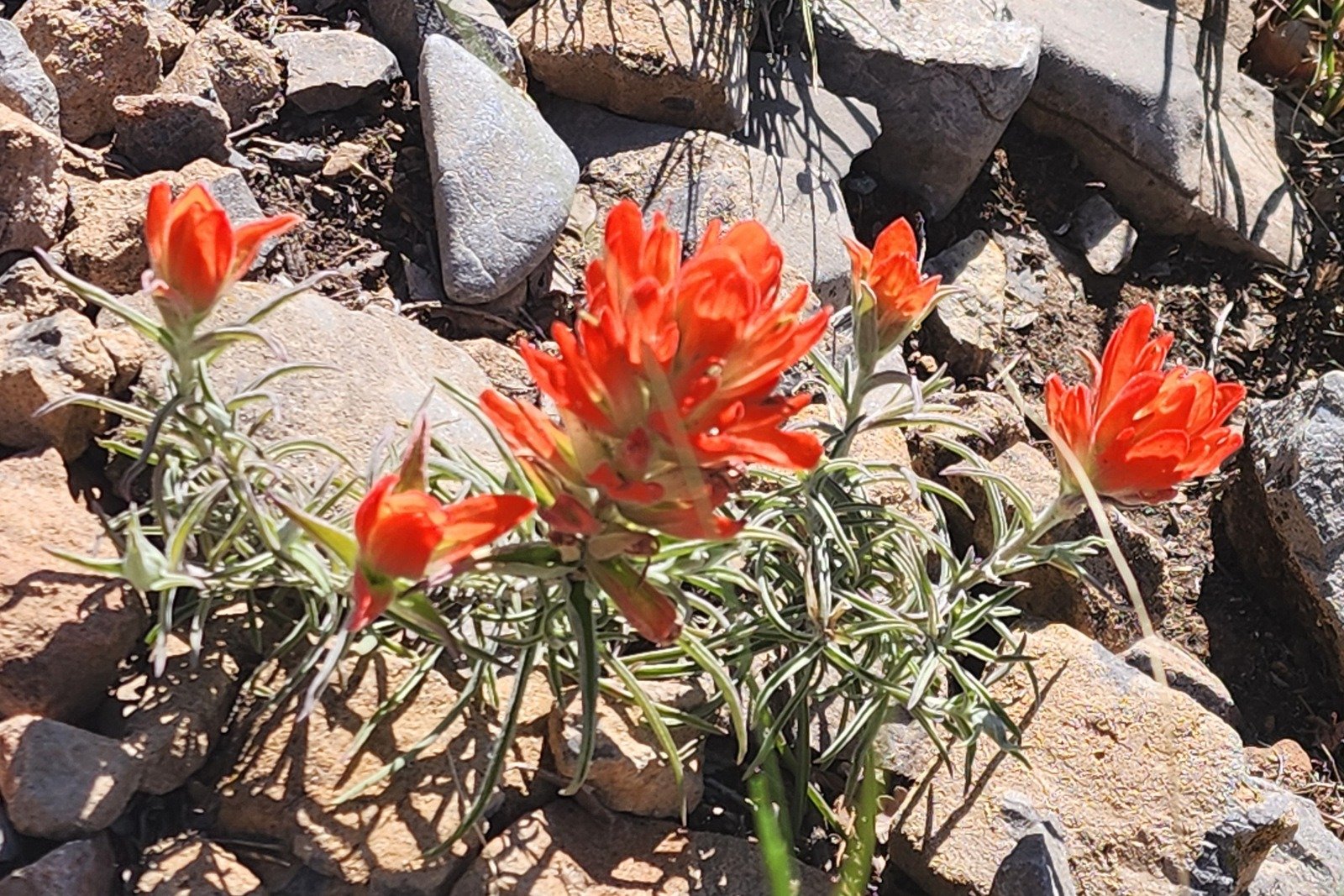 | 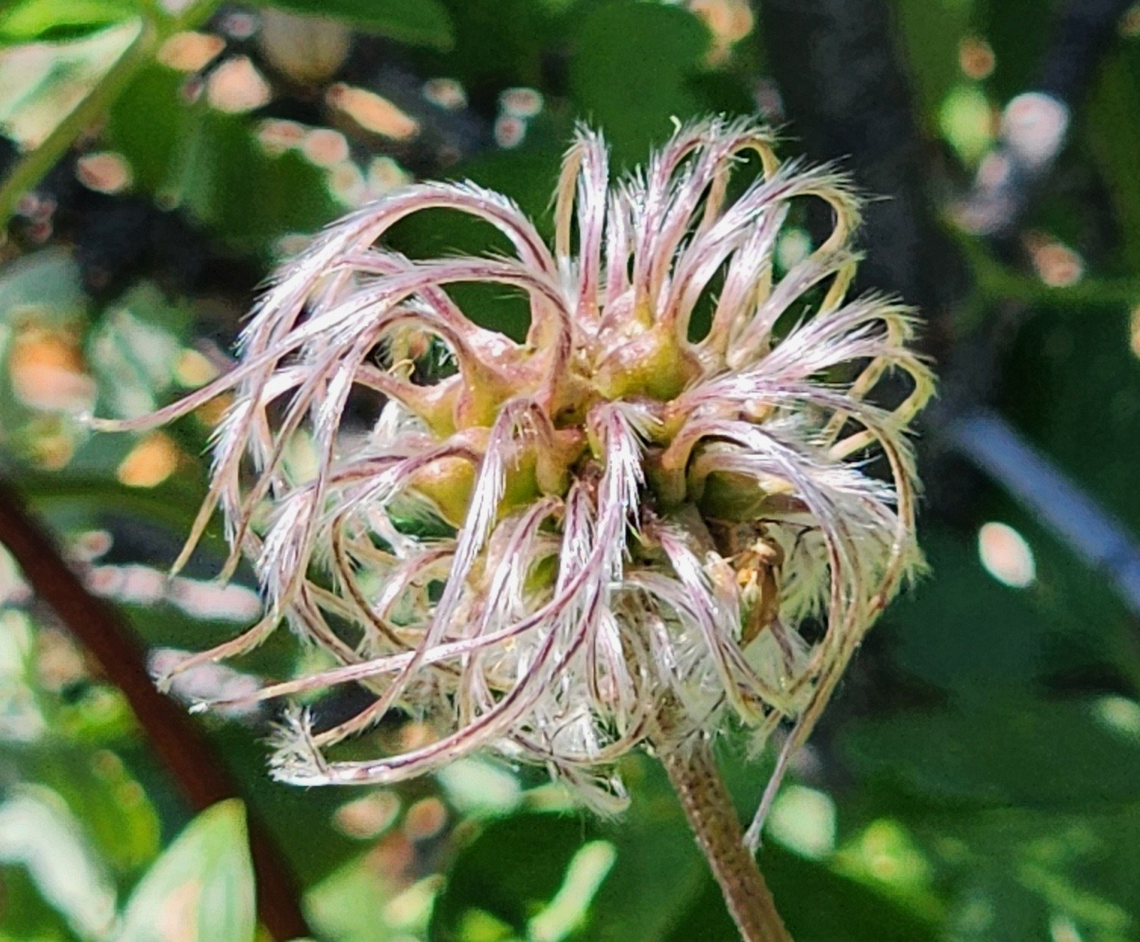 |  |
 |  |  |
Statistics
Total Distance: 2.6 miles
Elevation: start 8,630 ft, maximum 8,831 ft, minimum 8,629 ft
Gross gain: 202 ft. Aggregate ascending 637 ft, descending 638 ft
Maximum slope: 47% ascending, 30% descending, 7.7% average
Duration: 3:12, Average Speed: 0.8 mph
| GPS Track Files for Download | |
79 Downloads | |
|---|---|
80 Downloads | |
| Link to GAIA GPS: “Tecolote Trail Hike” | |
| If you haven’t explored these hiking tracks with Google Earth, give it a try. With the virtual 3-dimensional presentation, achieved by panning and tilting the view, you can get good idea of the hike and the terrain. For some ideas, check out Using Google Earth Track Files. | |
If you haven’t explored these hiking tracks with Google Earth, I urge you to try it. With the virtual 3-dimensional presentation, achieved by panning and tilting the view, you can get a much better idea of the hikes and terrain than you can get from the screenshot above. For some ideas, check out Using Google Earth Track Files.
References and Resources
AllTrails: Tecolote Trail
Dog of the Desert: Tecolote Trail in the Sandia Mountains
Views to date: 8 views.