
A morning hike ‘in the neighborhood’, Dale Ball trails near Jay’s place.
The Drive In
Drive up Hyde Park Road (NM 475) from Santa Fe to the Sierra del Norte Trailhead; there is a parking lot on the left of the road.
The Hike
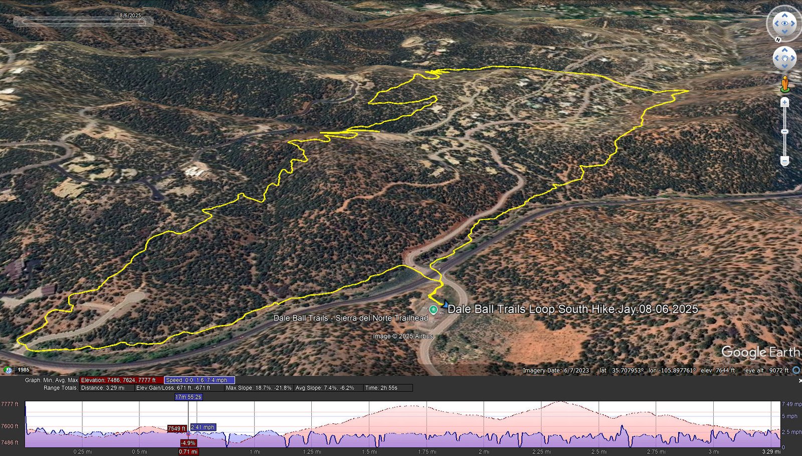
Dale Ball Trails Loop South Hike.Jay.08-06-2025
Notes about the Google Earth screenshot: the graph at the bottom shows elevation of the track (pink area) and speed (the blue line).
A nice loop hike in juniper forest, well used trails, just the right amount of elevation gain for a ‘neighborhood hike’. A good description for a hike on the same trail back in 2023: Dale Ball Trails.
Statistics
Total Distance: 3.29 miles
Elevation: start 7,581 ft, maximum 7,777 ft, minimum 7,486 ft
Gross gain: 291 ft. Aggregate ascending 671 ft, descending 671 ft
Maximum slope: 19% ascending, 22% descending, 7.1% average
Duration: 2:01, Average Speed: 1.6 mph
| GPS Track Files for Download | |
122 Downloads | |
|---|---|
119 Downloads | |
| Link to GAIA GPS: “Dale Ball Trails Loop South Hike” | |
| If you haven’t explored these hiking tracks with Google Earth, give it a try. With the virtual 3-dimensional presentation, achieved by panning and tilting the view, you can get good idea of the hike and the terrain. For some ideas, check out Using Google Earth Track Files. | |
Related Posts
Dale Ball Trails
All Posts for Dale Ball Trails
References and Resources
See Dale Ball Trails.
Views to date: 40 views.