Exploring trails around Los Alamos.
The Drive In
The Mitchell Trailhead is on the northern edge of a residential area in Los Alamos. Coming into the town on NM 502, it becomes Central Avenue then Canyon Road. At the “T” turn right on to Diamond Dr, then .8 mile left onto Urban Street; .3 mile right onto N Road, .4 mile onto Yucca Street, take the next right onto 45th Street, then .2 mile onto Arizona Ave, and you’re there. Here is a link to the route from Santa Fe on GoogleMaps.
The Hike
Mitchell Trail Hike.Jay.2025-10-22
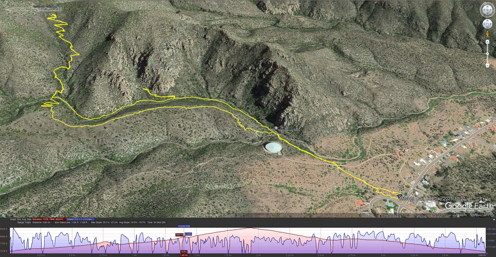
Notes about the Google Earth screenshot: the graph at the bottom shows elevation of the track (pink area) and speed (the blue line). Click on the image for a full-screen view.
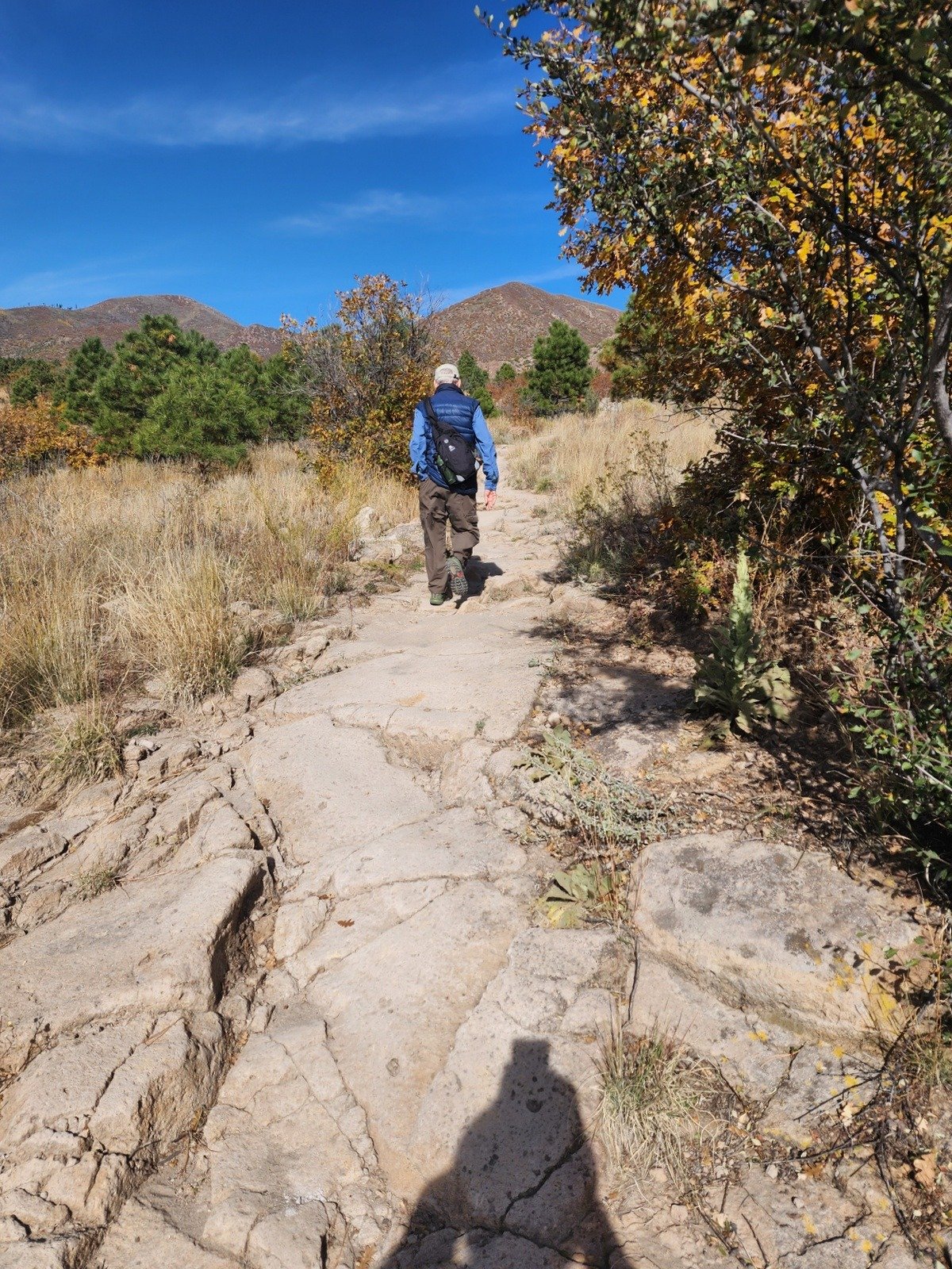
 From the trailhead and for the first third of a mile the trail surface is a mixture of sand and sections of flat rock .. the latter quite different than trail surfaces that we usually encounter. It was there that we encountered a junction with a trail coming down from the left (more about that later). I chose for us to remain in the bottom of the canyon (later discovering that it is the “Old Mitchell Trail”); the surface became like so many in the bottom of a canyon – rocky and uphill.
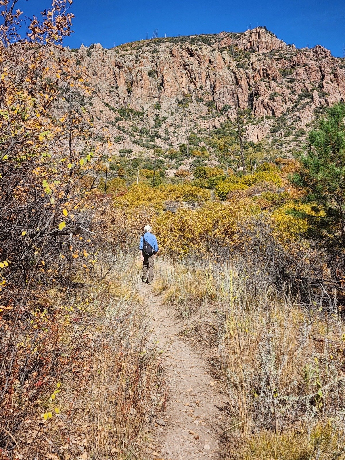
Two-thirds into the hike we came to a cairn marking a side trail that went up to a “Natural Arch”. Curious, we worked our way up this side trail until it became evident that a rock scramble would be required to climb up to the Arch. We turned back to the main trail and continued on the 1.25 mile point. Again encountering a junction that GAIA showed as a route back to the outbound trail. Again, curious, we chose to continue up the Mitchell Trail – it became more sandy .. and a bit steeper than before, a bit narrow in places with regular switchbacks.
Two miles in, we decided enough and turned back. At the aforementioned junction, we turned to the right and found the trail to be quite easy – sandy surface and a general descent on top of the ridge (later learning that this is now The Mitchell Trail). At about 3.25 miles into the hike, the trail began an easy descent back to the canyon floor and to the trailhead.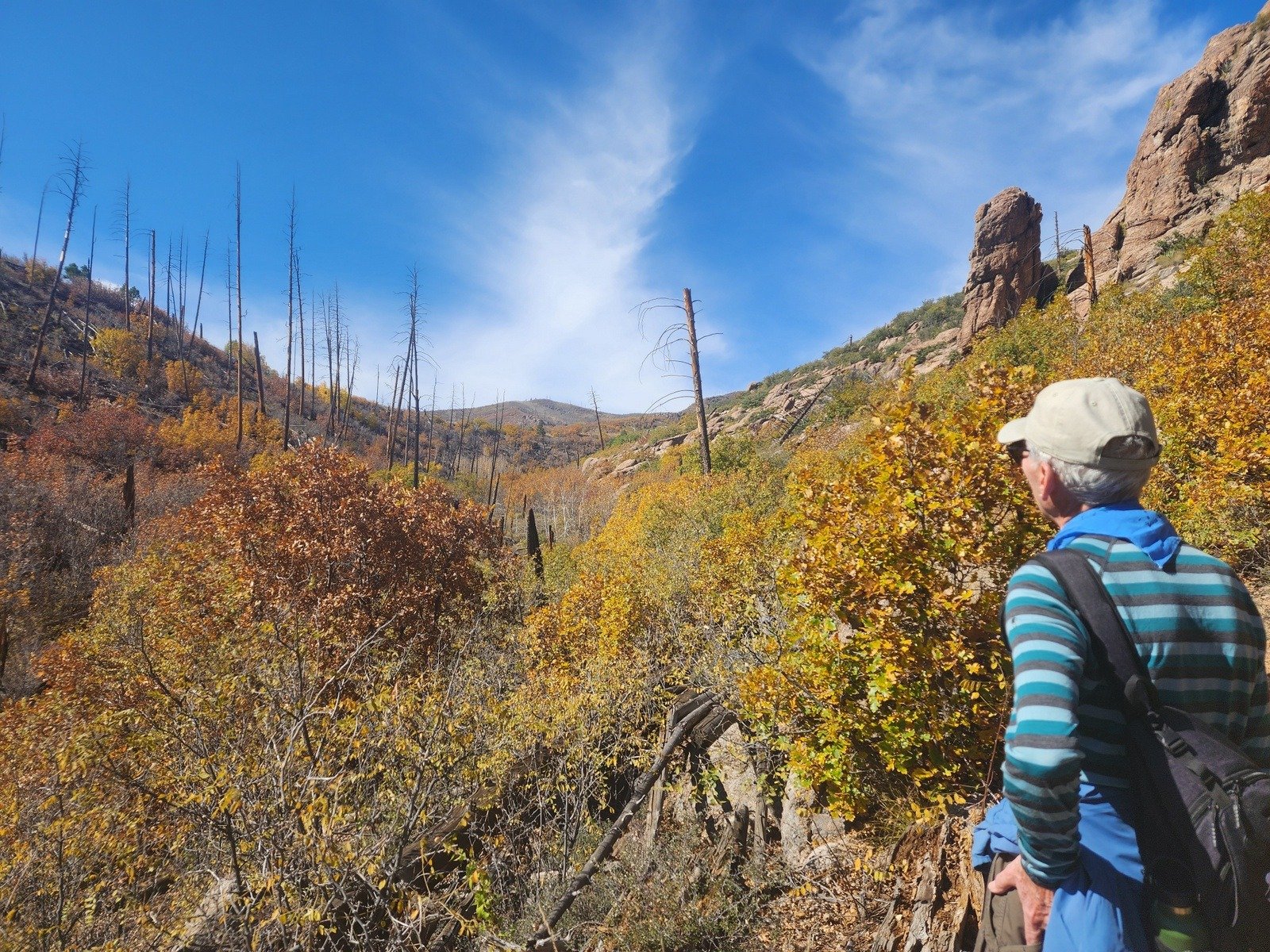
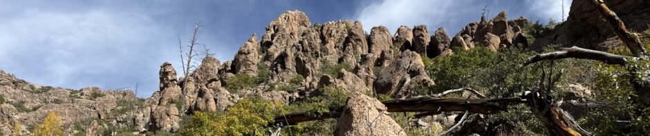
Along the way there was nice scenery – fall colors of the oak trees beginning the recovery from the fire some years ago and the mountains in ahead of us.
Jay here: The new Mitchell Trail next time, for sure. Could see us doing this trail again in late fall, and this time getting to the top of the ridge. View must be even better from atop that point.
Statistics
Total Distance: 3.83 miles
Elevation: start 7,483 ft, maximum 8,325 ft, minimum 7,478 ft
Gross gain: 847 ft. Aggregate ascending 1,124 ft, descending 1,128 ft
Maximum slope: 35% ascending, 27% descending, 10.4% average
Duration: 3:36, Average Speed: 1.1 mph, Shade: 10%
| GPS Track Files for Download | |
0 Downloads | |
|---|---|
62 Downloads | |
| Link to GAIA GPS: “Mitchell Trail Hike” | |
| If you haven’t explored these hiking tracks with Google Earth, give it a try. With the virtual 3-dimensional presentation, achieved by panning and tilting the view, you can get good idea of the hike and the terrain. For some ideas, check out Using Google Earth Track Files. | |
If you haven’t explored these hiking tracks with Google Earth, I urge you to try it. With the virtual 3-dimensional presentation, achieved by panning and tilting the view, you can get a much better idea of the hikes and terrain than you can get from the screenshot above. For some ideas, check out Using Google Earth Track Files.
References and Resources
Los Alamos County: Mitchell Trailhead
Mitchell Trail Loop (-our- hike)
Visit Los Alamos: Mitchell Trailhead (.pdf)
AllTrails: Mitchell Trail
Hiking Project: Mitchell Trail #69
Wanderlusting the Jemez: Wanderlusting the Mitchell Trail
Photos
This collection of Jay’s Hipstamatic Photos provide a good “tour” of this hike. Thanks, Jay!


Views to date: 39 views.