Jay laid the groundwork for exploring a new territory for us – a web of trails just south of White Rock, with trailheads are on the left along NM 4 as one drives from White Rock towards Bandelier.
The Drive In
Take NM 4 from Pojoaque west towards Los Alamos, but follow the signs to remain on NM 4 to White Rock – 16 miles. For this hike we continued for 2.5 miles, to a large parking area on the left and Gate 8a, the trailhead for Ridgeline-Portillo Mesa Trail system.
The Hike
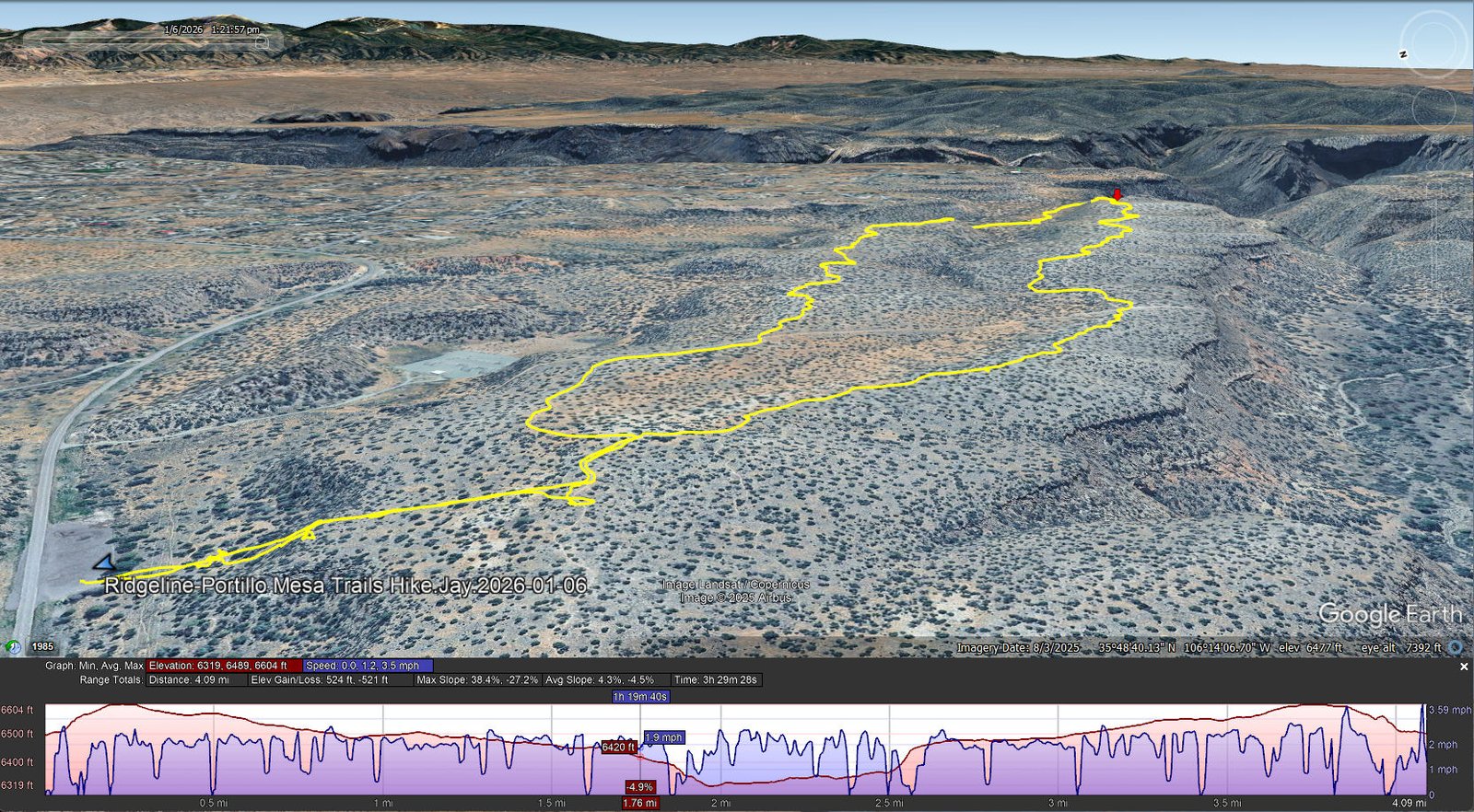
Ridgeline-Portillo Mesa Trails Hike.Jay.2026-01-06
Notes about the Google Earth screenshot: the graph at the bottom shows elevation of the track (pink area) and speed (the blue line). Click on the image for a full-screen view.
A sign just inside Gate 8a outlines the trails in this area – Potrillo Mesa and adjoining and nearby canyons. After a short distance we encountered … a very steep, winding trail up, over, and around rocks to ascend about 80 feet to the top of Potrillo Mesa. From there the trail, well used by hikers and in some sections by mountain bikers, was easy going – dirt interspersed with flat rock surfaces.
Along the way we encountered numerous signs identifying the trail, particularly at intersections. Not (yet) being familiar with this web of trails, we referred often to our GPS and GAIA so as to follow our chosen track.
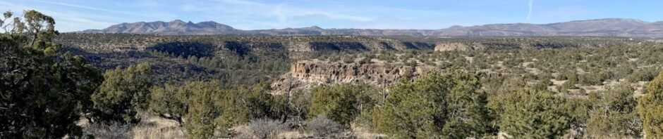
Jay here: Passing by these trail signs for many years on the way to Bandelier or up to the Caldera in the Jemez, my curiosity was piqued but never satisfied. Now we’re looking forward to exploring many more of these trails. Both the topography and the view perspectives are unique to this area, so it’s refreshing to see the Sandias far off in the distance or the Truchas peak aspect in a way we do not normally see these mountains.
Highlight
… To explore a new area of trails.
Statistics
Total Distance: 4.09 miles
Elevation: start 6,496 ft, maximum 6,604 ft, minimum 6,319 ft
Gross gain: 285 ft. Aggregate ascending 524 ft, descending 521 ft
Maximum slope: 39% ascending, 27% descending, 4.4% average
Duration: 3:29, Average Speed: 1.2 mph, Shade: 20%
| GPS Track Files for Download | |
55 Downloads | |
|---|---|
53 Downloads | |
| Link to GAIA GPS: “Ridgeline-Portillo Mesa Trails Hike.Jay.2026-01-06” | |
| If you haven’t explored these hiking tracks with Google Earth, give it a try. With the virtual 3-dimensional presentation, achieved by panning and tilting the view, you can get good idea of the hike and the terrain. For some ideas, check out Using Google Earth Track Files. | |
Related Posts
Mitchell Trail Hike – 10/22/2025
Water Canyon Loop Trail Hike – 11/02/2023
References and Resources
Los Alamos County Open Space & Trails: Trail Network Map (pdf)
Los Alamos County Trail Network Guide: White Rock Canyon Trailheads
AzecNM: White Rock Trails
AllTrails: Potrillo Canyon Loop
Powerline Point
Potrillo Canyon Trail to Lower Water Canyon Trail Loop
Santa Fe New Mexican: Public Trails on Los Alamos National Laboratory Land
Photos


Views to date: 23 views.