
Elena Gallegos Hike.Pat.2015-02-18
A delayed entry into the Journal. Pat and I hiked the trails in Elena Gallegos regularly, before we struck out further from home.
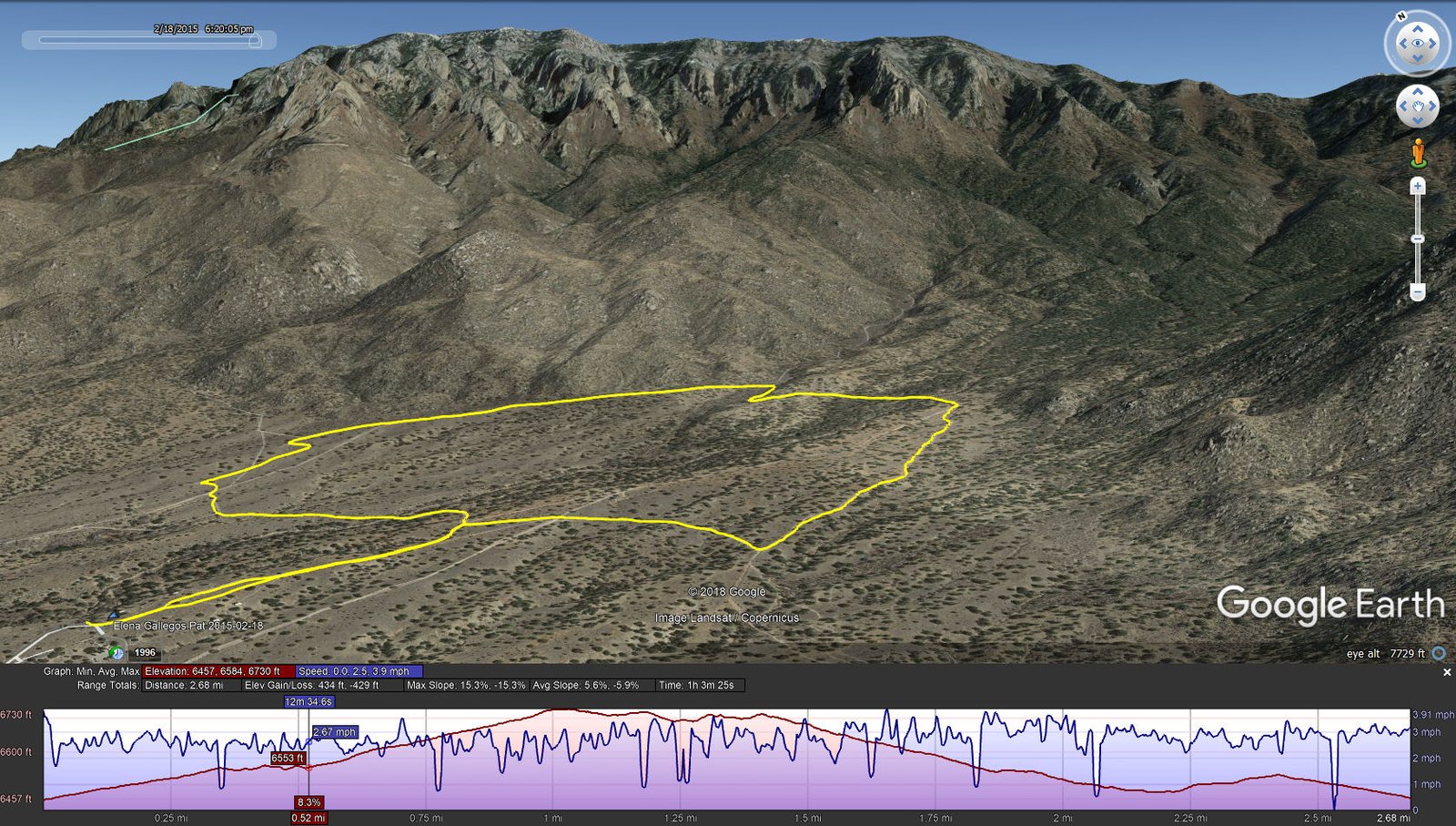
Statistics
Total Distance: 2.68 miles
Elevation: start 6,475 ft, maximum 6,730 ft, minimum 6,475 ft
Gross gain: 255 ft. Aggregate ascending 434 ft, descending 429 ft
Maximum slope: 15% ascending, 15% descending, 6% average
Duration: 1:03
| GPS Track Files for Download | |
211 Downloads | |
|---|---|
251 Downloads | |
I urge you to explore our hiking tracks with Google Earth. With the virtual 3-dimensional presentation, achieved by panning and tilting the view, you can get a much better idea of the hikes and terrain than you can get from the 2-dimensional screenshot above. For assistance: Using Google Earth Track Files.
References
City of Albuquerque: Elena Gallegos Open Space
New Mexico History: Elena Gallegos Grant