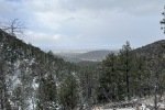
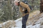
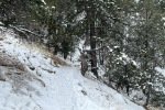
‘Tis great to go hiking with Jay again, this time on one of the Dale Ball Trails on the outskirts of Santa Fe – Dorothy Stewart Trail, with extension.
The Drive In
The trailhead is on Camino De Cruz Blanca – I’m not one to give directions for navigating around Santa Fe, Jay navigates thereabouts. So I’m going to leave you with – use your favorite driving navigation tool, and follow that.
The Hike
Notes about the Google Earth screenshot: the graph at the bottom shows elevation of the track (pink area) and speed (the blue line).
 The Dale Ball trails are really great, used heavily by locals, afoot and sometimes on bikes. So they are well defined, easy to traverse (even tho’ the elevation gains and slope can be large in some places). There are great maps for download, and the maps are posted at the trailheads and major intersections of the trails.
The Dorothy Stewart Trail is a loop of about 1.6 miles in length. We opted to follow trails beyond the DST to get added distance. From the elevation profile above, you can see the changes in elevation in the trail. The first mile and half, down then up then down again, were easy going. Then the climb in the next mile is a bit strenuous (’tis the first challenging elevation change that I’ve seen in many weeks of waling around Albuquerque). From the top  ’tis an easy downhill return to the trailhead (the last half mile or so down a gated residential street).
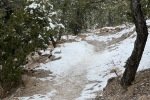
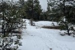
For our hike this day, we bundled up for the 30 degree temperatures (fortunately with no wind to make it -cold-). We started in sunshine but clouds soon moved in and snow flurries soon followed; that continued until we neared the finish line. For much of the trail we hiked through 1″ to 4″ of recently fallen snow – it had not melted so we saw ice in only one section. Otherwise, except for a couple of very steep sections, footing was sound with only our hiking boots.
Statistics
Total Distance: 3.55 miles
Elevation: start 7,550 ft, maximum 7,845 ft, minimum 7,290 ft
Gross gain: 655 ft. Aggregate ascending 929 ft, descending 929 ft
Maximum slope: 31% ascending, 27% descending, 9.0% average
Duration: 2:25
| GPS Track Files for Download | |
100 Downloads |
|
|---|---|
174 Downloads |
|
If you haven’t explored these hiking tracks with Google Earth, I urge you to try it. With the virtual 3-dimensional presentation, achieved by panning and tilting the view, you can get a much better idea of the hikes and terrain than you can get from the screenshot above. For some ideas, check out Using Google Earth Track Files.
Related Posts
Dale Ball Trails Hike – 08/25/2021
Nature Conservancy-Dale Ball Trails Hike – 02/26/2021
Dale Ball Loop North Trail Hike – 05/23/2019
Hiking in the Santa Fe area
References and Resources
Santa Fe Conservation Trust: Dale Ball Trails
AllTrails: Camino Cruz Blanca to Dal Ball Trails Loop
The north extension is Dorothy Stewart
Dorothy Stewart Trail
Only in Your State: … Dorothy Stewart Trail


