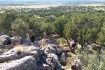
Pat’s brother Steve and wife Sharon visited, and of course we included a trip to our cabin, El Cerrito, near Manzano.
The Walkabout
We made the usual tour of our cabin and 120 acres. Up the hill from the cabin to the top/eastern border, then down to the rock overlook at the southeast east corner of Cerrito del Llano. From there down hill to corners of our boundary, a visit to the Ruins, the well, and back to the Shop Area and the Cabin.
Statistics
Total Distance: 1.11 miles (more, I started tracking late)
Elevation: start 6,738 ft, maximum 6,791 ft, minimum 6,699 ft
Gross gain: 92 ft. Aggregate ascending 128 ft, descending 141 ft
Maximum slope: 24% ascending, 21% descending, 4% average
Duration: 2:20 (more, I started tracking late)
| GPS Track Files for Download | |
240 Downloads |
|
|---|---|
128 Downloads |
|


