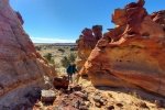
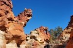
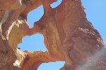
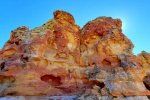
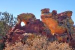
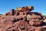
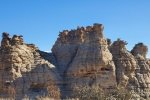
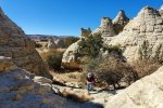
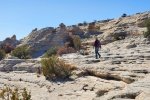
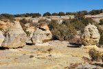
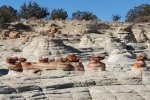
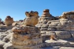
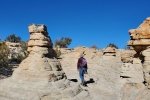
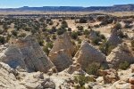
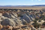
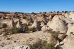
Weather was beautiful this day in New Mexico, perfect for returning to the Rio Puerco, and to visit geologic formations that are a favorite of our friend and photographer Pat Barrett. We enjoyed a really good hike and the geologic formations are something to behold.
A note about the name I’m using – I haven’t found a name associated with these formations on any map. Three miles southeast are formations and a mesa dubbed La Mesita Blanca, and further south is Mesita Negra. So it seems appropriate, given the red rock outcroppings, that this should be called La Mesita Roja.
UPDATE, 11/29/2022: I’ve discovered the “proper” name for this small but amazing outcrop of hoodoos: Cañada del Ojo. See References below.
The Drive In
The drive from I-40 is paved for 6 miles, then graded and well used dirt to the parking area. There are many roads scattered in the Rio Puerco and few significant landmarks, plus the route passes through the To-Hajiilee Navaho Reservation, so it is easy to unintentionally arrive at the middle of nowhere. So here are detailed directions:
- Drive west from Albuquerque to the Cañoncito turnoff, then drive north towards To-Hajiilee on Trail 56, also identified as Cañoncito School Road.
- Just before the Cañoncito School, turn right off of the pavement, then immediately left to continue on Trail 56. (There are signs for Trail 56 and Trail 57 – Trail 57 angles off to the right, terminating back at I-40, at the interchange near the Route 66 Casino.)
- Continue north on Trail 56. Don’t take the Y to the left two-tenths of a mile along, nor the Y to the left 3 miles along; as a guide, stay on the road that is in the better condition.
- Pass through the 1st fence line (with cattle guard), the boundary between the Reservation and the Herrera Ranch (private land). Another mile along park just beyond the 2nd fence line; you are now on BLM land.
The Hike
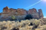
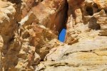
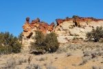
Not being familiar with the territory, we struck out east from the parking area on a 2-track that crossed over the southern end of a ridge. Soon the 2-track headed north, and recalling Pat Berrett’s advice, we left the 2-track and set out towards the fence line. As we crossed Cañada del Oso, we headed southeast, towards a prominent and interesting geologic feature. Along the way the red rocks that Pat B. had spoken about came into view. We continued on toward the “Red Butte” to take a closer look. The formation, maybe 30′ tall with columns and windows and amazing range of red colors and hues. Our photos don’t give it its due.
After ogling Red Butte, we headed north to Mesita Roja, the ridge of colorful red rock outcroppings. We wandered through passageways, looking at the most interesting features of color and shapes, windows and forms, passagways and dead ends. Mesita Roja is definitely the most interesting geologic features that we have visited. These photos and in the Gallery below may give you some idea of the beautiful Mesita Roja.
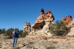
 Finding ourselves atop the ridge of Mesita Roja, we could see clearly the Hoodoos a quarter of a mile distant. We descended off of the Mesita and across the arroyo to find ourselves in an amazing array of 20-30 foot tall Hoodoos. We wandered among them, working our way around the collection that sits below the boundary of what I will call “Hoodoo Mesa”. We worked our way
up the east side, then up onto the Mesa to look at the Hoodos from above – great views. Along the way we came across more and more interesting features and formations.
Not finding a way down the west side of Hoodoo Mesa, we circled back to the east side and circled around the Mesa to the west side to where the cañon narrowed.
Having thoroughly enjoyed Mesita Roja and Its Hoodoos, we took a bearing from US Topo and struck out for the truck. Taking the direct route, we found ourselves crossing Cañada del Oso through sometimes tall lumps of grass, at other times wending our way through waist to chest high bushes. That along with the soft surface made the hiking a bit more strenuous – that is, a good workout.
Highlight
‘Tis a beautiful place, with such a variety of interesting features – shapes, colors, and more. We’ve enjoyed Goblin Colony, Tent Rocks, Dinosaur Ridge, and mesas around Mesa de Cuba. But this is our favorite. And it is secluded – ‘tho a car was parked near ours when we returned, evidence (and location) suggest that it is rarely visited.
Statistics
Total Distance: 4.27 miles
Elevation: start 5,943 ft, maximum 6,012 ft, minimum 5,812 ft
Gross gain: 69 ft. Aggregate ascending 645 ft, descending 648 ft
Maximum slope: 19% ascending, 26% descending, 5.0 % average
Duration: 4:33
| GPS Track Files for Download | |
0 Downloads |
|
|---|---|
194 Downloads |
|
148 Downloads |
|
259 Downloads |
|
I urge you to explore our hiking tracks with Google Earth. With the virtual 3-dimensional presentation, achieved by panning and tilting the view, you can get a much better idea of the hikes and terrain than you can get from the 2-dimensional screenshot above. For assistance: Using Google Earth Track Files.
References and Resources
Thanks to Pat Barrett for telling us about this amazing place, and for the directions to get there.
Update – links to References for Cañada del Ojo:
AllTrails: Canada del Ojo
Woman Seeks Elevation: Cañada del Ojo: An eyeful of hoodoos
The Gentle Art of Wandering: 49 Canada del Ojo
Can also find information in the book “60 Hikes Within 60 Miles, Albuquerque“


