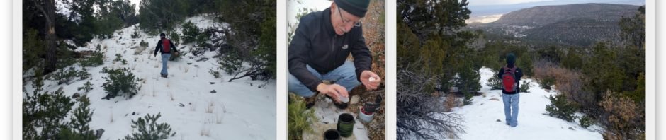
This was our second hike on the Osha Spring Trail. As on the earlier outing (Osha Spring Trail Hike), we’re anticipating a future hike to the Land’s End Mine. The day was chilly with snow flurries, and a muddy trail in spots, so it was shortened.
The Hike
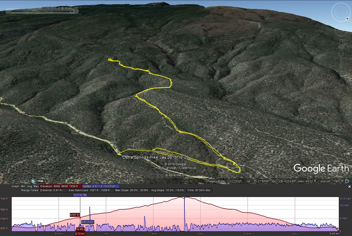
Osha Spring Hike. 12/20/2015
Statistics
Total Distance: 3.47 miles
Elevation: 6,859 start, 7,334 maximum, 6,500 minimum
Gross gain: 834 ft. Aggregate ascending 1,021 ft, descending: 1,058 ft
Maximum slope: 29% ascending, 34% descending, 10% average
Duration: 2:55
| GPS Track Files for Download | |
190 Downloads | |
|---|---|
342 Downloads | |
I urge you to explore our hiking tracks with Google Earth. With the virtual 3-dimensional presentation, achieved by panning and tilting the view, you can get a much better idea of the hikes and terrain than you can get from the 2-dimensional screenshot above. For assistance: Using Google Earth Track Files.
References
GeoCaching.com: Landsend Barite Cache
Exerpt from Sandia Mountain Hiking Guide: Barite Mine, LNDMRK


