
Just a short drive out of Albuquerque, then south on South 14 (oops, that is now NM 337), Oak Flats is an Albuquerque Open Spaces trail. The terrain is quite level, forested, and provides an easy trail surface – lots of pine needles.
The Hike
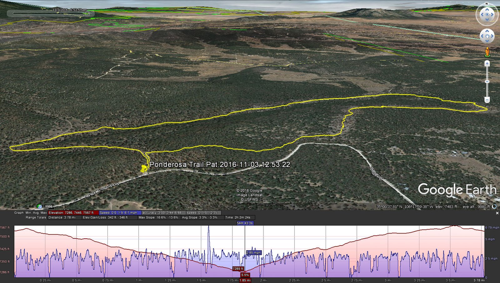
Ponderosa Hike in Oak Flats out of Tijeras (Pat, 2016-11-03)
Statistics
Total Distance: 3.78 miles
Elevation: 7,535 start, 7,567 maximum, 7,285 minimum
Gross gain: 282 ft. Aggregate ascending 342 ft, descending: 346 ft
Maximum slope: 17% ascending, 14% descending, 3% average
Duration: 2:02
| GPS Track Files for Download | |
492 Downloads | |
|---|---|
243 Downloads | |
If you haven’t explored these hiking tracks with Google Earth, I urge you to try it. With the virtual 3-dimensional presentation, achieved by panning and tilting the view, you can get a much better idea of the hikes and terrain than you can get from the screenshot above. For some ideas, check out Using Google Earth Track Files.


