This is the 2nd half of our first camping trip of the year, returning to Cave Creek Canyon in the Chiracahua Mountains. After a day of hiking and a day visiting Douglas, AZ and Agua Prieta, MX (see the post for the first half of our camping trip), we set out to hike the Silver Peak trail. The next day we drove across the middle of the Chiracahuas to the Chiracahua National Monument, then back to Agua Prieta to eat at the restaurant we discovered and attended a cross-border Binational Play.
The Drive In
For the hike, from Stewart Campground drive back towards Portal for half a mile; park at the trailhead on the left (north side of Cave Creek Road/Forest Rd 42).
The Hike
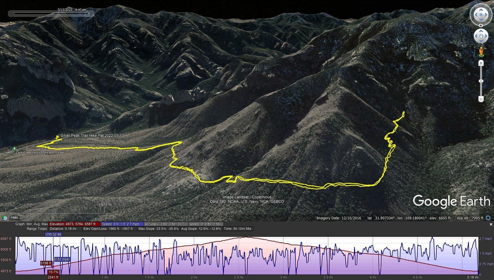
Silver Peak Trail Hike.Pat.2022-03-13
Notes about the Google Earth screenshot: the graph at the bottom shows elevation of the track (pink area) and speed (the blue line).
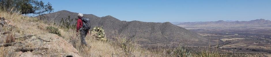
 This hike proved to be one of the most challenging that we’ve done. The trail is well used; for the 1st mile/800 feet it is a constant slope on fairly flat terrain, but the surface is broken/flat rocks all the way – tough walking. As we climbed, the views out across San Simon Valley and beyond are what we came for.
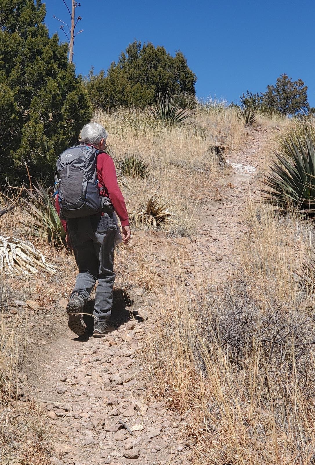
After that 1st mile, trail changes to a traverse along a very steep slope as it continues gaining elevation. The trail becomes quite narrow, in places -very- narrow, generally with a gravel surface. This required constant attention and great care because any slip would likely lead to a tumble down the steep slope, encountering yucca and prickly pear along the way.
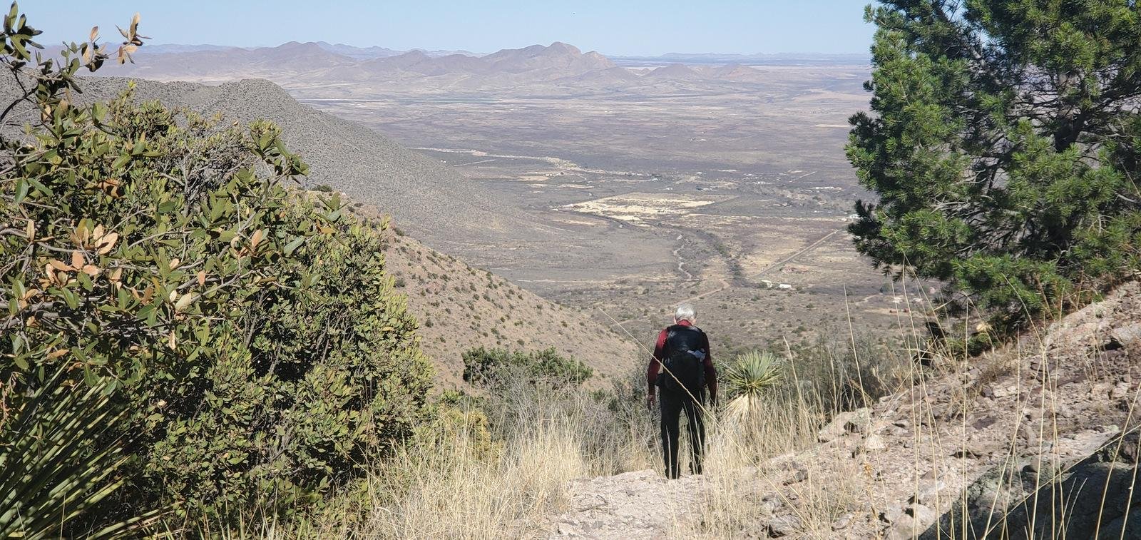 ‘Tho the trail continues on another 2 miles and 1,400 elevation gain to the peak itself, our 2.6 miles and 1,600 feet was enough for us. We found a nice place to sit and have lunch, then headed back to the trailhead.
Epilogue
After the Silver Peak hike, we skipped more hiking in favor of investigating the drive through the heart of the Chiracahuas, over to the National Monument. FR 42 and Pinery Roads are examples of well maintained Forest Service roads – graded gravel surface and generally wide enough for cars to pass. Having said that, for us most of the route was daunting – like the Silver Peak trail carved out of -very- steep mountainsides. And for emphasis, for much of the distance in the heart of the mountains it was 1,000 feet (seemed like more) from the road to the bottom of the canyon. And the road has many turns; no fast driving.
Our visit to the Chiracahua National Monument was brief – we had visited it years ago, even hiked the Echo Canyon Trail. The rock formations are most interesting, quite different from Cathedral Rock and the other formations above Cave Creek Canyon.
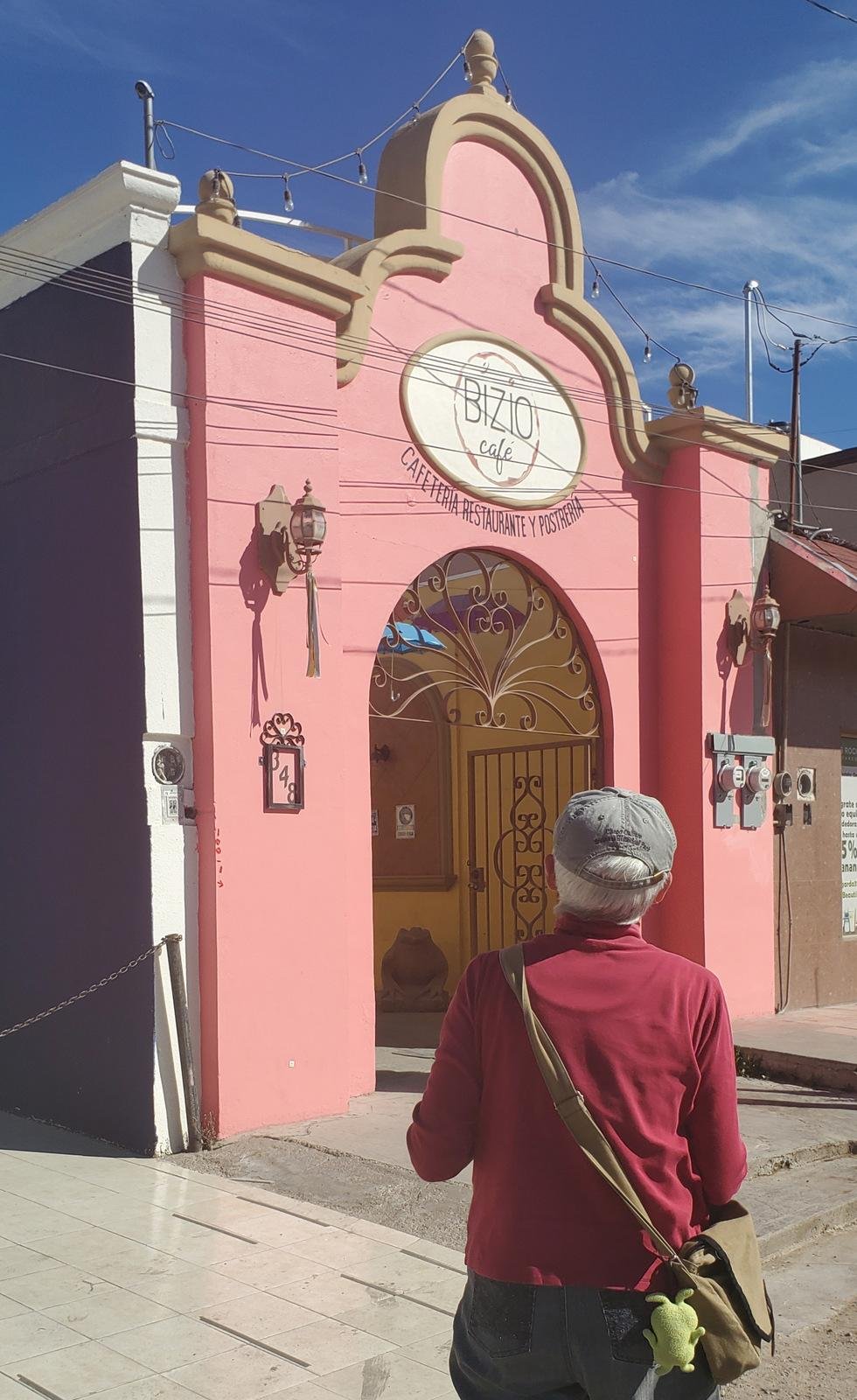 To return to Cave Creek, one has a choice – go north to I-10 to circle around the north end of the Chiracahuas, or go south to Douglas – each is about 110 miles. We opted to return to Douglas and cross into Agua Prieta to eat at the cafe we discovered on our earlier trip, the Bizio Cafe – a very nice lunch.
Along the way we learned of an event being held that evening. There is ongoing effort to build connections between the communities across the border. One example is an event in which people on each side of the border present a multidisciplinary play about the history and conditions at the border (see the link below). The event began at dusk with participants on both sides presenting a story or dance about life along the border. In some cases participants on each side would make their presentation in turn. At other times the story was interrelated, as though the participants were on a single stage and not separated by the steel slat fence.
So, it appeared that the two communities were sharing the same space comfortably. We saw a constant flow of people across the border; families from Agua Prieta returning home with groceries from the nearby Walmart, cars with Arizona license plates returning from activities in Agua Prieta, and a few like us – visitors exploring.
Statistics
Total Distance: 5.18 miles
Elevation: start 4,973 ft, maximum 6,587 ft, minimum 4,973 ft
Gross gain: 1,614 ft. Aggregate ascending 1,960 ft, descending 1,957 ft
Maximum slope: 34% ascending, 36% descending, 12.6% average
Duration: 5:11
| GPS Track Files for Download | |
197 Downloads | |
|---|---|
137 Downloads | |
186 Downloads | |
188 Downloads | |
If you haven’t explored these hiking tracks with Google Earth, I urge you to try it. With the virtual 3-dimensional presentation, achieved by panning and tilting the view, you can get a much better idea of the hikes and terrain than you can get from the screenshot above. For some ideas, check out Using Google Earth Track Files.
Related Posts
References and Resources
USDA Forest Service: Silver Peak Trail #280
Chiracahua Mountains Hiking Trails: Silver Peak Trail #280
AllTrails: Silver Peak Trail
Hike Arizona: Silver Peak Trail #280, AZ
STAV is LOST: Hike Silver Peak
The DriveAcross and Douglas/Agua Prieta
USDA Forest Service: Pinery Canyon #42 Scenic Drive
Arizona Republic: Youth-led binational play at the border wall …


