It has been a long time since Pat and I have hiked in the Sandias; last time was in 2017, coincidentally on Mar 30 we hiked the Three Gun Spring Trail. We had also hiked there on three outings back in the winter of 2010-2011 (if I was recording tracks then, I’ve since lost the files). This time of year, the southern end of the Sandias is preferable – more sun – it’s not so pleasant during summer temperatures. And the Three Gun Spring trail is an easy one – a really easy trail surface and a -steady- climb for a nice gain in elevation.
The Hike
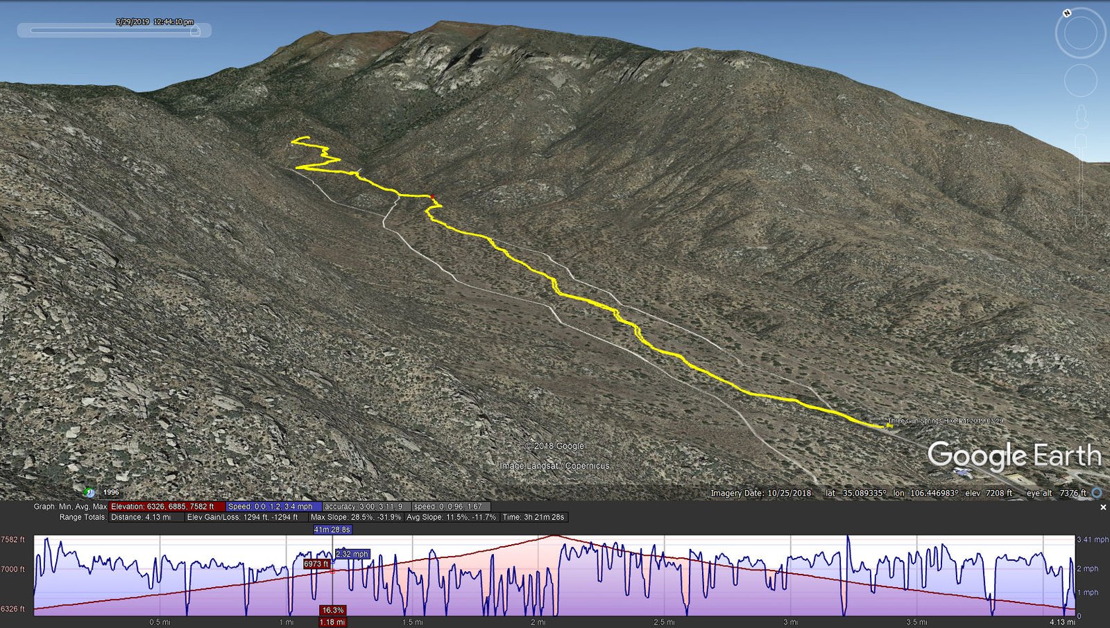
Three Gun Springs Hike.Pat.2019-03-29
Access to the trailhead is all-season: I-25 east from Albuquerque, exit at Tramway to get on NM 333 (also Old Rt 66); 3.17 miles, turn left (north) onto Monticello Dr, then up the hill for .5 miles. A sign directs you to turn left onto Alegre, then right (another sign) onto Tres Pistolas Trail. Park, check the map on the large signboard, and set out up the Three Gun Springs Trail (also know as Tres Pistolas trail). In about .3 miles you will encounter the entrance to the Sandia Mountain Wilderness; a few yards beyond that the junction with the Hawk Watch Trail, another great hike (seek hikes with Pat back in 2011, and with Jay back in 2013 and 2014).


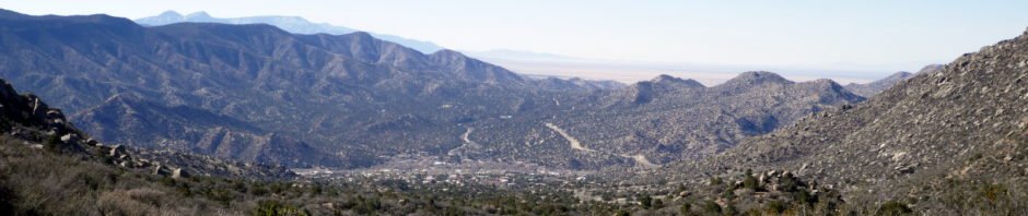
This is a -very- scenic hike, with views of mountainscapes left, right, and ahead, especially to the vertical rock “slopes” of South Sandia peak. And views of a few of Mother Nature’s interesting rock sculptures. On this day Mother Nature also blessed us with so many early signs of spring (deserving of a post itself).
About a 1.5 miles up the trail, crossing a small canyon (or ravine?), one can turn a bit to the right to visit the trail’s namesake, Three Gun Spring. We chose to continue on up the trail, stopping for our mid-hike break with a -superb- view down the canyon, across the Manzanita Mountains to the Monzanos, and to their right the open plains of Kirtland AFB, and beyond, what we know of as Tierra Grande. ‘Tho it was a bit hazy, we could also make out the Los Pinos Mountains.
People who live in Albuquerque are so fortunate to have such amazing places to visit, to be outdoors among interesting places with scenic views. And some many so very close – within less than a half hour drive from anyplace in the city.
Statistics
Total Distance: 4.13 miles
Elevation: start 6,327 ft, maximum 7,582 ft, minimum 6,326 ft
Gross gain: 1,256 ft. Aggregate ascending 1,294 ft, descending 1,294 ft
Maximum slope: 29% ascending, 32% descending, 11.5% average
Duration: 3:21
| GPS Track Files for Download | |
201 Downloads | |
|---|---|
155 Downloads | |
I urge you to explore our hiking tracks with Google Earth. With the virtual 3-dimensional presentation, achieved by panning and tilting the view, you can get a much better idea of the hikes and terrain than you can get from the 2-dimensional screenshot above. For assistance: Using Google Earth Track Files.


