Our 2nd hike on a 5-day camping trip to the Jemez Mountains with Jay and Nancy. We set up camp in the Jemez Falls Campground, a very nice Forest Service campground in the middle of the Jemez Mountains and close to Valles Caldera. Nearby are great hiking opportunities – for all skill levels, any distances.
The Drive In
From the campground, drive east to the entrance to the Valles Caldera National Preserve. There is only one road into the Preserve which takes one to the Visitor Center. To proceed beyond this point one must register (and may be required to pay an access fee, ‘tho in recent months the fees have been waived). After receiving your Pass, you will be allowed to lower the entrance cable and proceed into the Preserve.
The trailhead for this hike is in the northwestern corner of Valles Caldera. Within the Preserve, vehicles must remain on the two roads. From the Visitors Center, VC01 goes northwest between Valle Grande the lava domes Cerro La Jara and South Mountain to the Cabin District. (Among the buildings there is the ranch house featured in the series “Longmire”.) From there, VC02 proceeds northeast, about 10 miles to a T intersection with VC09. To continue for hiking downstream on San Antonio Creek, turn left on VC09 – 4 miles to park at the end of allowed access.
The Hike
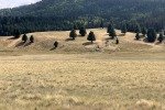
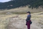
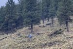
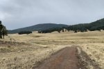
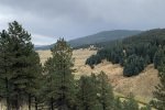
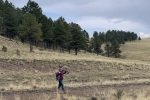
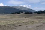
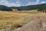
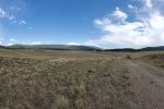
This is may be the most beautiful area of Valles Caldera. We parked at the end of access on VC-09, then continued on foot in the wide valley of San Antonio Creek. We enjouyed magnificent views of the surrounding lava domes: to the south Cerro Seco and San Antonio Mountain, and to the north and west the rim of the Caldera. About a mile along the old roadbed of VC-09 we crossed the bridge over San Antonio Creek, and then .. the rain showers that had sprung up around the area caught up with us. We repaired up the slope and found a ponderosa pine that gave us some protection from the rain and popcorn hail shower.
 After about 45 minutes pinned down by the shower, we returned to VC-09 to continue our hike. A quarter of a mile on we passed out of the Preserve and onto FR 376 which followed the contour of the caldera rim 60 feet or so above the floor of the valley. The view of the Creek from this vantage point is beautiful. In another half mile we found ourselves at the base of the road Jay and I had taken down from FR 144 for the San Antonio Canyon North Hike back in 2017. We chose to turn back here, but take a route along the Creek itself.
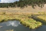
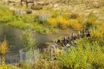
 Of interest to us in the creek were the artificial “beaver dams” that were being constructed when Pat & I hiked here back in 2019 (Valle de San Antonio Hike – 09/11/2019). Work had been completed and the posts with willow woven between them were intact .. but no sign of beaver (yet).
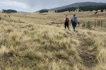
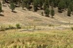
The track along the river is most pleasant, with the green grasses, recently planted willows (within exclosures for protection), and the gently flowing stream. The trail is easy walking, ‘tho with one place where the artificial dam had backed up water over the trail necessitating a detour up the slope a bit. About midway back  towards the parking area, the trail returns to the road and across the bridge. Proceeding north on VC-09, the view across the wide valley of San Antonio Creek is splendid. All in all, this hike easily makes it worth the extra drive from the Valles Caldera entrance.
Jay here: Wouldn’t you know it. Hail storm again. Nancy and I had been partway on the road into the caldera but never to the end where this hike began. It’s a long ride. Seems longer on the way out after a long hike. A lot of downed trees throughout which is a bit sad but the regeneration is already underway so that’s a positive sign. Nancy found some rusty gems to take back, so it was worth the trek.
Highlight
A slide show of the beautiful vista views of the Valle de San Antonio.
Statistics
Total Distance: 4.35 miles
Elevation: start 8,390 ft, maximum 8,474 ft, minimum 8,326 ft
Gross gain: 148 ft. Aggregate ascending 618 ft, descending 618 ft
Maximum slope: 40% ascending, 42% descending, 04.8% average
Duration: 3:35
GPS Tracks
| GPS Track Files for Download | |
185 Downloads |
|
|---|---|
124 Downloads |
|
I urge you to explore our hiking tracks with Google Earth. With the virtual 3-dimensional presentation, achieved by panning and tilting the view, you can get a much better idea of the hikes and terrain than you can get from the 2-dimensional screenshot above. For assistance: Using Google Earth Track Files.
Previous Posts
Valle de San Antonio Hike – 09/11/2019
VC-09 Valle San Antonio Hike – 07/25/2019
San Antonio Canyon North Hike – 11/12/2017
References and Resources
National Park Service: Valles Caldera
New Mexico Nomad: The Valles Caldera
An Excellent overview of the geology and history
NM Bureau of Geology and Mineral Resources: The Valles Caldera: New Mexico’s Supervolcano (PDF)
Natural Atlas: Valles Caldera National Preserve (Topo & Trails)
National Geographic, Four Corners Region: Valles Caldera National Preserve – Fly Fishing
Any Place America: Valles Caldera National Preserve
Features: creeks, springs, valleys & canyons, peaks, even “mines”
Las Cruces Sun News: Experience the beauty of Valles Caldera National Preserve
In Light of Nature: Epic Winter Crossing of the Valles Caldera
Bikepacking.com: Valles Caldera Supervolcano Explorer, New Mexico
Really great photos


