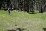
This was our first hike during a 3 days visit to the Jemez Mountains, in the vicinity of the Valles Caldera National Preserve. We set up our R-Pod trailer/camper in the Jemez Falls Campground, a base camp from which to explore and hike in the area. Our first stop was the Visitors Center in the Caldera where we obtained suggestions for hiking, maps of the Preserve, and … a pass that permitted us to drive beyond the Center. We were advise that we would not be able to go deep into the Caldera because of a road washout. From this review we chose to drive to the Cabin District, park, and hike on a logging road – VC02.
The Hike
The weather was perfect – comfortable temperature, no wind (a relief this time of year), and mostly clear sky. It appears that VC02 may be used by Preserve staff and maintained in good driving condition, so it was easy walking mostly on dry dirt with a couple of areas covered with rocks.
With this year’s wet spring the ground was covered with grasses and many different blooming flowers (the yellow of dandelions being the most prevalent against the green grasses). The forest was quite healthy – small and large ponderosa pines interspersed with groves of aspen. A few streams crossed the road, through culverts or meandering across the road, snowmelt from higher up on Redondo Peak to the west. And the views across the Caldera were spectacular; it is so vast (5 miles of completely open plain across to the other side of this section of the Caldera) which makes it very difficult to get a perspective of distances.
About a mile into the hike, we spotted our first elk of the trip – two at a distance near the edge of the forest. They appeared to survey us for a few minutes, then retreated into the trees. A bit over a mile on, we came upon a junction with VC0201 where we chose to turn back towards the truck. VC0201 appears to be an old logging trail, not used these days. Covered with grass it was more pleasant than VC02; it was easy to follow this old two track and made for easy walking.
Statistics
Total Distance: 3.06 miles
Elevation: start 8,740 ft, maximum 8,934 ft, minimum 8,721 ft
Gross gain: 213 ft. Aggregate ascending 535 ft, descending 526 ft
Maximum slope: 24% ascending, 20% descending, 5.6% average
Duration: 1:49
| GPS Track Files for Download | |
281 Downloads |
|
|---|---|
454 Downloads |
|
I urge you to explore our hiking tracks with Google Earth. With the virtual 3-dimensional presentation, achieved by panning and tilting the view, you can get a much better idea of the hikes and terrain than you can get from the 2-dimensional screenshot above. For assistance: Using Google Earth Track Files.
References
National Park Service: Valles Caldera-Plan Your Visit
AllTrails: Valles Caldera National Preserve
(VC02 isn’t marked, but this presents an overview of trails in the Caldera)
Los Alamos Woods Wanderer:
Valles Caldera National Preserve: New South Mountain Hike
(This report dates back to a time before the Caldera came under National Park Service management and became available to the public. But it offers some good description of the area of VC02 and photos.)


