I’m publishing this in 2018, so I don’t have fresh memory of the hike itself. But here is the usual technical data, some references, and photo galleries.
The Hike
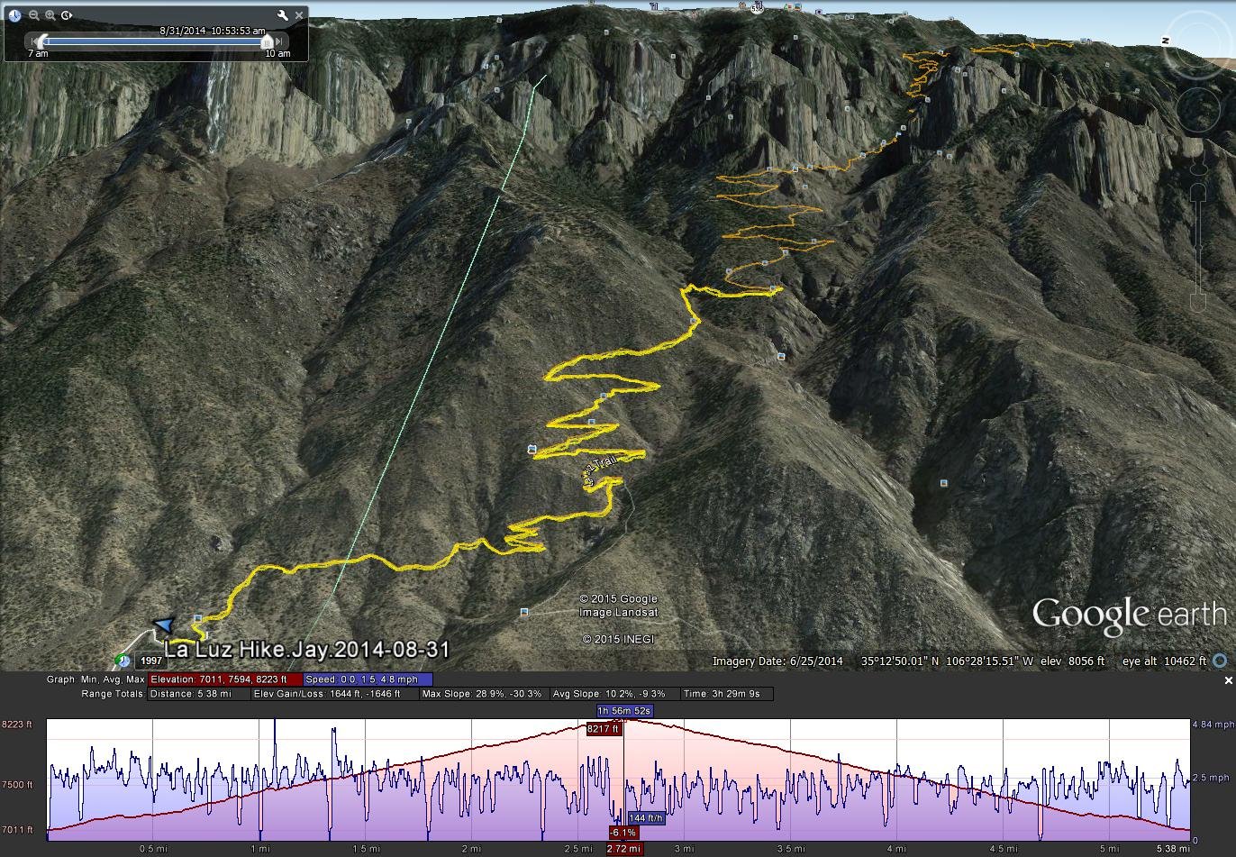
La Luz Hike & Trail.Jay.2014-08-31
Statistics
Total Distance: 5.35 miles
Elevation: start 7,010 ft, maximum 8,219 ft, minimum 7,010 ft
Gross gain: 1,209 ft. Aggregate ascending 1,779 ft, descending 1,781 ft
Maximum slope: 27% ascending, 27% descending, 10.0% average
Duration: 3:29
| GPS Track Files for Download | |
240 Downloads | |
|---|---|
174 Downloads | |
I urge you to explore our hiking tracks with Google Earth. With the virtual 3-dimensional presentation, achieved by panning and tilting the view, you can get a much better idea of the hikes and terrain than you can get from the 2-dimensional screenshot above. For assistance: Using Google Earth Track Files.
References
LaLuzTrail.com: La Luz Trail
AllTrails: La Luz Trail
USDA Forest Service: La Luz Trailhead and La Luz Trail 137
Cloudhiking Mountains: Sandia Mountains – La Luz Trail


