Introduction
Another “back on the trail” hike, this day with my long time hiking buddy. For some weeks, he’s invited me to join him on a new trail near Santa Fe. We hit the trail a bit early, hoping it would be a bit cooler even at the higher elevation. And afterwards, as has been our habit we stopped for breakfast, this day at Pantry Dos (the best smothered breakfast burrito that I’ve eaten).
The Drive In
Getting to the Spur Trailhead is a bit convoluted. I won’t try to describe it, but use this link to GoogleMaps.
The Hike
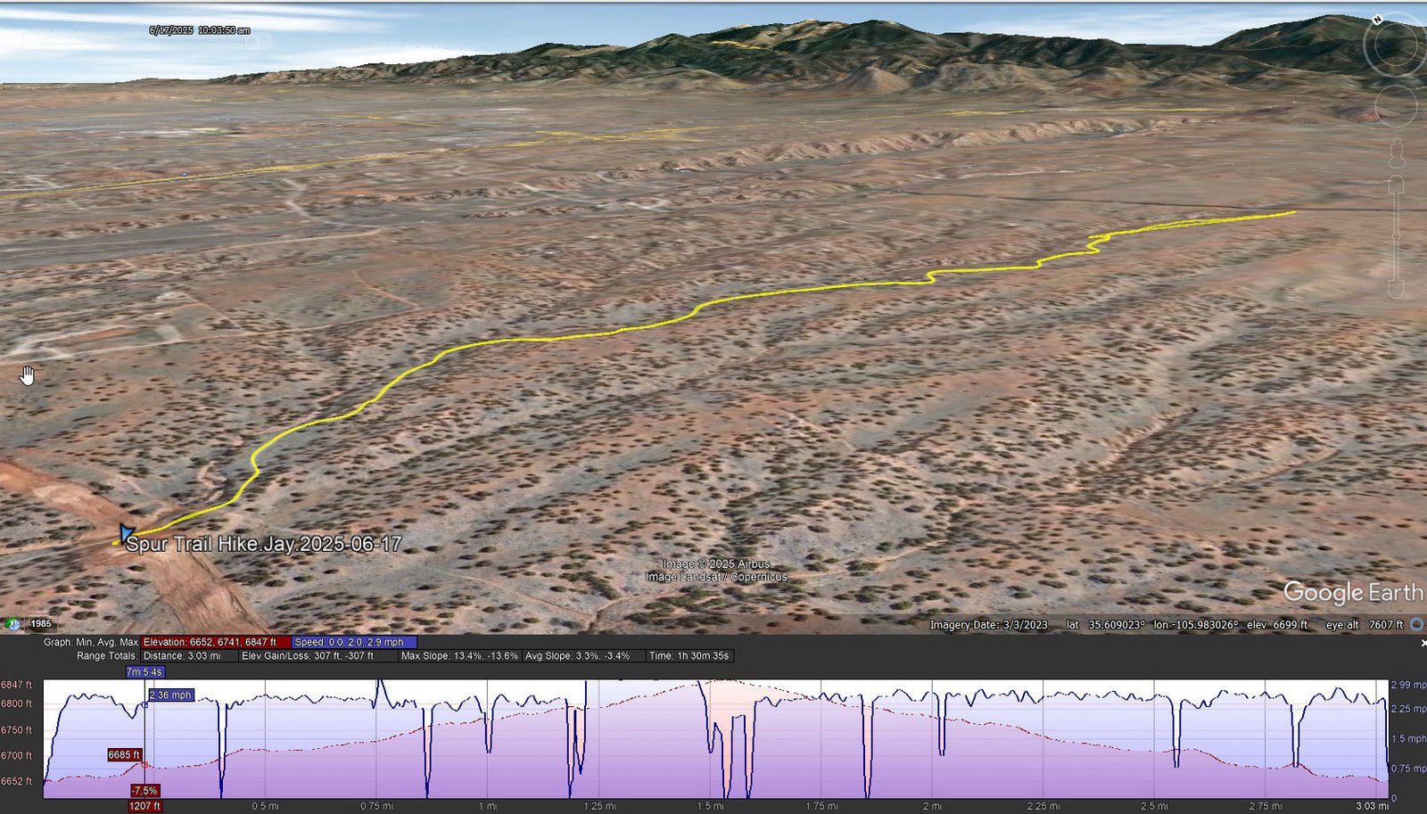
Spur Trail Hike.Jay.2025-06-17
Notes about the Google Earth screenshot: the graph at the bottom shows elevation of the track (pink area) and speed (the blue line).
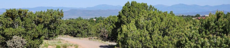
The Spur Trail is a well groomed out-and-back trail through open juniper forest (if one can call it a “forest”); we hiked the eastern portion of the trail, from Falcon Way to the Santa Fe Rail Trail and back. The trail presents a few ups-and-downs with easy slopes and only a little elevation gain overall. At the highest point one can see the mountains in every direction (except southeast): Ortiz, San Pedro, and Sandias to the southwest, Jemez to the northwest, and the Sangre de Cristo to the northeast. Oh, and some nice person has placed 4″ painted rocks marking 1 mile outbound and 2 mile return-bound – a nice touch – thanks.
Highlight
Simply being back on a hiking trail, again.
Statistics
Total Distance: 3.03 miles
Elevation: start 6,652 ft, maximum 6,847 ft, minimum 6,741 ft
Gross gain: 106 ft. Aggregate ascending 307 ft, descending 307 ft
Maximum slope: 13% ascending, 13% descending, 03% average
Duration: 1:31, Average Speed: 2.9 mph
| GPS Track Files for Download | |
107 Downloads | |
|---|---|
104 Downloads | |
| Link to GAIA GPS: “Spur Trail Hike” | |
| If you haven’t explored these hiking tracks with Google Earth, give it a try. With the virtual 3-dimensional presentation, achieved by panning and tilting the view, you can get good idea of the hike and the terrain. For some ideas, check out Using Google Earth Track Files. | |
References and Resources
AllTrails: Spur Trail from Rancho Viejo to Santa Fe Rail Trail