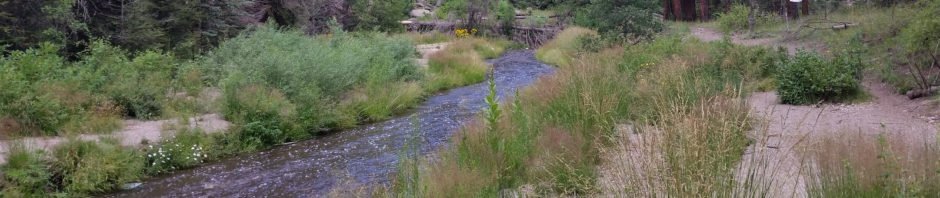
It is still summer here in New Mexico, so we continue to seek trails at higher elevations and in the shade of woods, and where there is some feature of interest. This hike, in the Jemez Mountains, above 7,000 feet elevation, with a water feature – a “Box”. (In New Mexico, a “Box” is a place where a river gets squeezed between steep, rock outcroppings, creating rapids and sometimes a waterfall.)
The Drive In
The the East Fork Trail #137 goes from Battleship Rock on the west to Las Conchas on the east, crossing NM 4 at about the halfway point. For this hike, we started at the East For Trailhead. Reach the trailhead by driving on NM 4 from San Ysidro through the Jemez Puebl0 (honor their speed limit, it is aggressively enforced) and Jemez Springs. Continue up the Jemez River and past La Cueva and the intersection with NM 126. Continue on NM 4 past the Jemez Falls Campground (6 miles, then another mile to parking on the left for the East Fork Trailhead.
The Hike
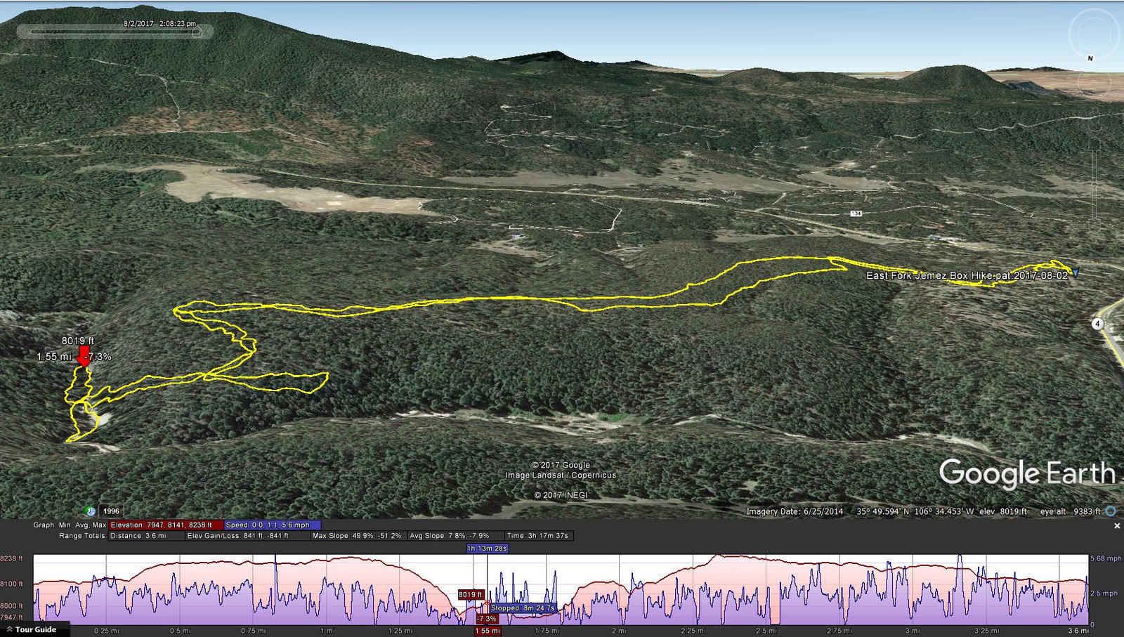
East Fork Jemez Box Hike.pat.2017-08-02
Our hike was on a middle section of the 5-mile long East Fork Trail #137. From the trailhead on NM 4, one can hike west to Jemez Falls, or as we did go east to the Jemez River Box. As you can see from the elevation profile from GoogleEarth in the image above, the terrain for the first mile is generally level, and follows a tw0-track making it very easy. Then … to get to the Box one must descend some 300 feet into the Jemez River canyon.
This must be a popular trail as stairs have been put in place for the steepest parts of the descent. And … a fallen-log-bridge has been placed across the river providing access to the beach on the north side. It is a short walk up-river to the Box; passage further will require some wading. Going down-river will also require wading as the streambed wanders from one canyon wall to the other. This time of year the river is quiet enough that such wading would be no problem (we didn’t have equipment such as wading shoes or boots – that will be for another visit).
The climb back out of the canyon was easy (stairs are nice). After our mid-hike break, we encountered a wye in the trail, so “we took it” (per Joe DiMaggio) thinking it might offer a way down into the canyon for the return to parking. It became quite steep, and anticipating even from there would require wading, we went back to the out-bound trail and back to parking. ‘Tis a great place for an afternoon hike.
Statistics
Total Distance: 3.6 miles
Elevation: start 8,100 ft, maximum 8,238 ft, minimum 7,947 ft
Gross gain: 291 ft. Aggregate ascending 841 ft, descending 841 ft
Maximum slope: 50% ascending, 51% descending, 8% average
Duration: 3:18
| GPS Track Files for Download | |
307 Downloads | |
|---|---|
359 Downloads | |
If you haven’t explored these hiking tracks with Google Earth, I urge you to try it. With the virtual 3-dimensional presentation, achieved by panning and tilting the view, you can get a much better idea of the hikes and terrain than you can get from the screenshot above. For some ideas, check out Using Google Earth Track Files.
References
SummitPost: East Fork Box
USDA Forest Service: East Fork Trail (FT #137)
ASCHG: East Fork Box Wade Hike


