Pat & I went looking for new territory; checked for opportunities around Santa Fe since we needed to take the Tacoma in for servicing. We were pleased to find a few opportunities more or less on our way from Albuquerque … and near the canyon through which the Rio Grande flows on its way to Cochiti Lake (White Rock Canyon). Diablo Canyon appeared to be interesting, and would allow us to reach the Rio Grande.
The Drive In
‘Tis a bit of a drive from NM 599, paved for a while, then a well-used gravel/sand road; about 22 miles to the Diablo Canyon Recreation Area. The trailhead and trail are easy to find – a few yards and down into the sandy bottom of the Canyon in the Diablo Canyon Recreation Area. It is a long drive from NM 599, about five mile on pavement, then some 8 miles on a well maintained and used gravel road. From the interchange on US 84 to NM 599, drive 3.5 miles south on 599 to the exit for Camino la Tierra, (exit 282). After about 4 miles (on pavement), turn right onto Old Buckman Road (a dirt road). These may also be marked as Sandoval County Road 77. Some 7.5 miles on, pass the Recreation Area; continue another 2.5 miles to the Trailhead.
The Hike
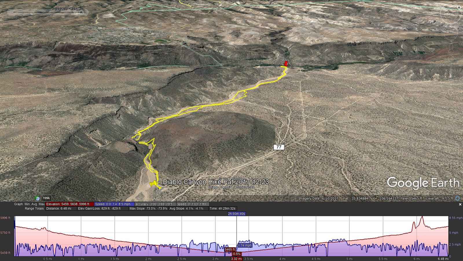
Diablo Canyon Hike.Pat.2017-12-23
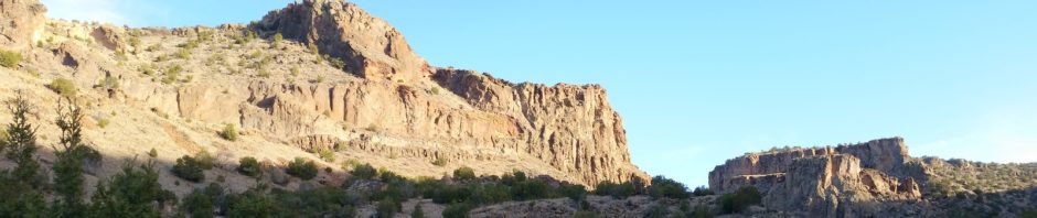
The beginning of the trail is through a -real- canyon – vertical walls on both sides, at least 300 feet high with the flo or only 50 feet wide. And we discovered that the walls are favored by rock climbers – there were two groups at it when we arrived, with climbers gripping the rock about half way up. We were in the canyon for about half a mile, then the track opened up with a mesa on the left (south) and open scrubland on the right (north).
We walked at times on the sand of the canyon’s wash (always looking for a surface more firm than loose sand), at other times among the sparse juniper brush along the wash. ‘Twas like this all the way to the river, where we enjoyed our mid-hike break listening to the Rio Grand flow over rocks creating a Class II rapids. The return hike was easy. We found a group of climbers in the Canyon, with one climber still up on the wall (see last photo below).
Statistics
Total Distance: 6.48 miles
Elevation: start 5,844 ft, maximum 5,844 ft, minimum 5,459 ft
Gross gain: 385 ft. Aggregate ascending 829 ft, descending 929 ft
Maximum slope: NA% ascending, NA% descending, NA% average
Duration: 4:30
| GPS Track Files for Download | |
264 Downloads | |
|---|---|
250 Downloads | |
Note for this track: Disregard what appears to be a track that goes up on the wall within the canyon. The GPS looses satellite signals in canyons like this and records erroneous positions.
If you haven’t explored these hiking tracks with Google Earth, I urge you to try it. With the virtual 3-dimensional presentation, achieved by panning and tilting the view, you can get a much better idea of the hikes and terrain than you can get from the screenshot above. For some ideas, check out Using Google Earth Track Files.
References
BLM: Diablo Canyon Recreation Area
Recreation.gov: Diablo Canyon Recreation Area, NM
ASCHG: Diablo Canyon Hike
AllTrails: Diablo Canyon
Only in Your State:
The Unrivaled Canyon Hike In New Mexico Everyone Should T ke At Least Once (great photos)
Mountain Project: Diablo Canyon Rock Climbing
YouTube: Diablo Canyon Recreation Area
Wikipedia: Caja del Rio


