Introduction
Picking up the pace of hiking this year, Jay met me in our old “hiking grounds” – the trails around Placitas.
The Drive In
The trailheads for Agua Sarca and Tunnel Spring are near each other. Starting at the Cafe along NM 165 in Placitas, drive east for 2.7 miles, then turn right on Road 231 (Tunnel Springs Road).
- On the dirt road it is 1.3 miles to parking for the Agua Sarca Trailhead.
- The Tunnel Spring Trailhead is 200 yards further along with ample parking.
- One passes under a very big cottonwood tree, courtesy a spring flowing out of a pipe on the right.
The Hike

 Agua Sarca Hike Agua Sarca Hike |
Click on the images to see full-screen view; <back> on your browser to return to the page.
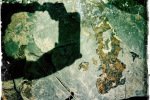
Notes about the Google Earth screenshot: the graph at the bottom shows elevation of the track (pink area) and speed (the blue line).
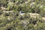
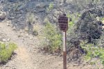
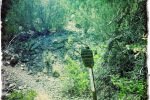
Driving to the trailhead(s) we first encountered the sign for Agua Sarca, with an arrow pointing on to Tunnel Spring; we chose to go up Agua Sarca. It was many years ago that we last hiked this trail, so it was like new to me.
- From parking, the trail was a smooth incline — for a quarter of a mile or so.
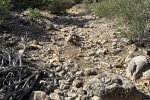
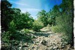
- But .. the sides of the cañon began to close in and the trail became nothing but rocks.
- That was okay for a while, but then the incline went from 5% to 17%.
- I’m not yet in condition to be strong enough for a trail like this, so I decided we should turn back at half a mile and check out the Tunnel Spring Trail.
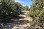
Tunnel Spring must be one of the only trails that Jay and I have not hiked over these past 13 years hiking together. But it was more favorable to me than Agua Sarca – mostly a rock-free trail surface with moderate elevation changes.
Jay here: How we overlooked Tunnel springs is hard to understand. Very little grade so quite a comfortable and scenic jaunt. I would skip the lower return in favor of coming back the way we went out.
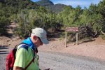
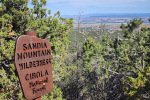
- From the parking area, a signboard with a map of trails in the Sandias introduces this trail. Not acquainted with the details, we inadvertently set out on what is the North Crest Trail (a fact that I discovered while writing this BLOG entry).
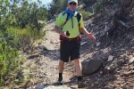
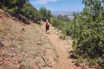
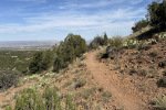
- For the first half mile along this slope of this northeastern corner of the Sandias the trail is quite easy going.
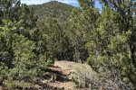
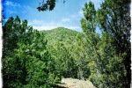
- Throughout the trail passes through the juniper/piñon “forest” typical at this elevation.
- Past the half mile point and for the next half mile, the trail makes an easy descent from 6,400 to 6.200 feet, then climbed a bit until we chose to turn back to make our goal of 3 miles for the day.
- Noting on the map a parallel trail just downhill from our trail out, we descended (north) off of the North Crest Trail onto -the real- Tunnel Spring Trail (also discovered while reviewing details on GAIA, also on AllTrails). So then on the Tunnel Spring Trail we returned to the trailhead – still a nice trail with some elevation changes.
- Note: Scrutinizing again the GAIA version of maps with trails etc., I can now see that -the- Tunnel Spring Trail (on which we returned to parking) would continue east from where we joined it, for only .2 mile to what GAIA depicts as .. a tunnel entrance. AllTrails also shows this extension as the “Tunnel Spring East Trail”.
Highlight

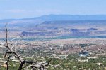
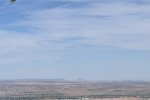
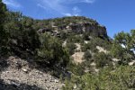
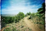
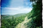
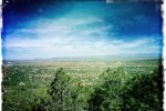
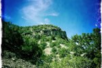
On so many of our hikes, we enjoy marvelous views under amazing skies across the valleys and mountains of New Mexico. So it was on this hike.
Statistics
Agua Sarca
Total Distance: 0.93 miles
Elevation: start 6,355 ft, maximum 6,580 ft, minimum 6,354 ft
Gross gain: 226 ft. Aggregate ascending 281 ft, descending 281 ft
Maximum slope: 35% ascending, 35% descending, 09.8% average
Duration: 0:40, Average Speed: 1.4 mph
Tunnel Spring
Total Distance: 2.29 miles
Elevation: start 6,388 ft, maximum 6,433 ft, minimum 6,261 ft
Gross gain: 172 ft. Aggregate ascending 598 ft, descending 603 ft
Maximum slope: 24% ascending, 30% descending, 07.9% average
Duration: 1:31, Average Speed: 1.5 mph
| GPS Track Files for Download | |
38 Downloads | |
|---|---|
34 Downloads | |
38 Downloads | |
40 Downloads | |
If you haven’t explored these hiking tracks with Google Earth, I urge you to try it. With the virtual 3-dimensional presentation, achieved by panning and tilting the view, you can get a much better idea of the hikes and terrain than you can get from the screenshot above. For some ideas, check out Using Google Earth Track Files.
Related Posts
Agua Sarca Hike – 06/15/2014
Agua Sarca Hike – 9/18/2016
Agua Sarca Trail Hike – 12/15/2019
Placitas Area Hikes
References and Resources
AllTrails: Tunnel Springs Loop
Best trails near Tunnel Spring
ASCHG: Tunnel Springs Hike (This too is the Loop)
ondafringe: Tunnel Spring
Trails Offroad: Highlights of Tunnel Spring
Woman Seeks Elevation: Tunnel Spring will show you ….
Photos
Views to date: 21 views.


