Introduction
 ‘Tis Friday, and we’re off to another trail, today to the Magdalena Mountains. We were seeking a trail with moderate elevation gain for 1.5 to 2.0 miles for an out-and-back hike; we’re back hiking regularly after nearly a year away from trails. We hoped for cool temperatures, but ’tis 1.5 hour drive from home so starting about 9:30, the temperatures was on the rise. And the elevation isn’t high enough to really get cooler air.
The Drive In
Water Canyon is south of US 60 west of Socorro. From south downtown Socorro, head west on US 60 for 15.5 miles, then turn left onto a paved Water Canyon Road, then 4.7 miles to the Water Canyon Picnic Area. From the picnic area we drove up the narrow steep road to the right, up to the Campground where we parked.
Of note: I had done some reconnoitering on GAIA (and other maps) and we set out for what GAIA labeled as the South Canyon Trail (15). It appeared to meet our objectives. But … land between US 60 and the boundary of the Cibola National Forest is BLM .. a gate blocked our way. And a glimpse of the ‘road’ just off the highway revealed – a very rough track, at least at the start. So we continued on to Water Canyon.
The Hike
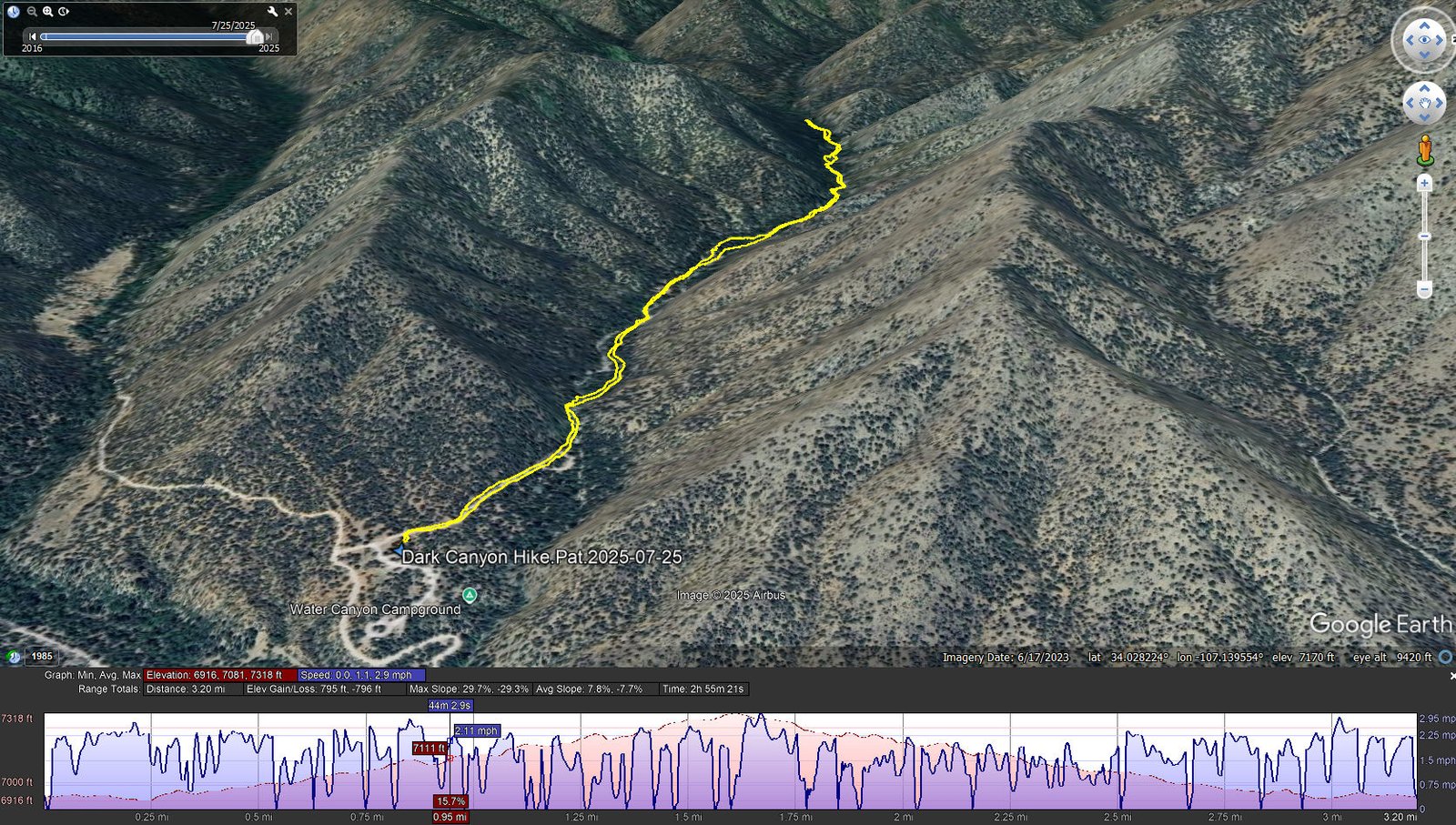
Dark Canyon Hike.Pat.2025-07-25
Notes about the Google Earth screenshot: the graph at the bottom shows elevation of the track (pink area) and speed (the blue line).
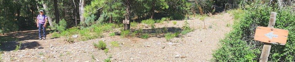
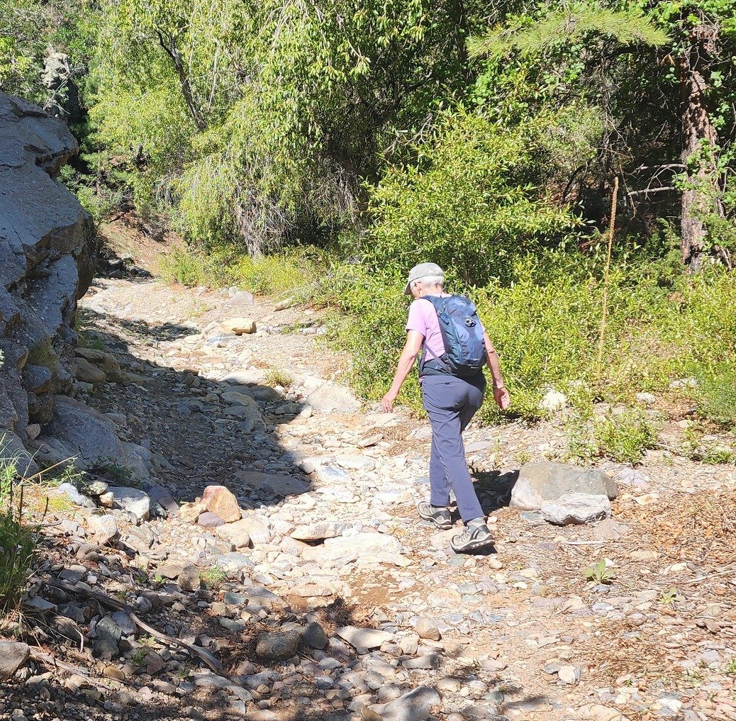
Geeze, it was 7 years ago that we camped here in Water Canyon, and one of our two hikes was .. Dark Canyon (or “North Fork Water Canyon”. My post back then provides a good description for this hike: “.. old two track .. hardly suitable for any but the best off-road vehicle .. etc”. The “trail”/canyon is much like it was back then – for the first half mile or so, it was sections of rocky stream bed interspersed with a smoother trail alongside the stream bed. Then the stream bed widened a bit and there was more “two track” for an easier trail.
Statistics
Total Distance: 3.2 miles
Elevation: start 6,934 ft, maximum 7,318 ft, minimum 6,916 ft
Gross gain: 384 ft. Aggregate ascending 795 ft, descending 796 ft
Maximum slope: 30% ascending, 29% descending, 7.8% average
Duration: 2:51, Average Speed: 1.1 mph
| GPS Track Files for Download | |
104 Downloads | |
|---|---|
117 Downloads | |
| Link to GAIA GPS: “Dark Canyon Hike” | |
| If you haven’t explored these hiking tracks with Google Earth, give it a try. With the virtual 3-dimensional presentation, achieved by panning and tilting the view, you can get good idea of the hike and the terrain. For some ideas, check out Using Google Earth Track Files. | |
Related Posts
North Fork Water Canyon Hike – 09/13/2018
Mesa Trail #15 Hike – 09/12/2018
Posts for hikes in the Socorro Area
References and Resources
Magdalena, New Mexico:
Recreation – Magdalena Mountains – Trail Descriptions (.pdf)
Photos


Views to date: 35 views.