In Placitas for this weekend giving us an opportunity to revisit trails in the area that we’ve enjoyed in the past. And a favorite: Del Agua, with a loop finishing on the Piedra Lisa trial. We’ve hiked each of these trails and the loop many times in the past, most of them before I started this BLOG. So I will offer details more typical of recent posts.
The Drive In
Access to the trailhead for both trails is via the Forest Loop Rd. There are two entrances, not far from each other: from the Placitas Cafe the first one – .5 miles, the second one – .8 miles; the second one is preferred. This Loop Road is quite rough with rocks exposed throughout; a high-clearance vehicle isn’t required but the suspension of any vehicle will get a workout.
The Hike
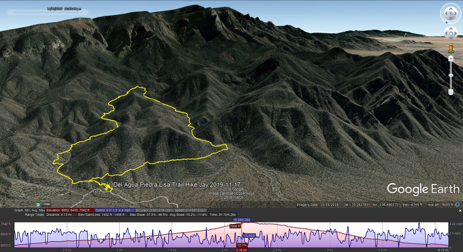
Del Agua-Piedra Lisa Trail Hike.Jay.2019-11-17
Initially we were a bit befuddled looking for parking for the trailhead. What we determined: since our last visit, there had been a land swap between the Forest Service and the Sandia Pueblo, and the approach to the Del Agua canyon is now on Pueblo land and off limits. Backtracking on the road to a small parking area, we discovered a sign identifying the Piedra Lisa Trail. From a past hike, we guessed that we would find a new trail that would take us from Piedra Lisa to Del Agua (we had, in fact, traversed that area on a previous Del Agua – Piedra Lisa hike). Our guess was right: some 800 yards up Piedra Lisa we encountered an intersection with the (new to us) Tightrope Trail.
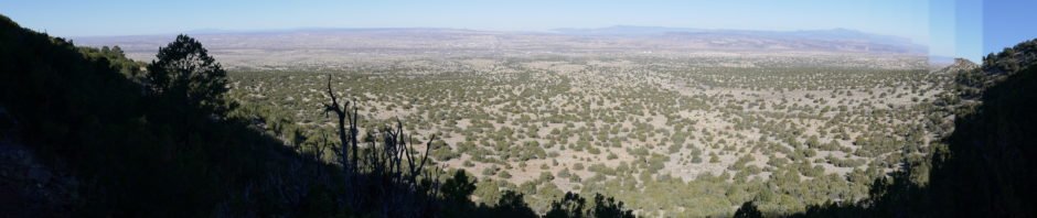
Tightrope crosses the northern slopes of these foothills. It is a great trail, an improvement over the earlier approach to Del Agua; the latter was a boring half mile trek across flat, open juniper, the new trail rises up the slopes providing great views to the west and north. It is also a well made trail, along some sections following terraces on the slope making it an easy portion of the trail. Rounding the corner we found ourselves in familiar surroundings: a firm sand bottom of the canyon, juniper, oak, and cottonwood trees and underbrush through which the trail meanders. Some sections are up on the side slope of the canyon but easy treading. In the upper half of Del Agua one encounters a half dozen 8-12 foot tall rock faces to climb, but in each case there are natural steps and/or footholds that make the ascent easy. At about 2.19 miles into the hike (1.3 miles after entering the canyon) and climbing up and over those rock faces, we reached the intersection with the Piedra Lisa Trail. Piedra Lisa’s termini are on the Loop Road (north) and in Juan Tabo Canyon (south).
After our mid-hike break, we turned left (north) and headed back to the north trailhead. On the way down, a bright white outcrop caught our attention – the Quartz Outcrop to which we had hiked a couple of times in the past (which were challenging hikes – someday we might attempt a bushwhack from Piedra Lisa across an intervening arroyo to Quartz Outcrop).
Jay here: It’s been quite a while since we’ve tackled Del Agua. Which is why the new access via Tightrope had us flummoxed for a bit. But the new access is a great improvement. Not many good coffee shops (i.e. flat spots with a rock to hold the stove and a great view) but we did the best we could with what we had. Down Piedra Lisa with its usual hairy footing on loose rock is always a thrill. Two women on horseback with 2 dogs on leashes passed us going up. Still trying to figure that one out because the trail can be very narrow with steep hillside drops. I guess the horse can slip on one hoof but still have three more to work with.
Statistics
Total Distance: 4.13 miles
Elevation: start 6,003 ft, maximum 7,042 ft, minimum 6,003 ft
Gross gain: 1,039 ft. Aggregate ascending 1,452 ft, descending 1,456 ft
Maximum slope: 37% ascending, 47% descending, 11.6% average
Duration: 3:15
GPS Tracks
| GPS Track Files for Download | |
249 Downloads | |
|---|---|
234 Downloads | |
If you haven’t explored these hiking tracks with Google Earth, I urge you to try it. With the virtual 3-dimensional presentation, achieved by panning and tilting the view, you can get a much better idea of the hikes and terrain than you can get from the screenshot above. For some ideas, check out Using Google Earth Track Files.
References and Resources
USDA Forest Service: Sandia Mountain Trails (pdf)
Del Agua Trail 248
Sandia Hiking Guide: Del Agua Trail, Piedra Lisa Trail
ASCHG: Piedra Lisa North – Del Agua Loop Hike
ondafringe: North Piedra Lisa/Del Agua Loop
AllTrails: Del Agua Trail
Piedra Lisa Trail and Del Agua Trail Loop
Dog of the Desert: A note on Del Agua Trail in the northern Sandias


