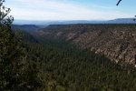
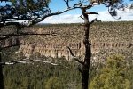
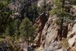
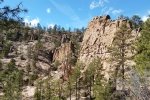
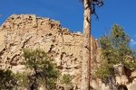
Went looking for a hike with no snow or muddy roads, headed for FR 269 which goes up San Juan Canyon from the upper end of the village of Ponderosa. But … ’tis winter when the Forest Services closes many of the roads in the Jemez. This called for Plan B, which we decided would be to go up FR 10 beyond the Paliza Campground, to a point where we thought we might be able to descend into San Juan Canyon. No dice for that either – FR 10 was also closed.
The Hike
Oh well …. We hiked up FR 10 to the top of Ponderosa Mesa, then headed into the woods looking for ruins at locations that I had found on Google Earth. What we found were the open areas but could not conclude that they were ruins sites; if sites, then they were covered after archeology work. But we think it’s more likely these sites were related to mining.
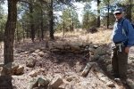
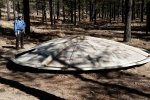
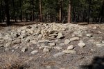
However … in the vicinity of the first area I saw a depression characteristic of a kiva which I’ve seen at other sites, and at each area we -did- find one-room ruins. The first one had very well defined walls, straight and at right angles to each other. At the other site, the shape of the structure was not so well defined, mostly a pile of rock rubble but clearly an example of Pueblo ruins.
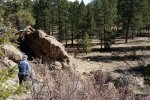
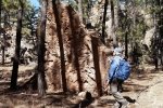
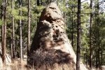
Having hiked out about 2.9 miles, we headed b ack along FR 10 for a short distance, then descended into Goblin Colony for today’s mid-hike repast. From there, back to the truck.
Jay here: The mountain goat forgot to mention bushwhacking (or more accurately boulder whacking) up a canyon because “it’s more scenic than going by road.” Uh-huh. I still have scars from the last time we took the scenic route up a cliff face. Also, we took the route that skirts most of the upper portion of Goblin Colony which was much less difficult than the last time when we tried to come down the center line over some treacherous drops. It was like taking the relief route.
Statistics
Total Distance: 5.11 miles
Elevation: start 6,982 ft, maximum 7,689 ft, minimum 6,915 ft
Gross gain: 774 ft. Aggregate ascending 1,167 ft, descending 1,165 ft
Maximum slope: 29% ascending, 34% descending, 7.3% average
Duration: 3:43
| GPS Track Files for Download | |
339 Downloads |
|
|---|---|
109 Downloads |
|
272 Downloads |
|
207 Downloads |
|
I urge you to explore our hiking tracks with Google Earth. With the virtual 3-dimensional presentation, achieved by panning and tilting the view, you can get a much better idea of the hikes and terrain than you can get from the 2-dimensional screenshot above. For assistance: Using Google Earth Track Files.
Related Posts (providing References)
Ponderosa Mesa Hike – 02/18/2018
Ponderosa Mesa Hike – 08/29/2017
Ponderosa Mesa-Boletsakwa Ruins Hike- 8/7/2016
Paliza Canyon Hike/Bushwach – 08/04/2018
Paliza Canyon Hike – 11/09/2017
Paliza Canyon, Ruins, Goblin Colony Hike – 9/11/2016
Paliza Canyon & Goblin Colony Hike – 09/09/2015
Paliza Canyon & Goblin Colony Hike – 7/19/2015
Paliza Canyon Hike – 8/24/2014
Boletsakwa Ruins Hike – 07/11/2015
Boletsakwa Hike – 07/01/2015


