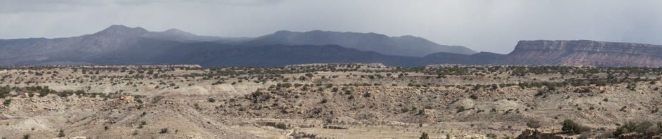
It was still winter, the best time to hike in the open territory of the Ojito Wilderness; the weather becomes quite hot in summertime.
The Hike
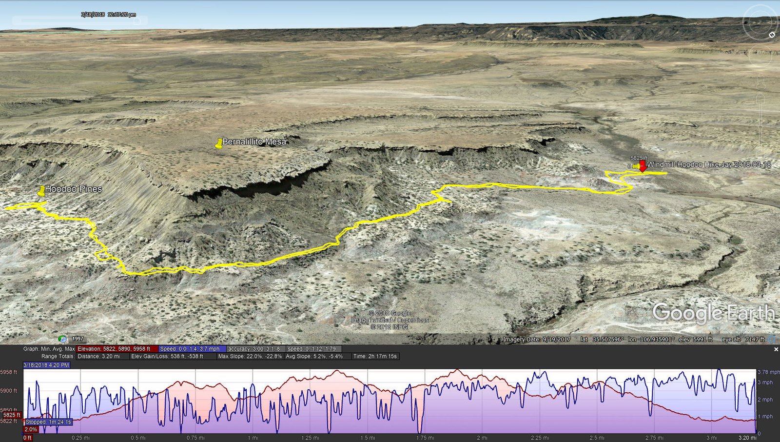
Windmill-Hoodoo Hike.Jay.2018-03-18
For this day we set out from the end of the two-track in Marquez Wash that we usually use for the Mesita de Ricardo hikes, this time going to the east (rather than north) which takes one below the north face of Bernalillito Mesa. After inspecting the building and windmill at the parking place, we headed around the somewhat tall hill, then along the lower slope of the Mesa. The going was reasonably easy, easier when we found rock cairns marking a trail that we followed the remainder of the hike.
Always looking over us was the face of Bernalillito Mesa, with varying, interesting formations along the edge. We remembered that we had hiked out to the point of the Mesa (Bernalillito Mesa Top Hike – 12/11/2016) , and the deep crevices at the edge that defined large blocks that seemed to be ready to break off like calving icebergs (someday). Along the trail we found many quite interesting rock formations (check the photos below).
About 1.2 miles into the hike we rounded the point and headed south. Soon we began to see things that looked familiar. Sure enough, we realized that we had come to Hoodoo Pines, a destination for other hikes (Hoodoo Pines Hike – 01/03/2017 and Hoodoo Pines Hike – 12/17/2017). We also noticed that weather that had been bringing snow to the Naciemento Mountains to the northwest was spreading in our direction. It was time for our mid-hike break (fresh coffee and snacks). As the clouds to the west became darker, we beat a retreat to the truck. If any precipitation that fell on the 1 mile of two-track back to Pipeline Road, we would surely get stuck. It was a close call; we had snow flurries on our drive out.
Jay here: Perfect example of New Mexico weather changing rapidly and biting us in the butt. We just barely made it back to the truck when the snow squall hit. You can’t photograph snowfall (it melts in the lens, ha), but it was coming down hard as we left the trailhead. Within minutes we were out of this very localized squall and racing for the paved highway.
Statistics
Total Distance: 3.20 miles
Elevation: start 5,822 ft, maximum 5,958 ft, minimum 5,822 ft
Gross gain: 136 ft. Aggregate ascending 538 ft, descending 538 ft
Maximum slope: 22% ascending, 23% descending, 5.2% average
Duration: 2:17
| GPS Track Files for Download | |
276 Downloads | |
|---|---|
174 Downloads | |
I urge you to explore our hiking tracks with Google Earth. With the virtual 3-dimensional presentation, achieved by panning and tilting the view, you can get a much better idea of the hikes and terrain than you can get from the 2-dimensional screenshot above. For assistance: Using Google Earth Track Files.
Related Posts (in the vicinity)
References
Hiking in New Mexico: Our hikes in the Ojito Wilderness
Descriptions, tracks, references, and photos


