This hike is the first during 4 days of camping at Jemez Falls Campground. Its about a 2.5 hour drive from Albuquerque, towing our R-Pod up US 550, then NM 4 past La Cueva to this very nice National Forest Service campground. After getting the camper set up, we headed further east on NM4, past Valles Caldera to the trailhead for the Upper Frijoles Cañon Overlook trail (also the trailhead for the Sawyer Mesa Trail, and across NM4 from the Cerro Grande Trail).
The Hike
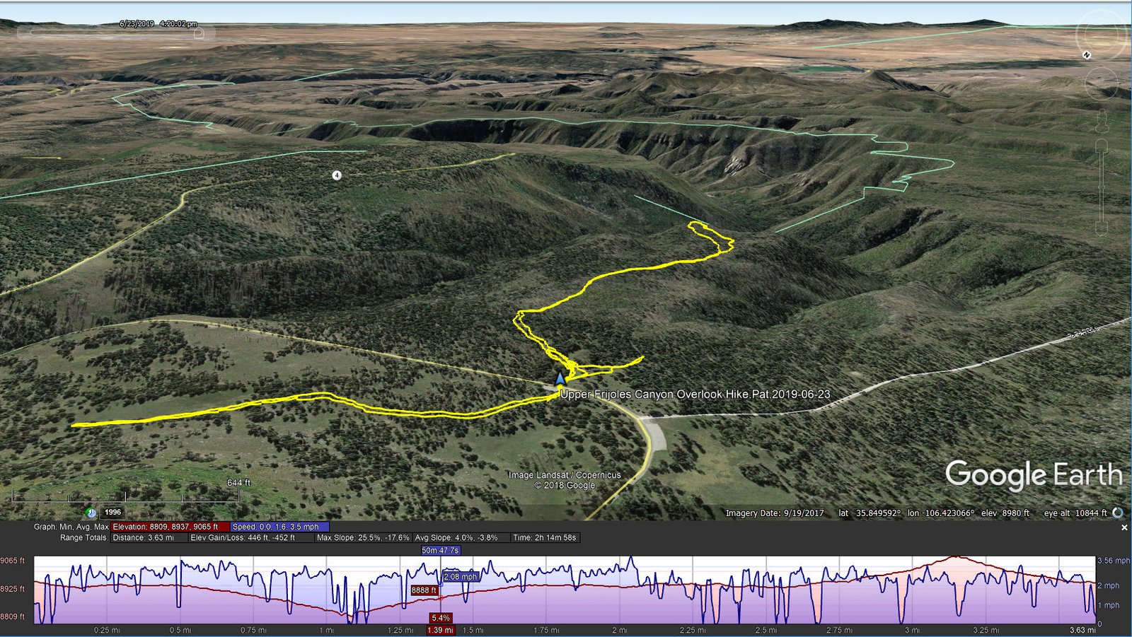
Upper Frijoles Canyon Overlook Hike.Pat.2019-06-23
This trail is a very nice one – this year green with grasses, aspen and oak (retaking the territory after the fire some years back), and flush with flowers. There are many standing and down tree trunks from the fire; sad ‘tho the benefit is great views to the horizons and into the cañons. The trail itself is clear of rocks for nearly the whole distance, and very little elevation gain (as you can see from the reddish elevation profile in the screenshot above).
As the map shows, there are two ‘loops’: one offers one path outgoing, another when returning; the other a ‘lollipop’ at the far end of the trail which provides 1) a view into the cañon to the east and 2) a view into the cañon to the west. The out-and-back distance is about 2.1 miles – we had energy remaining to crossed NM4 and hiked up the Cerro Grande trail for half a mile, just to extend our hiking for that day (see our hike on the Cerro Grande Trail two days later).
Highlights
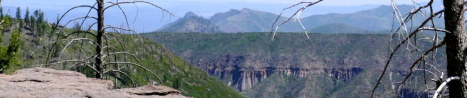
This territory is spectacular and becomes more so as we gain familiarity with it. From the screenshot above, one can get an impression of how rugged it is, the many deep cañons with their precipitous walls, the result of water eroding the volcanic material over centuries on its way to the Rio Grande River. But to get an even better view, check it out on Google Earth using the Track Files that you can download from links below. Or head out there yourself.
Statistics
Total Distance: 3.63 miles
Elevation: start 8,958 ft, maximum 9,065 ft, minimum 8,809 ft
Gross gain: 256 ft. Aggregate ascending 446 ft, descending 452 ft
Maximum slope: 26% ascending, 18% descending, 4.0% average
Duration: 2:15
| GPS Track Files for Download | |
198 Downloads | |
|---|---|
203 Downloads | |
I urge you to explore our hiking tracks with Google Earth. With the virtual 3-dimensional presentation, achieved by panning and tilting the view, you can get a much better idea of the hikes and terrain than you can get from the 2-dimensional screenshot above. For assistance: Using Google Earth Track Files.
References
AllTrails: Upper Frijoles Canyon Overlook Trail
YouTube: Sky Island – New Mexico’s Jemez Mountains


