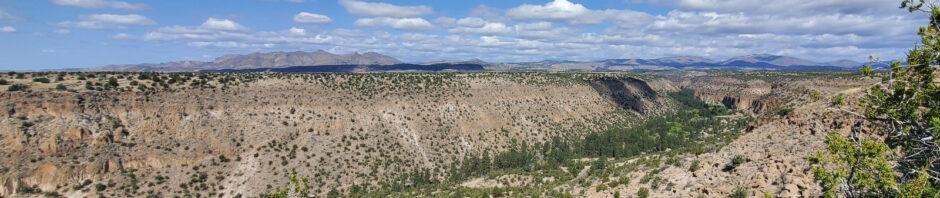
Our first full day on a camping trip to Bandelier National Monument. Wanting a trail with some elevation gain, we chose the Frey Trail for a few hundred feet up and back down again.
The Drive In
The trailhead is down in Frijoles Canyon, so the drive in is to go to the Bandelier Visitor Center.
The Hike
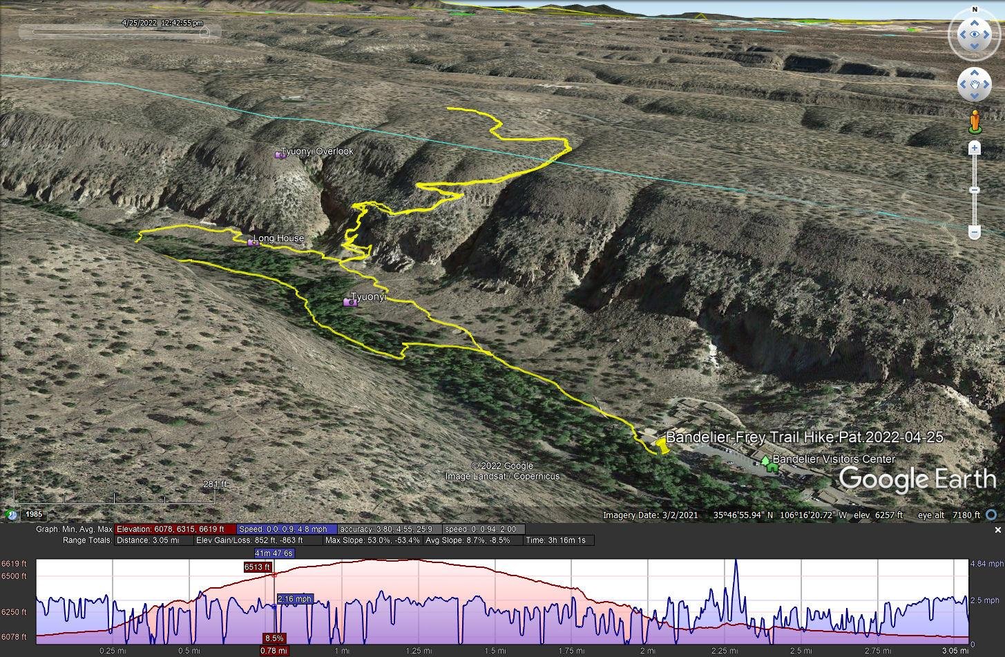
Bandelier-Frey Trail Hike.Pat.2022-04-25
Notes about the Google Earth screenshot: the graph at the bottom shows elevation of the track (pink area) and speed (the blue line).
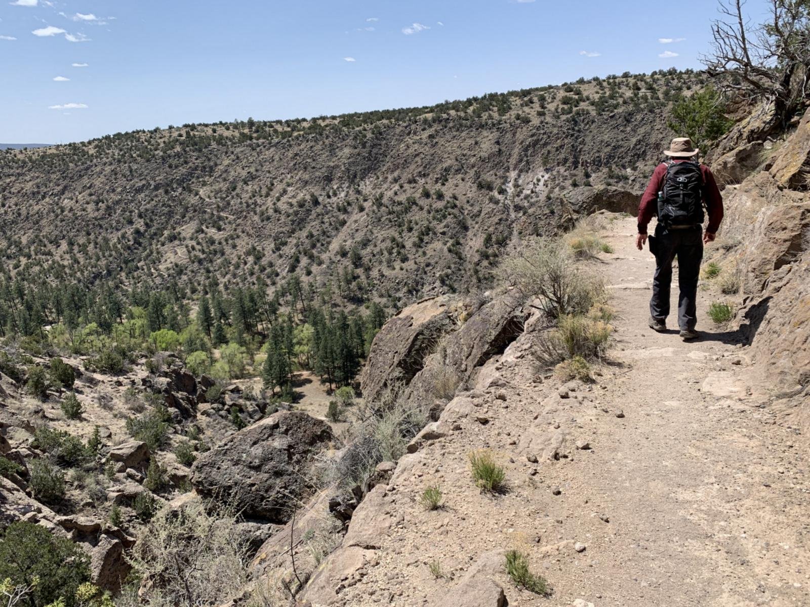 We sought a hike with some elevation gain – Frey Trail offered some – 541 ft up from Frijoles Canyon. The trailhead is 400 yards from the Bandelier Visitors Center, on the right bit past the Tyuonyi Ruins. It is a well used trail up the canyon wall topping out on the mesa top. We continued another quarter mile continuing on the Frey Trail, then turned back and down into Frijoles Canyon.
Back on the canyon floor, we turned right onto the Alcove House Trail for 1/3rd of a mile, then crossed over Rio de los Frijoles to the Long Trail. From there we returned to the visitors center, having gotten -some- elevation gain.
Statistics
Total Distance: 3.05 miles
Elevation: start 6,089 ft, maximum 6,619 ft, minimum 6,078 ft
Gross gain: 541 ft. Aggregate ascending 852 ft, descending 853 ft
Maximum slope: 53% ascending, 53% descending, 8.6% average
Duration: 3:16
| GPS Track Files for Download | |
153 Downloads | |
|---|---|
163 Downloads | |
If you haven’t explored these hiking tracks with Google Earth, I urge you to try it. With the virtual 3-dimensional presentation, achieved by panning and tilting the view, you can get a much better idea of the hikes and terrain than you can get from the screenshot above. For some ideas, check out Using Google Earth Track Files.
Related Posts
Hikes in Bandelier National Monument
References and Resources
NPS Bandelier National Monument:
Frey Trail
Virtual Hike on the Frey Trail
AllTrails: Frey Trail
The Great Outdoors: Hike the Frey Trail
ProTrails: Frey Trail – 3.4 miles
gHikes: Frey Trail


