Back in July, Jay and I hiked some distance out on North Crest Trail (Agua Sarca Then North Crest/Tunnel Spring Trails Hike – 07/14/2025); we wanted to return to explore further up the North Crest Trail.
The Drive In
Starting at the Cafe along NM 165 in Placitas, drive east for 2.7 miles, then turn right on Road 231 (Tunnel Springs Road).
- On the dirt road it is 1.4 miles to parking for the Tunnel Spring Trailhead.
- One passes under a very big cottonwood tree, courtesy “Tunnel Spring”flowing out of a pipe on the right.
- This is a trailhead for two trails. Passing by the sign for a few yards:
- Continuing ahead places one on the North Crest Trail.
- To the left, the Tunnel Spring East Trail descends a bit and continues generally parallel to the North Crest Trail for .8 mile; it ends at an intersection with the North Crest Trail.
The Hike
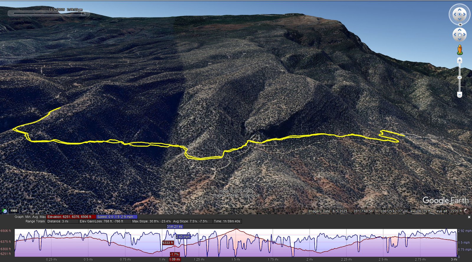
North Crest Trail Hike.Jay.2025-11-12 … Notes about the Google Earth screenshot: the graph at the bottom shows elevation of the track (pink area) and speed (the blue line). Click on the image for a full-screen view.
Borrowing from our earlier hike on the North Crest/Tunnel Spring Trails:
- From the parking area, a signboard with a map of trails in the Sandias introduces this trail. Having become oriented from the earlier hike, we set out this time knowing we were on the North Crest Trail.
- For the first half mile along this northeastern corner of the Sandias the trail is quite easy going. Past the half mile point and for the next half mile, the trail makes an easy descent from 6,400 to 6,200 feet, then a gentle climb as it rounds the end of a ridge.
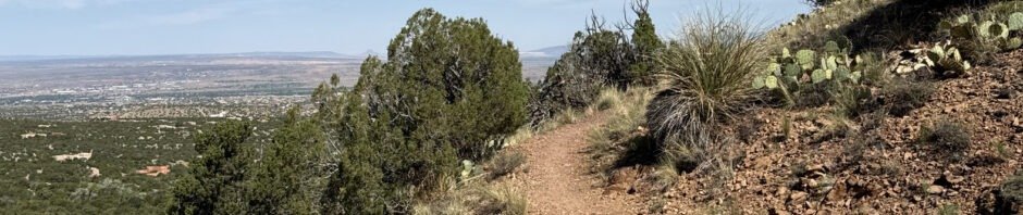
- Through the length of our hike, the trail traverses a very steep hillside. It is typically 4 feet or more in width, and .. there are no rails go guard against a slip and fall down the steep slope. Throughout the trail is mostly loose rock as it passes through the juniper/piñon “forest” typical at this elevation.
- A mile and half into the hike, and approaching what appeared to be an increasingly steep climb, we chose to head back, thus to make it another 3 mile hike.
Statistics
Total Distance: 3.0 miles
Elevation: start 6,375 ft, maximum 6,506 ft, minimum 6,251 ft
Gross gain: 255 ft. Aggregate ascending 768 ft, descending 766 ft
Maximum slope: 31% ascending, 23% descending, 7.5% average
Duration: 2:00, Average Speed: 1.5 mph, Shade: 10%
| GPS Track Files for Download | |
105 Downloads | |
|---|---|
89 Downloads | |
| Link to GAIA GPS: “North Crest Trail Hike” | |
| If you haven’t explored these hiking tracks with Google Earth, give it a try. With the virtual 3-dimensional presentation, achieved by panning and tilting the view, you can get good idea of the hike and the terrain. For some ideas, check out Using Google Earth Track Files. | |
Related Posts
Agua Sarca Hike – 06/15/2014
Agua Sarca Hike – 9/18/2016
Agua Sarca Trail Hike – 12/15/2019
Agua Sarca & Tunnel Spring Hike – 07/14/2025
Placitas Area Hikes
References and Resources
AllTrails: Tunnel Springs Loop
Best trails near Tunnel Spring
ASCHG: Tunnel Springs Hike (This too is the Loop)
ondafringe: Tunnel Spring
Trails Offroad: Highlights of Tunnel Spring
Woman Seeks Elevation: Tunnel Spring will show you ….
Photos


Views to date: 32 views.