Our third day camping/hiking in the Jemez Mountains, in and around Valles Caldera. Having worn ourselves thin on the Alamo Spring hike the day before, we intended to limit hiking this day. So, to start the day we headed south on FR 289 to see where it would take us (near St Peter’s Dome??) and to check out the road. Then we intended to only ‘check out’ the Cerro Grande trail, having gathered that it was steep with some 1,200 feet elevation gain.
The Drive In
FR 289, St Peters Dome Road DriveAbout: 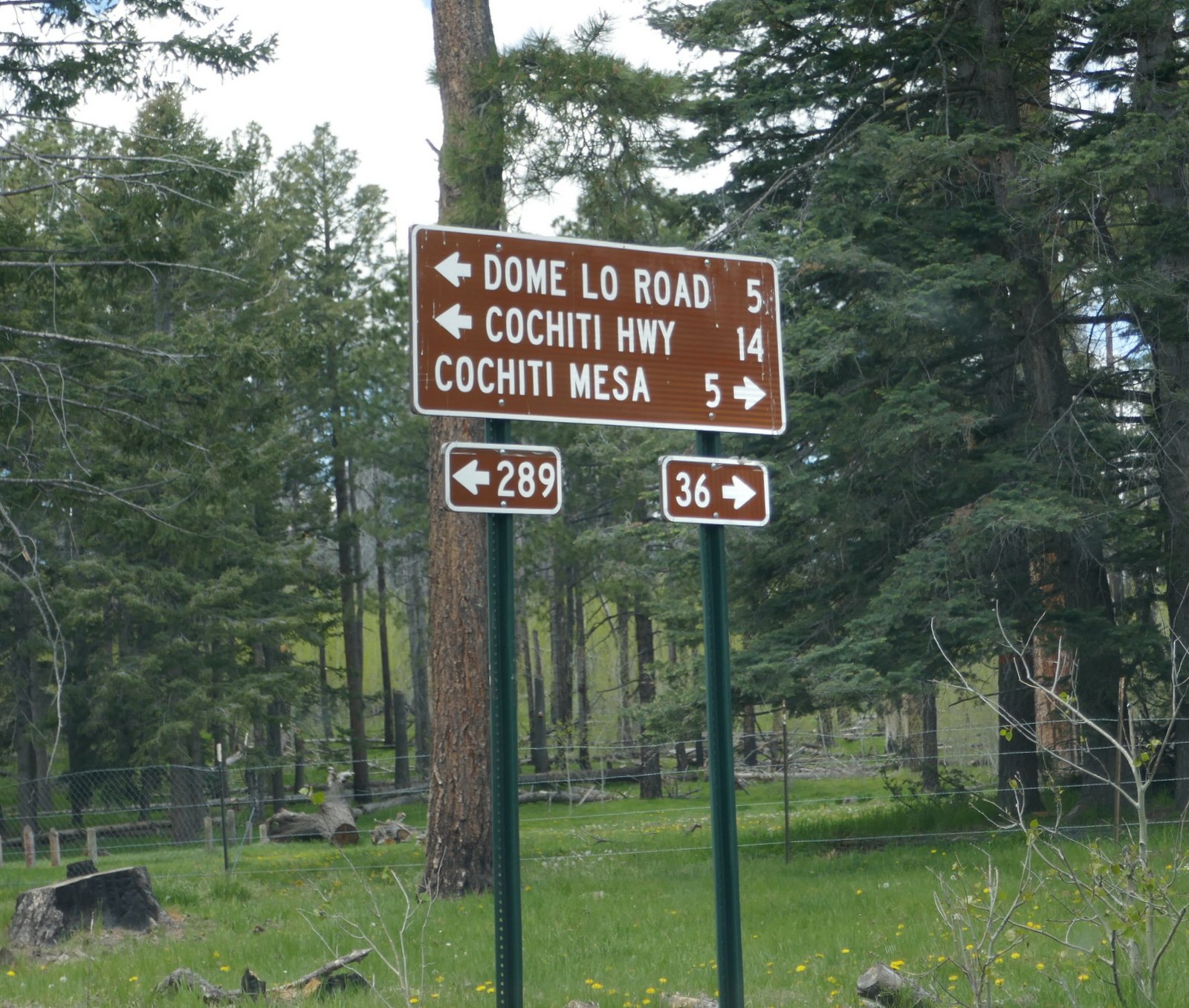 We had driven a few miles down FR 289 the day before, on our way to the Alamo Spring Hike. This day we continued for 6.2 miles from NM 4. This is clearly a well used road – graded gravel. (We’ve started referring to ‘graded gravel’ as New Mexico pavement. Such roads are passable in most conditions, differentiated from lessor roads, those without grading and gravel; they can be impassable if not totally dry.) The route was not challenging until we began to come near the end of the mesa, some 5 miles, where the road began winding and descending. As it began to look more challenging, we noticed very dark clouds to the north, suggesting rain. Promising to return another time, to attempt to make it as far as St Peter’s Dome, we turned back towards NM 4.
Some 2.5 miles from where we turned around we noticed a two-track heading to the east, back towards Alamo Canyon. The rain appeared to be staying to the north (we had enough cell phone service to get weather radar); we allowed our curiosity to get the better of us and we turned to explore. (This was one of those two-tracks mentioned above – don’t go there if it is not dry. And travel in a high clearance vehicle, preferably 4-wheel drive. It’s not the worst two-track I’ve been on, but it’s up there for our range of experience.) Again out of consideration of weather, we turned around some 2 miles; looking at the topo map, it appears we could hike from here to the end of the mesa passing abreast of Obsidian Ridge (from the Alamo Spring Hike) or drive to the right some distance further (which is marked on the topo map as the Bland Frijoles Trail), or hike down that deteriorating two-track from which there appears to me options, like descending into either of the canyons, Alamo on the left (east), Capulin on the right (west) — so many places to explore (all Forest Service land).
The Hike
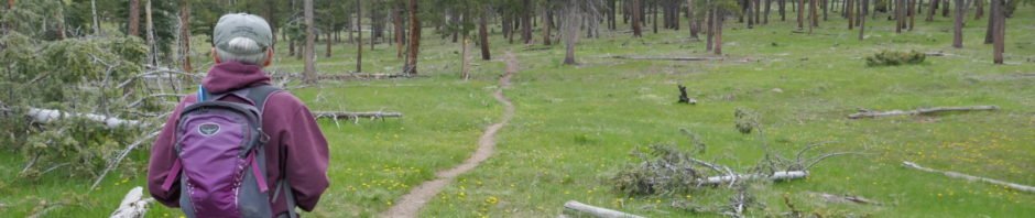
It was our intention to walk up the Cerro Grande Trail far enough to get a feel for just how much of a climb we would face. Parking at the trailhead, we started off through the most pleasant open forest on a really fine trail with just a slight gain in elevation. It did gradually increase, but not enough to cause us to pause and think – OK, we’ll return another day to ascend to the top. This continued for 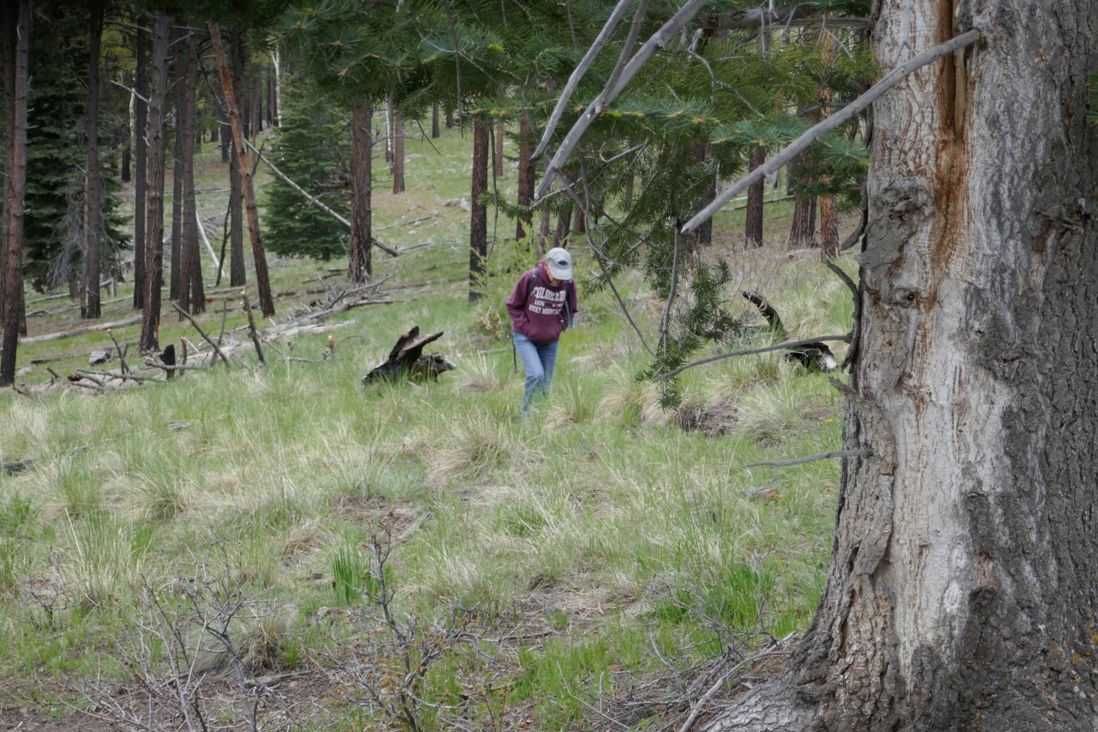 1.5 miles, where we topped the saddle between Cerro Grande and its companion (slightly shorter) to the south. But .. we weren’t ready to make the last 600 or so feet/half mile to the summit of Cerro Grande. We’ll do that another time.
The eastern/downwind side of saddle is covered with the most healthy grass clumps, no trees. The west/upwind side of the saddle, facing the Caldera, is strewn with downed tree trunks from many years ago. With only a couple of exceptions, they are all laying 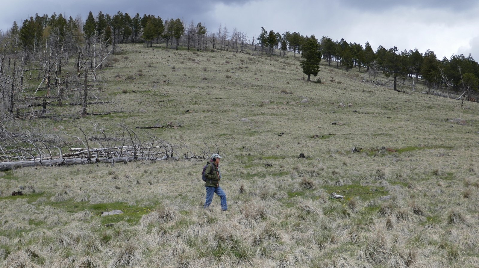 parallel, like a strong wind had come along and toppled them all at once, in the same direction. And the wind was blowing (and cold) that day; rain squalls were obscuring the view to the northwest, the far side of the Caldera. We retreated back downhill to get out of the wind and have our mid-hike/lunch break. We will return here, like the other places we visited this trip.
Highlight


This year we have enjoyed the wettest winter since moving to Albuquerque nine years ago. In the past, flowers in this quite dry climate have consistently attracted my attention. On this hike we saw so many flowers – I counted 17 different blossoms (with the ubiquitous dandelions by far the most prevalent). Here are photos of a few of the different blossoms we saw on the Cerro Grande Trail.
Statistics
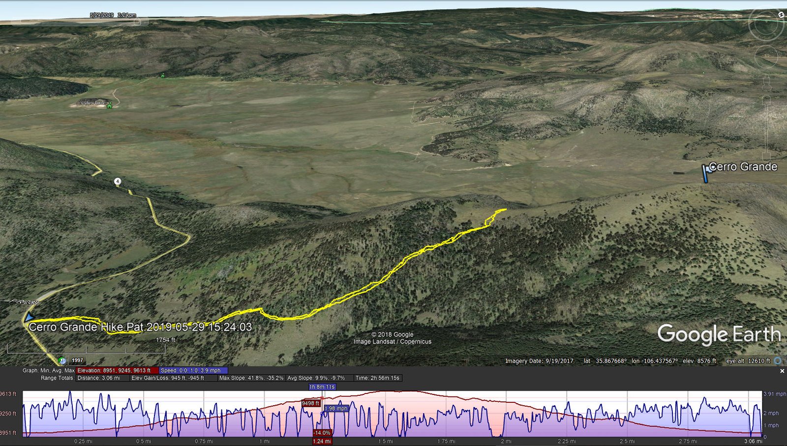
Total Distance: 3.06 miles
Elevation: start 8,951 ft, maximum 9,613 ft, minimum 8,951 ft
Gross gain: 662 ft. Aggregate ascending 945 ft, descending 945 ft
Maximum slope: 42% ascending, 35% descending, 9.9% average
Duration: 2:56
| GPS Track Files for Download | |
405 Downloads | |
|---|---|
226 Downloads | |
244 Downloads | |
199 Downloads | |
I urge you to explore our hiking tracks with Google Earth. With the virtual 3-dimensional presentation, achieved by panning and tilting the view, you can get a much better idea of the hikes and terrain than you can get from the 2-dimensional screenshot above. For assistance: Using Google Earth Track Files.
References
National Park Service, Bandelier: Cerro Grande Trail
AllTrails: Cerro Grande Trail
American Southwest: Cerro Grande Trail, Bandelier National Monument
ondafringe: Day Hike: Cerro Grande/Valles Caldera
Stav Is Lost: Hike Cerro Grande
Discover the West: The Cerro Grande Route (great review, recommended)
Valles Caldera Rim: Valles Caldera East Rim: Cerro Grande Snowshoe
Keeping in Tune: I Hike the Cerro Grande Trail in the Jemez Mountains
(great photos)
Los Alamos Daily Post: Amateur Naturalist:
Cerro Grande Peak: Scene – Human and Natural Impacts


