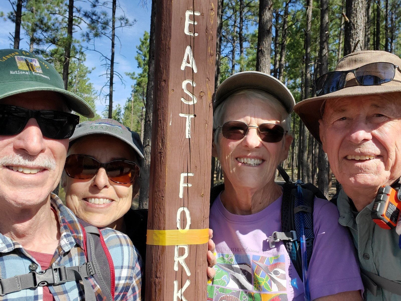
Jay, Nancy, Pat, & me
First day’s hike during a camping trip to Jemez Falls Campground with Pat, Jay, and Nancy. At various times we had done out-and-back hikes from each end of this trail. This day, with two vehicles, we welcomed the opportunity to make it a point-to-point, or through hike.
The Drive In
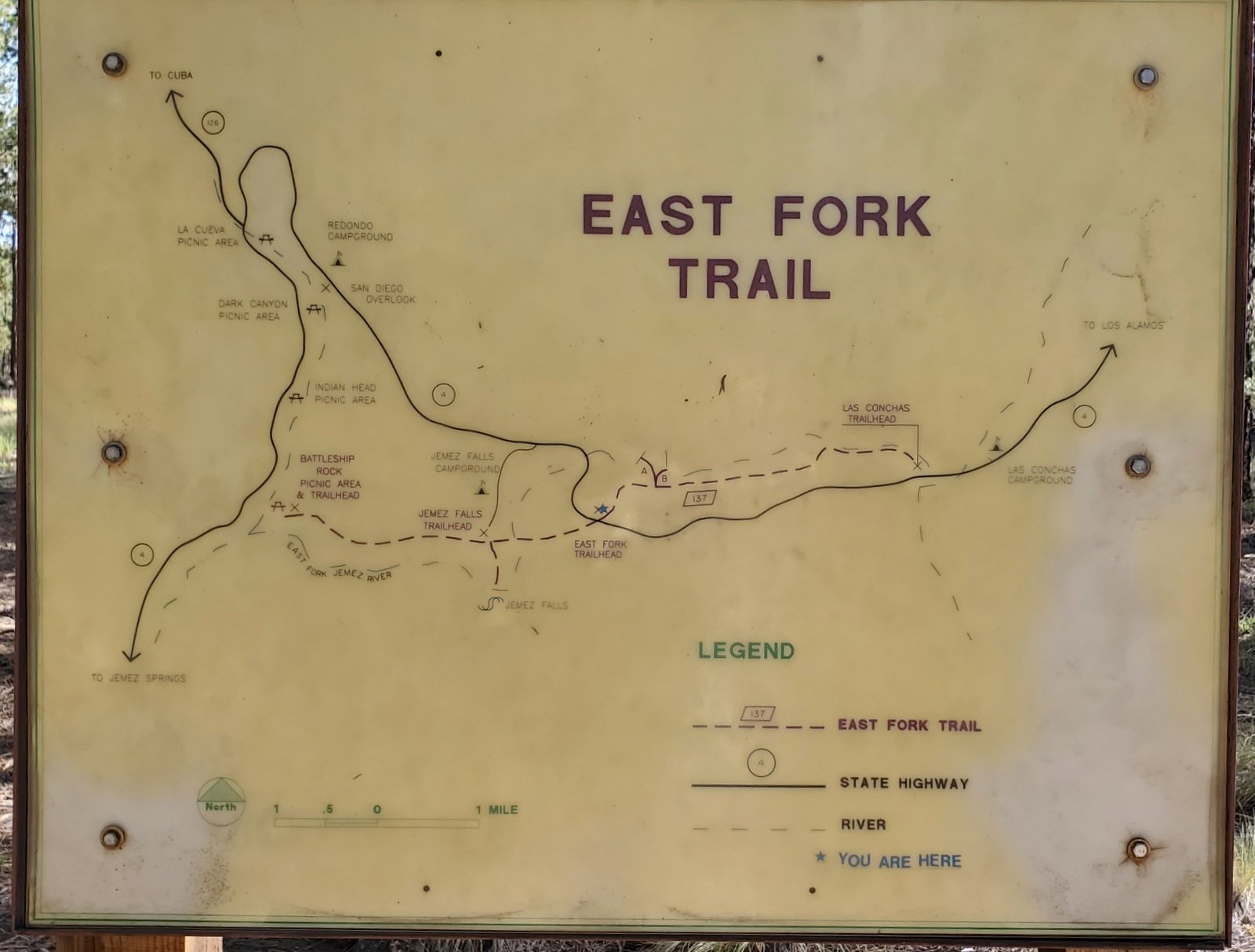 The trailhead is .9 miles east on NM 4 from the entrance to the Jemez Falls Campground. From here, trailheads of the East Fork Trail go in both directions, to the west passes the Jemez Falls Trailhead (and Campground), terminating at Battleship Rock, And to the east the trail passes above The Box and terminates at the Las Conchas Trailhead. We were taking the latter trail.
The Hike
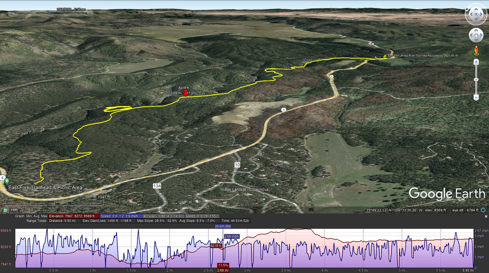
East Fork Jemez River Trail Hike.PatJayNancy.2021-09-18
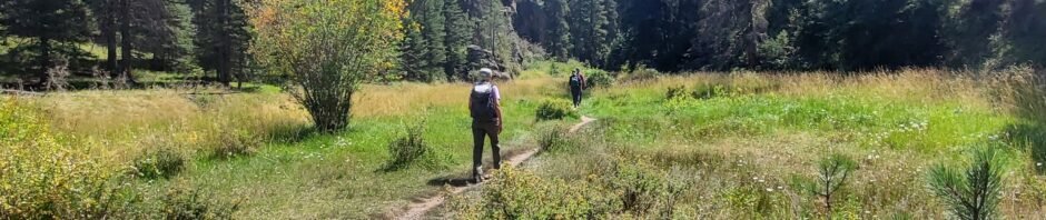
‘Tis a good trail, from beginning to end, smooth surface, little elevation changes, and shaded. The first half mile is on a well used two-track, but then the trail veers off into a pleasant open forest. There are signs along the way for guidance (‘tho the trail is so well used one could hardly get disoriented).
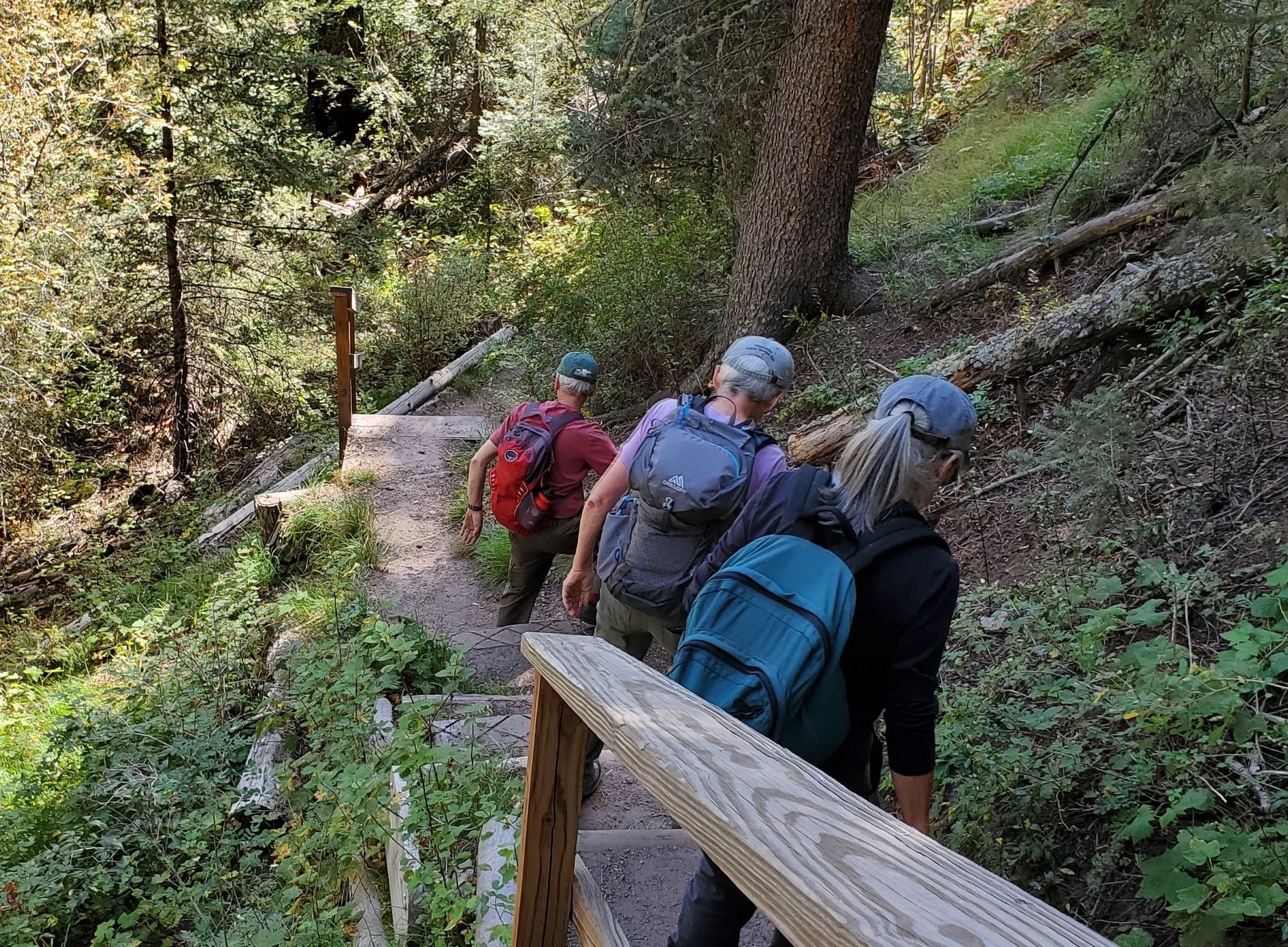 At about 1.1 miles from the trailhead we took a spur trail down into the canyon (250′ descent) to take a look at the East Fork Box. The descent is steep, but in the steepest stairs make it easy. At the bottom a bridge conveniently provides a way to cross and walk a bit upstream to the point where the Box blocks further passage (without wading).
 After climbing out of the canyon, we continued on the great trail. It does ascend some 300′ in a gentle slope over 1.5 miles or so, then descends back into the canyon and
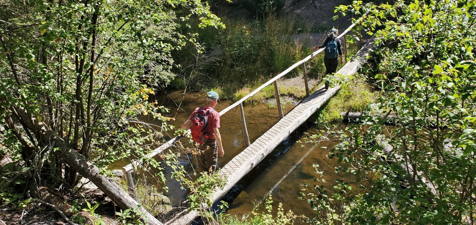
  hooks up with the Las Conchas Trail for the last 1.5 miles. There are river crossings, but in each case a bridge provides for a dry passage. And along the river, the setting is lush with grasses, trees, mosses on the rocks, overall a most pleasant trail.
Highlight
A great day hiking with really great friends.
Statistics
Total Distance: 5.93 miles
Elevation: start 8,113 ft, maximum 8,569 ft, minimum 7,947 ft
Gross gain: 622 ft. Aggregate ascending 1,455 ft, descending 1,168 ft
Maximum slope: 27% ascending, 33% descending, 6.7% average
Duration: 4:52
| GPS Track Files for Download | |
267 Downloads | |
|---|---|
166 Downloads | |
If you haven’t explored these hiking tracks with Google Earth, I urge you to try it. With the virtual 3-dimensional presentation, achieved by panning and tilting the view, you can get a much better idea of the hikes and terrain than you can get from the screenshot above. For some ideas, check out Using Google Earth Track Files.
Related Posts
Las Conchas Trail Hike – 08/29/2021
Las Conchas-East Hike – 10/15/2020
Las Conchas Trail Hike – 09/23/2020
East Fork Jemez Box Hike – 08/09/2017
East Fork Jemez Box Hike – 08/02/2017
References and Resources
USDA Forest Service: East Fork Trail (FT #137)
East Fork Trailhead #137
AllTrails: East Fork Trail via Las Conchas Trailhead
East Fork Trailhead from Las Conchas Trailhead …
Hiking Project: East Fork Trail #137
SummitPost: East Fork Box
Trip Advisor: Las Conchas Trailhead … (great reviews)


