We had no advance plan, but we needed to get out into nature this week. Weather was a bit iffy, forecast to be chilly and windy. We decided to visit an old friend, Goblin Colony, up Paliza Canyon in the Jemez Mountains.
The Drive In
Driving towards the Jemez Mountains is always pleasant. The scenery heading west on US 550 gets better as White Mesa comes into view on the left, and the red cliffs of Mesa Cuchilla west of San Ysidro and the Jemez River come into view. Then the drive north on NM 4 adds more scenery as one passes through the Jemez Pueblo (Obey the Speed Limits – the Pueblo police “give no quarter”.)
No more than half a mile from leaving the Pueblo, turn right onto NM 290, continue pasts the Ponderosa Valley Vineyards and Winery, through the sparse village of Ponderosa, past the lake providing irrigation water to the Pueblo, and onto FR 10 (where the road changes to gravel). In another 2.5 miles or so is the Paliza Camptround (not open yet, but a really nice campground). Turn left across the bridge over Paliza Creek and park at the junction of FR 10, FR 266, and FR 271.
The Hike
Goblin Colony is a great, short hike to some fascinating rock formations. The hike to goes up FR 271 (a two-track), then bears to the left. ‘Tis about 1.7 miles from parking with only a couple hundred feet elevation gain. For part of the way on the two-track, water was running in Paliza Creek and was filled with watercress. About .8 miles on, bear to the left and continue up a wash (bearing to the right, through a gate across the two-track, and up Paliza Creek makes for a great alternative, or an extension for some more hiking distance).
 Normally, we’ve taken the wash to the Colony. But today – we diverted to explore potential camping sites, looking for level ground on the hillside above the wash. So we climbed 50′ to to the first area, then 150′ to another; and then without a real plan we continued climbing up the side of this small mesa (I can’t find a name for it, so I’m dubbing it “Goblin Mesa”, in honor of the Colony). And we continued climbing.
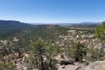
As we neared the top, of course it became more and more steep, until the last 100′ we were scrambling up a rock and gravel slope, about 45°. But we gained the top of Goblin Mesa. We found ourselves on flat & level rock surface that forms the end of the mesa, with an edge that was -vertical-, dropping precipitously a few 10s of feet. From this vantage point, where we paused for a snack, we took in the marvelous views of the canyons and mesas of this part of the Jemez Mountains. 
We gave only momentary thought to descending the way we came up. After checking the topo map (on USTopo, the GPS app on my phone), we decided to take our chances that there would be a easier descent (& safer!) at the other end of the mesa. The hiking along the mesa was easy with some rocky areas and a fair amount of deadfall in some areas (it appeared to be wind-blown where the mesa narrowed, exposing the trees to the strongest winds). 
From visits to various sites of Pueblo ruins, I suspected there might be a Pueblo ruin of some sort on this mesa; I was on the lookout for any sign of a ruin. And I did spot a mound with lots of rocks strewn across it, which did not look like something Mother Nature would have formed. I’m convinced it is a small (15’x15′) ruin site.  Hiking north for about half a mile, we found ourselves looking down upon Goblin Colony. And as hoped, we enjoyed a reasonable descent from the mesa top into the Colony.
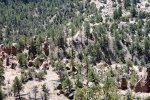
Entering from this direction introduced us to somewhat different formations – quite interesting. We descended to the lower portion of the Colony, stopped in a nook out of the wind for our usual lunch (Trader Joe’s Ramen, PB&J sandwich, apple slices, and carrot sticks) and admired the Goblins around us. Then we hiked down the wash and Paliza Creek, back to the Tacoma.
Statistics
Total Distance: 4.07 miles
Elevation: start 6,854 ft, maximum 7,519 ft, minimum 6,847 ft
Gross gain: 671 ft. Aggregate ascending 1,019 ft, descending 1,027 ft
Maximum slope: 48% ascending, 44% descending, 7.8% average
Duration: 5:30
| GPS Track Files for Download | |
389 Downloads |
|
|---|---|
150 Downloads |
|
If you haven’t explored these hiking tracks with Google Earth, I urge you to try it. With the virtual 3-dimensional presentation, achieved by panning and tilting the view, you can get a much better idea of the hikes and terrain than you can get from the screenshot above. For some ideas, check out Using Google Earth Track Files.
Previous Posts in the area
Paliza Canyon Hike – 8/24/2014
Paliza Canyon & Goblin Colony Hike – 7/19/2015
Paliza Canyon & Goblin Colony Hike – 09/09/2015
Paliza Canyon, Ruins, Goblin Colony Hike – 9/11/2016
Paliza Canyon Hike – 11/09/2017
Ponderosa Mesa Hike – 02/18/2018
References and Resources
***Geology of the Jemez Area, Chapter 13: The Holocene
Prime Passages: Goblin Colony Hike
Lauren Danner: Chasing goblins in the Jemez Mountains
Atlas Obscura: The Goblin Colony
The Shallow Sky: Paliza Goblin Colony (includes Kiatsukwa Ruins)
Only In Your State:
The Unforgettable New Mexico Hike That Leads To A Goblin Colony
AllTrails: Paliza Goblin Colony
The Gentle Art of Wandering: The Goblin Colony
Judith Bauman: Paliza Canyon Goblin Colony
The Kruse Chronicles: Paliza Canyon Goblin Colony


