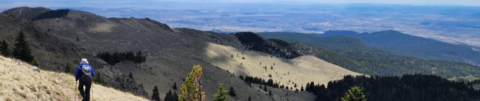
We returned to Mount Taylor again this year. This Gooseberry Springs Trail presents a challenging hike with great views going up, coming down, and from the peak – together they make it one of our favorite hikes. We plan to hike it each year in to the ?? future.
The Drive In
Borrowing from our visit back in 2020:
“We had an easy drive to Grants, then through Lobo Canyon on NM 547 to FR 193 and on to our target campsite. The road has fresh, deep gravel (a Class 3 road) but the Tacoma/R-Pod handled it easily. We chose the campsite closer to the trailhead; 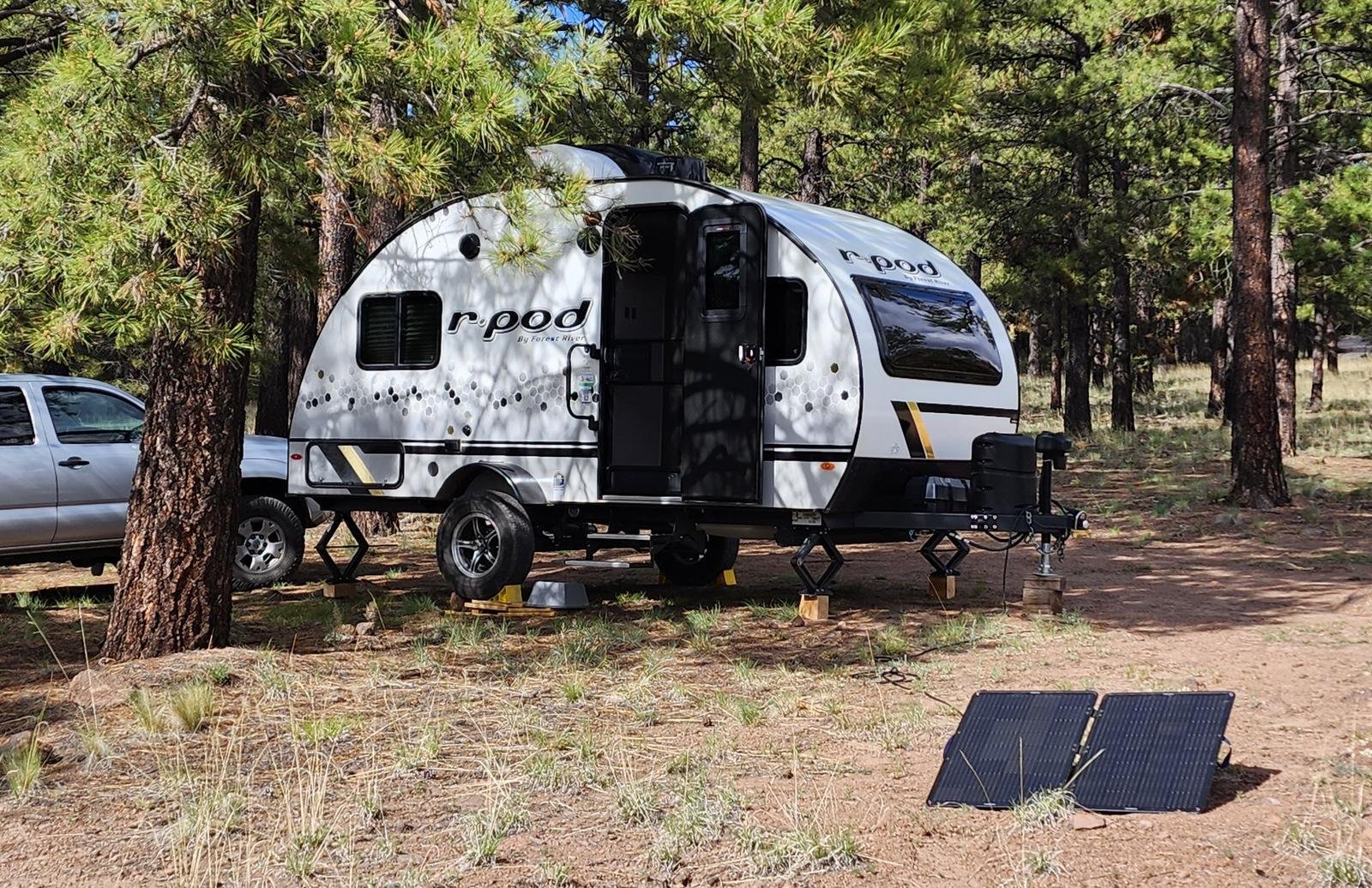 an added benefit – it is located on the edge of Lobo Canyon and thus affords better views than the other campsites.
 This, our first setup outside of an established campground challenged us in maneuvering It was still a challenge to maneuver the R-Pod among trees and rocks to an area relatively level – great experience for future forays.”
This is our new 2023 R-Pod – RP-171. We enjoyed 12 years of great camping and traveling with our 2011 RP-177, but time came for it to be retired. We miss the space of the slideout in the -177, but we are adjusting to this more compact camper – and we like very much the “picture window” in the front which “opens up” the space inside. And a new, larger 100 watt, solar panel.
The Hike
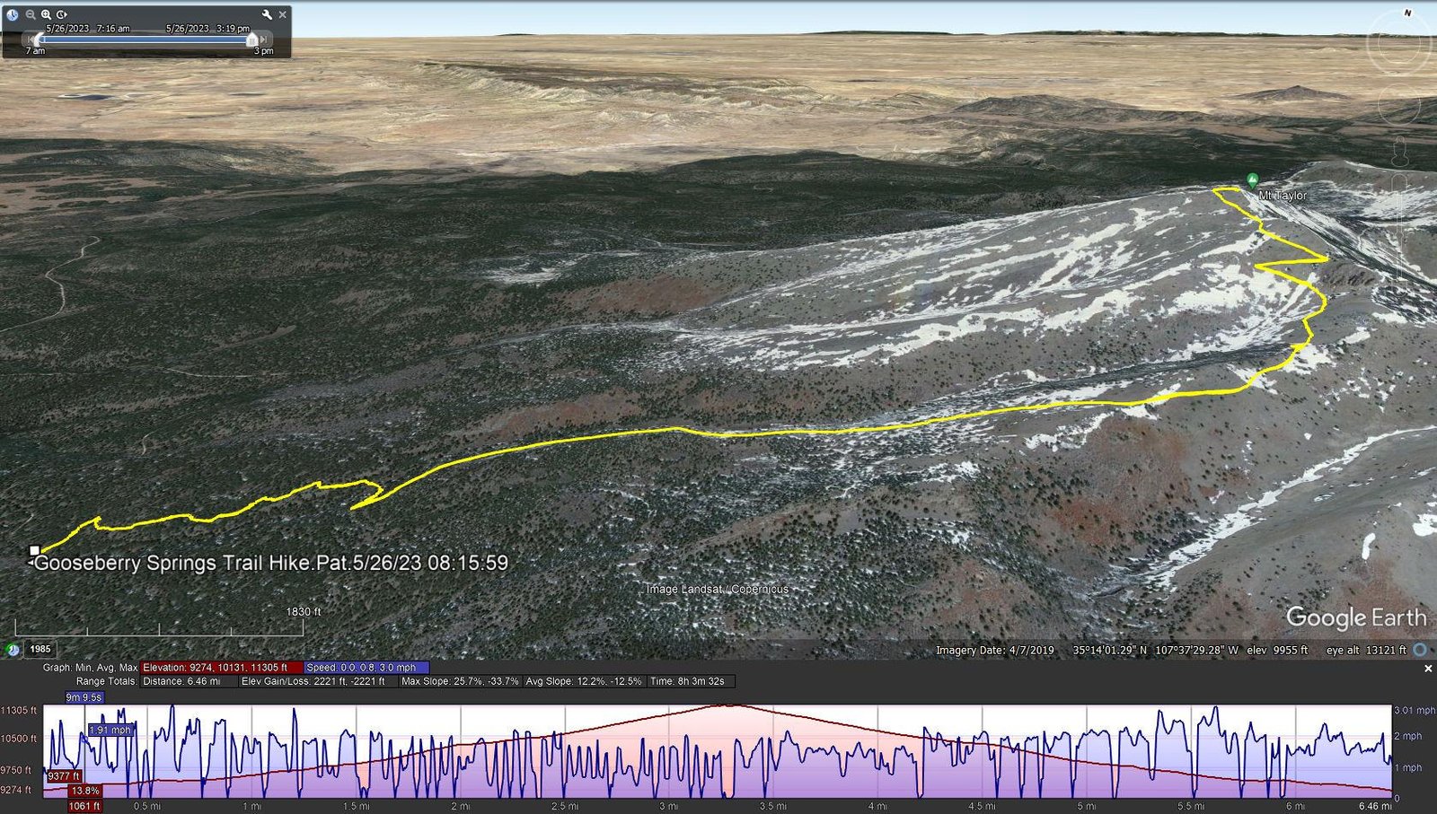
Gooseberry Springs Trail Hike.Pat.2023-05-26
Notes about the Google Earth screenshot: the graph at the bottom shows elevation of the track (pink area) and speed (the blue line).
We “trained” for this hike, walking daily in the Bosque during the winter and hiking up Three Gun Springs during the preceding weeks. This preparation no doubt served us well, but 2,000 feet elevation gain is nonetheless a challenge. The trail is well used, and descriptions of our previous hikes are still accurate.
Weather was perfect for this day’s hike, sunny and cool with some breezy and chilly conditions at the higher elevations. We stopped regularly for brief rests, especially on the steeper sections. We encountered only a couple of other hikers, ‘tho about half way up the open zig-zags approaching the peak, we noted a hiker with a dog following us; she passed us before we reached the peak. It was apparent from her pace and her pack that she was a through-hiker – she confirmed it during our brief conversation.
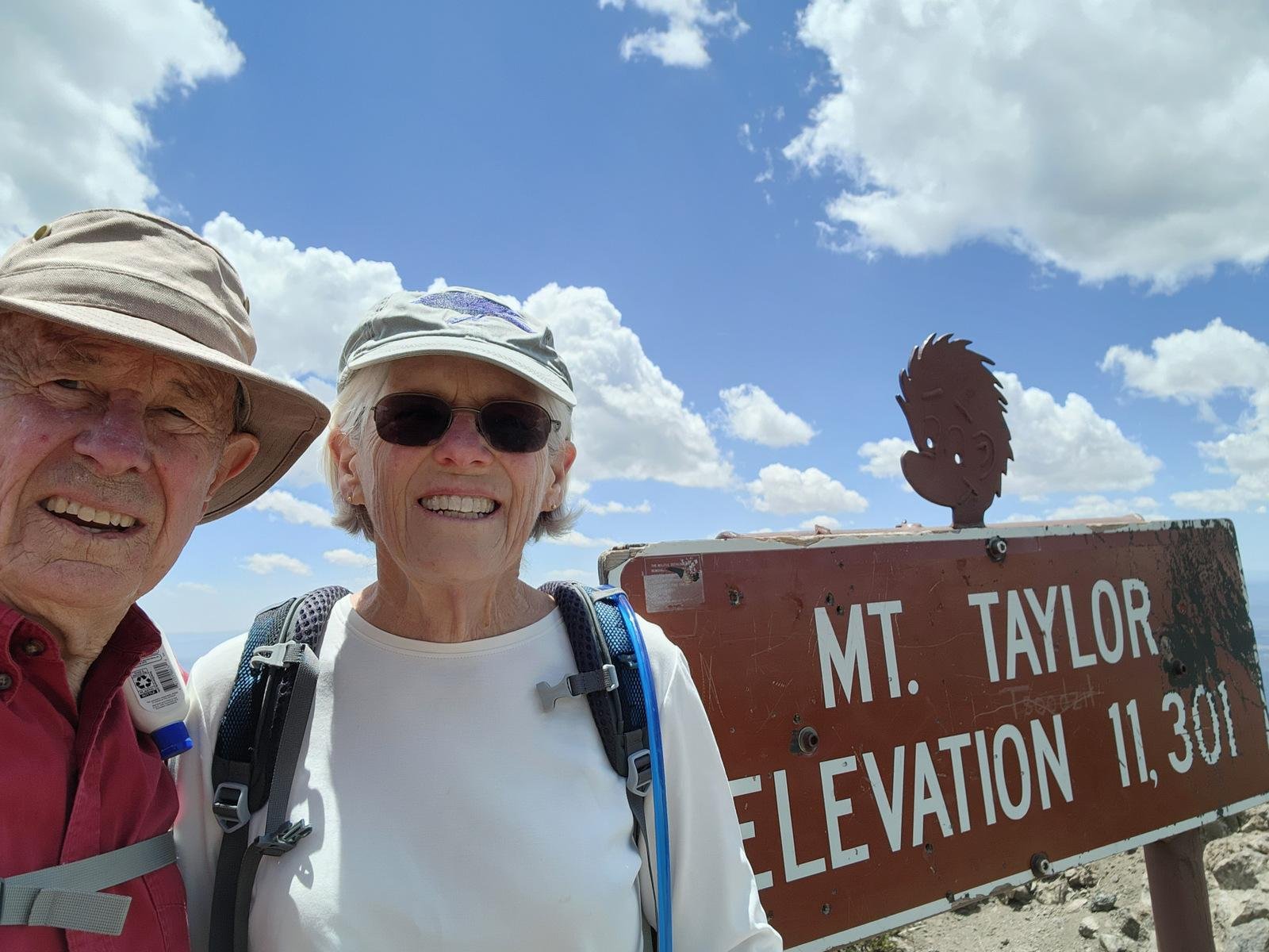 Approaching the peak we passed a couple of snow banks left over from this year’s heavy snow season. Reaching the peak, we took the obligatory selfie to document our arrival, then joined Brittany (trail name Dits) and Mono for lunch and pleasant conversation. As we headed back down the mountain, we wished her well on her journey as a NoBo (NOrth BOund) on the CDT.
This year we chose to return on the trail rather than the alternate routes that we chose on previous hikes. Returning to the R-Pod, we opened a beer and relaxed in the wonderful blue skies and clear air of New Mexico.


Highlight
As a bonus, during this last half of May we can anticipate meeting northbound through-hikers on the Continental Divide Trail. On the our hike in 2021 with Jay and Nancy, we met a couple of through-hikers and a Trail Angel, Cheshire Cat, and enjoyed the company of a through-hiker, trail name NoNo. And again this year, it was great to meet another CDT through-hiker, Dits and her dog Mono, and to share a mid-day meal with them atop Mount Taylor.
In 2021, No-No, gave us the link to her VLOG on YouTube, Jennifer Journeys. We continued to follow her progress up the CDT to Canada – she produced some truly great videos through which she shared her experience. She has published two other series of her adventures on YouTube: Peru 2022 and Mountains to Sea Trail. We hope that she is continuing with the life that she loves, and perhaps publishes VLOGs of more of her adventures. Thank you, Jennifer!
Statistics
Total Distance: 6.46 miles
Elevation: start 9,325 ft, maximum 11,305 ft, minimum 9,274 ft
Gross gain: 2,031 ft. Aggregate ascending 2,221 ft, descending 2,221 ft
Maximum slope: 26%% ascending, 34% descending, 12.4% average
Duration: 8:04
| GPS Track Files for Download | |
375 Downloads | |
|---|---|
188 Downloads | |
If you haven’t explored these hiking tracks with Google Earth, I urge you to try it. With the virtual 3-dimensional presentation, achieved by panning and tilting the view, you can get a much better idea of the hikes and terrain than you can get from the screenshot above. For some ideas, check out Using Google Earth Track Files.
Related Posts
Gooseberry Springs Trail Hike – 05/10/2021
Gooseberry Springs Trail Hike – 06/10/2020
Gooseberry Springs Trail Hike #2- 06/13/2018
Gooseberry Springs Trail Hike – 06/01/2018
References and Resources
A Note: I realize this is a long list of References and Resources, but I found many of them to be interesting, some going beyond just a hike up Mt. Taylor on the Gooseberry Springs Trail. I’ve marked with ** some that I found intriguing.
New References:
** PeakVisor: Cibola National Forest – Mt. Taylor Ranger District (East)
A comprehensive description of Mt Taylor and the region
Continental Divide National Scenic Trail Coalition:
** Day & Overnight Hikes – New Mexico (PDF)
A compendium of descriptions of segments of the CDT in New Mexico
Tsoodzil (Mt. Taylor), Cibola National Forest
** Hike with Gravity: CDT 2021: Day 27, Gooseberry Springs Trail …
This is a post in his BLOG of hiking the CDT – interesting reading.
SummitPost: Gooseberry Springs Trail
** Quincy Koetz: Mt Taylor, New Mexico Winter Hike
Hiking Tom: Mount Taylor – Gooseberry Springs Trail (YouTube, late winter)
Sharing my Suitcase: Mt. Taylor- The Gooseberry Springs Trail
** Overland Mama: Weekend Camping: Cabezon Peak to Mt. Taylor etc
Trip Advisor: Mount Taylor
From Previous Posts:
US Forest Service: Gooseberry Springs Trail
Gooseberry Springs Trailhead
SummitPost: Mount Taylor
AllTrails: Gooseberry Springs and Mount Taylor Loop
Mount Taylor via Gooseberry Trail
ondafring: Day Hike: Mount Taylor
ASCHG: Mount Taylor From Gooseberry Spring Hike
Stav is Lost: Hike Mt. Taylor via Gooseberry Springs Trail (great photos)
Four Corners GeoTourism: Gooseberry Springs Trail – Mt. Taylor
Outdoor Project: Gooseberry Springs Trail to Mount Taylor
Hiking Project: Gooseberry Trail


This sounds like a really enjoyable outing. Meeting and spending some time with other hikers is often a real treat. When I lived in New Mexico the hikes I took with you are some of my most enjoyable memories. I always enjoy reading your Hiking in New Mexico blog and seeing the photos. Keep it up!
Good morning, Vince. Thanks for the comment. I’ve said before – the hikes that I took with you, early introduction to New Mexico’s boondocks, got me started to explore NM myself and with others. Posting these BLOG entries adds a lot to my enjoyment of hiking, even more so to get feedback.
We view Mt Taylor as an annual “to do”; it does require some training to make a go of it; Three Gun Springs is a good training trail. I’m a bit behind for this year’s hikes so far, so more posts will be coming. Best to you and Jan!
BTW: After meeting NoNo 2 years ago, I’ve become intrigued by through-hiking (not so much that I intend to do it myself). But after following NoNo’s VLOG” rel=”noopener” target=”_blank”>NoNo’s VLOG and doing short out-and-back hikes whenever we come across the CDT, I’ve found BLOGs of hikers on the CDT to be most entertaining/interesting. I’m following one now, Jon Carter, who posts on The Trek and shares his GPS track on Garmin. I look forward to following him as he goes north.