 It has been a long time since we last visited the Rio Puerco. I checked out the handful of Wilderness Study Areas (SWAs), looking for something accessible (good road conditions) with interesting geology or at least topography for an easy hike – trail or no trail. Chose La Leña WSA with couple of hiking reports and .. the CDT crosses it. Great drive, and great short hikes
The Drive In
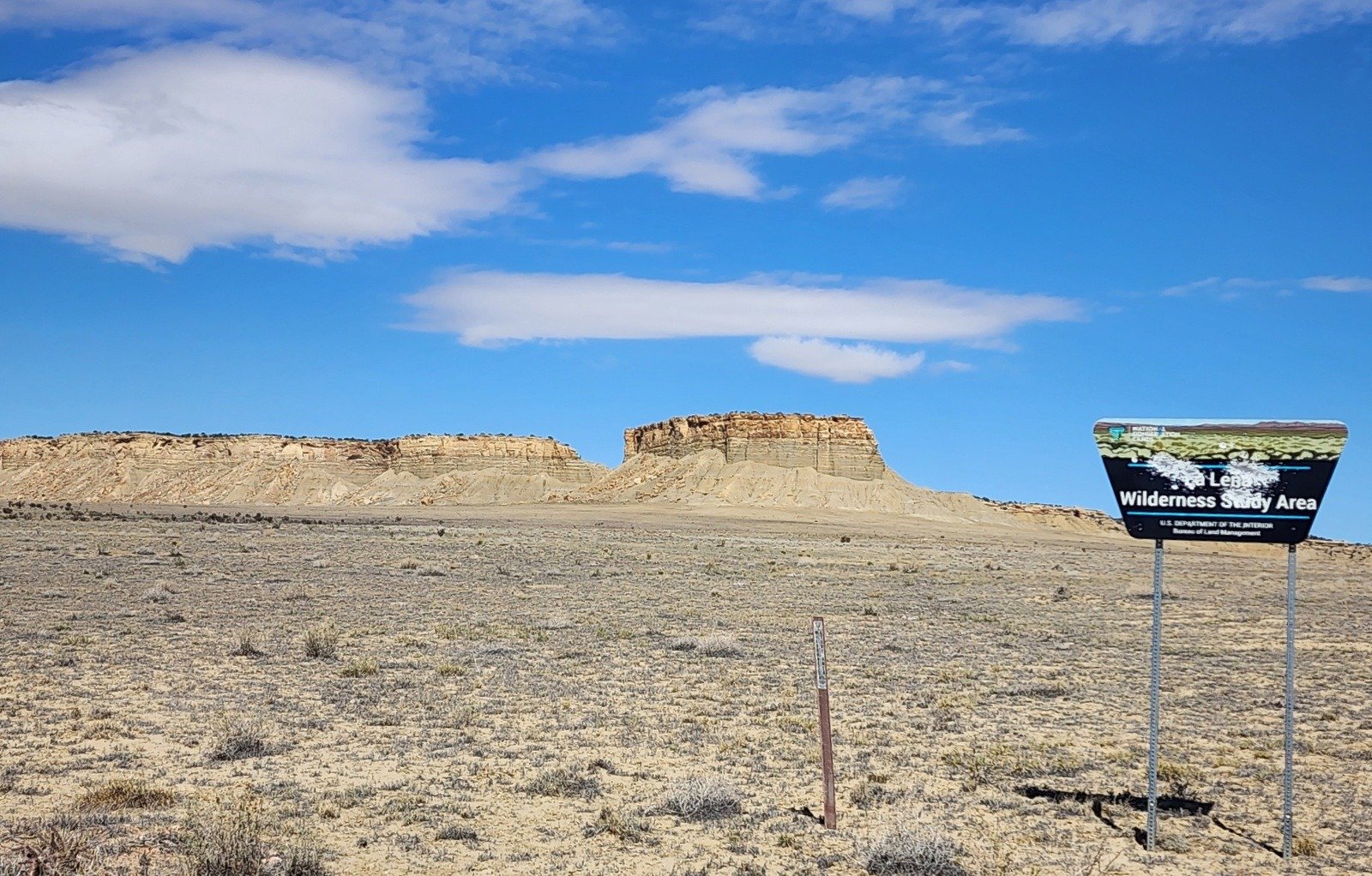
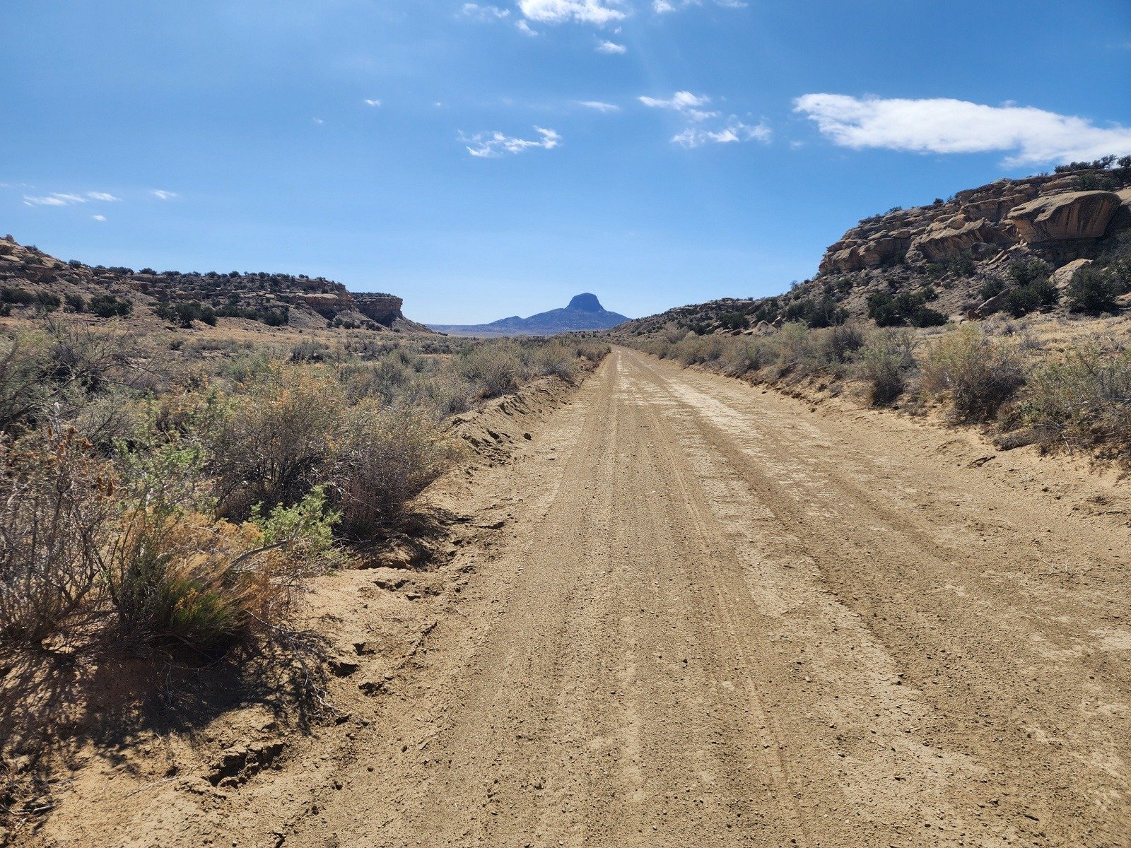
On US 550 from I-25 in Bernalillo, drive north 41.5 miles, turn right at the top of the hill onto CR 279. In 13.8 miles look for a well used dirt road to the right; turn onto a well graded but entrenched road and you are in the La Leña WSA.
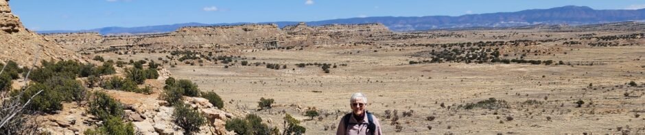
I’ll diverge here – the scenery is amazing, with mesas in every direction, the deep vertical-wall arroyo on our left, and Cabezon behind us (in front of us on the way out).
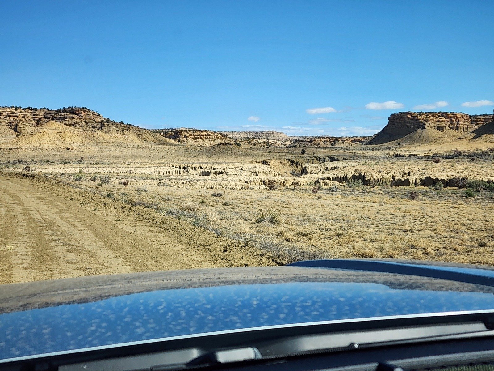
- About 2 mile on you will see the first of three canyons on your left. The trail we chose was the third one, 2.3 miles. Parking is a challenge – we parked the Tacoma on the bank of one of the water diversion ditches to the right of the road.
- After the Canyon hike we continued onward on the road for 2 miles where we spotted cairns marking the Continental Divide Trail (CDT). We pulled half way off the road, checked out the water stash for Through Hikers, then hiked south on the trail.
The Hike – La Leña Canyon
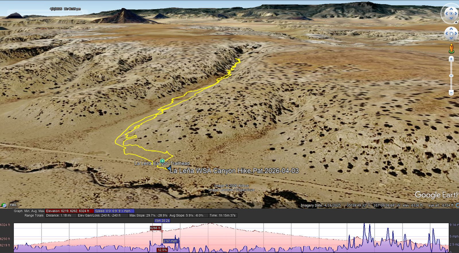
La Lena WSA Canyon Hike.Pat.2026-04-03
Notes about the Google Earth screenshot: the graph at the bottom shows elevation of the track (pink area) and speed (the blue line). Click on the image for a full-screen view.
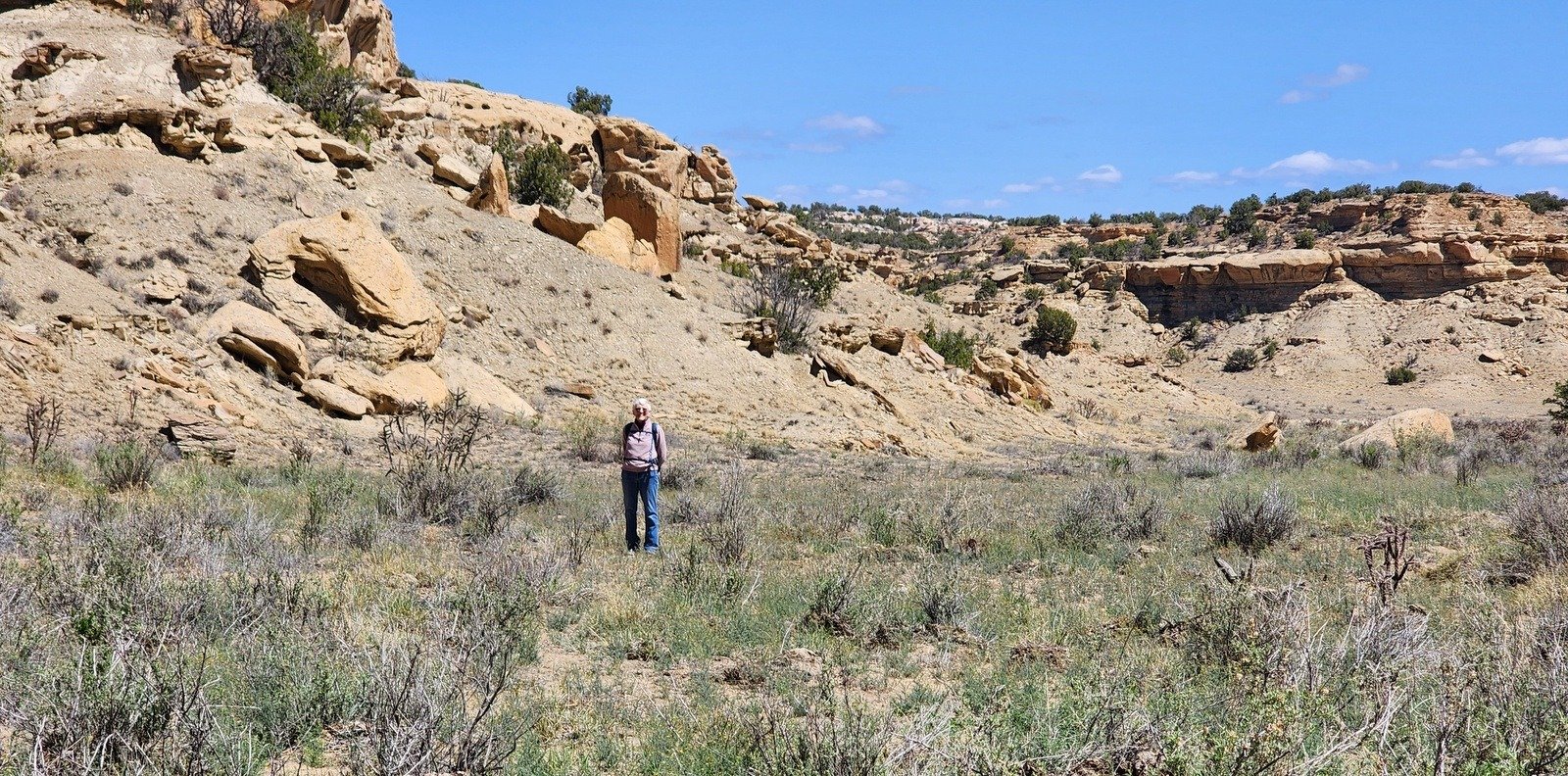
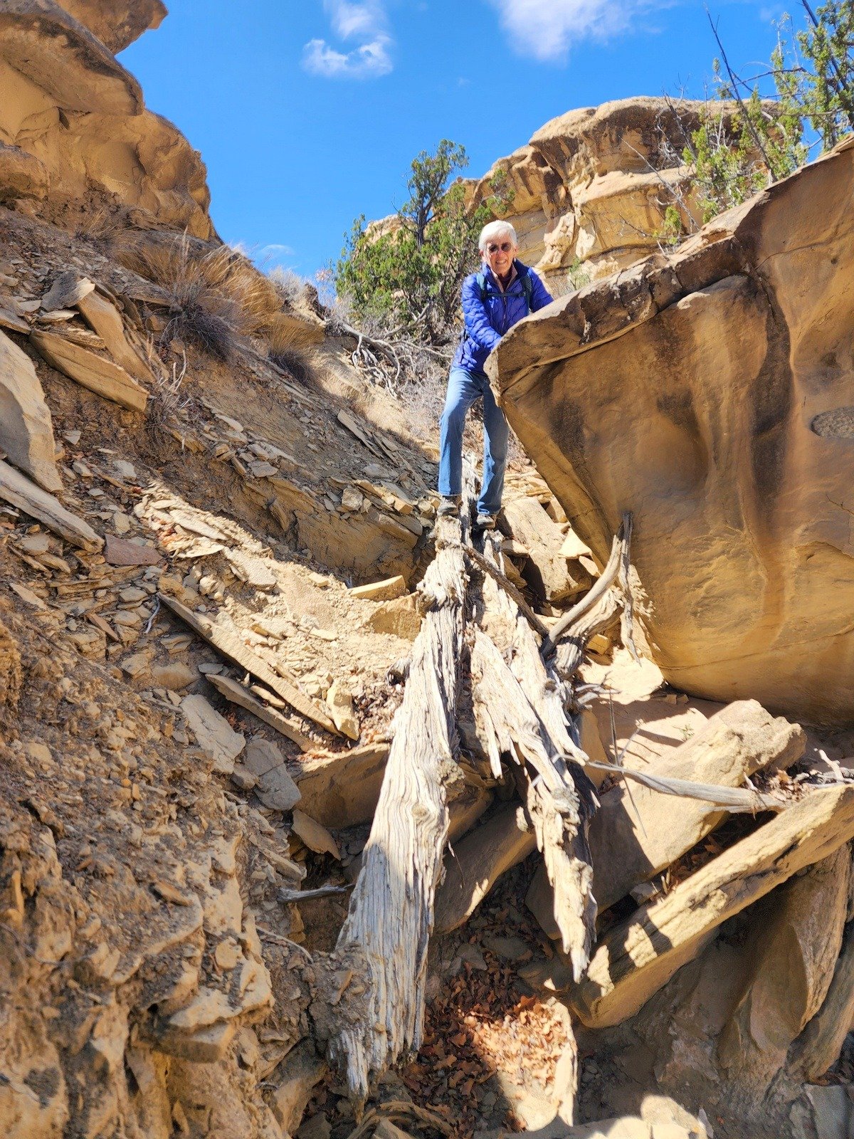
We always enjoy exploring new territory. We had only a GPS track that I found on the web, but we really didn’t need it – round the end of the mesa from where we parked and head up-canyon. At the entrance the canyon was 100+ yards wide with gently sloping edges and easy walking among scattered cholla over firm ground. As we proceeded up the canyon, the it became narrower with ultimately vertical walls and in the bottom some rock outcroppings. I kept an eye out for a way to ascend onto the mesa top, but … continuous vertical walls ruled that out. Nearing a quarter mile into the canyon, the rock outcroppings became more common; a couple were challenging to get past. Ultimately a bit past the half mile mark, we decided we could go no further and turned back.
The Hike – La Leña CDT
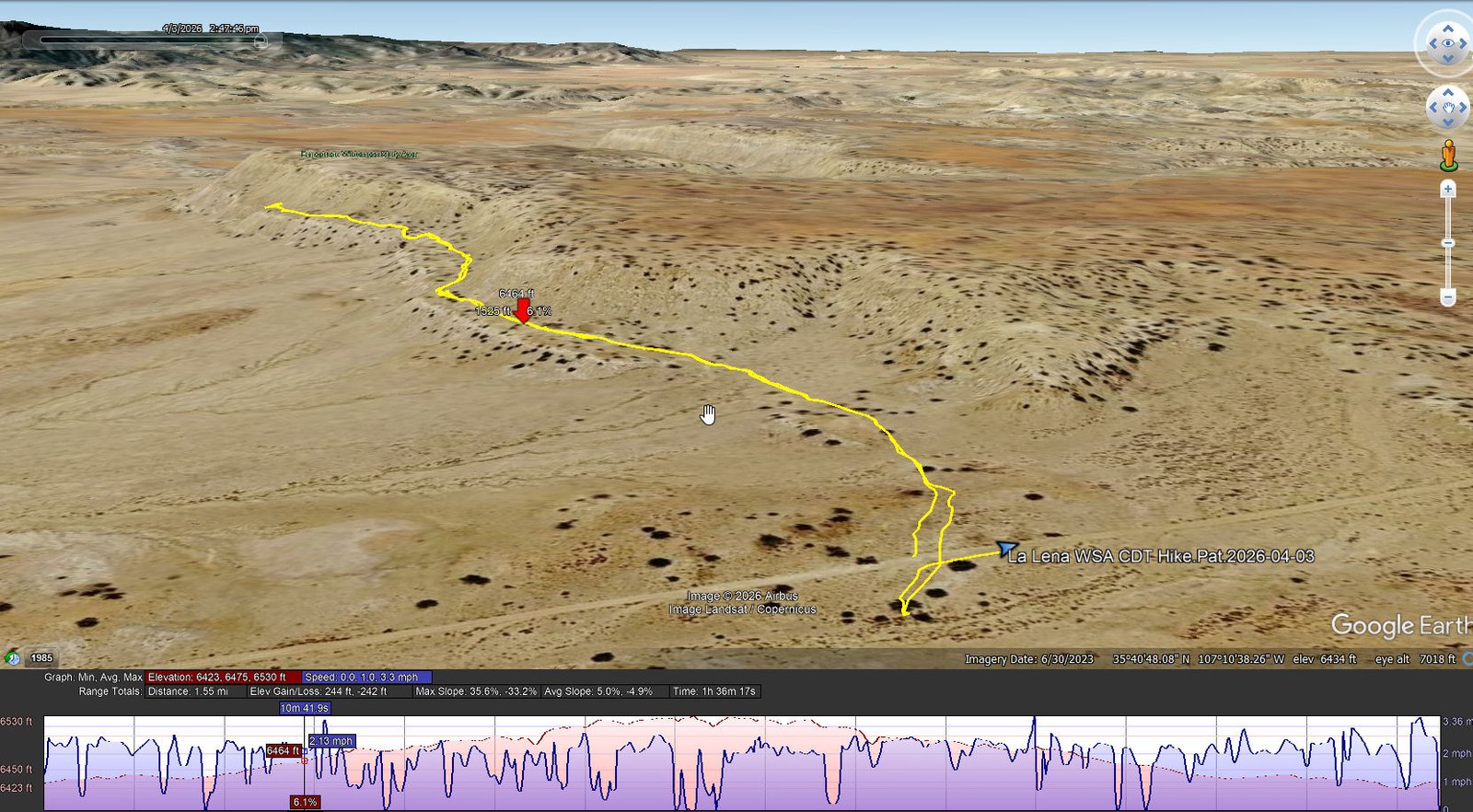
La Lena WSA CDT Hike.Pat.2026-04-03
Notes about the Google Earth screenshot: the graph at the bottom shows elevation of the track (pink area) and speed (the blue line). Click on the image for a full-screen view.
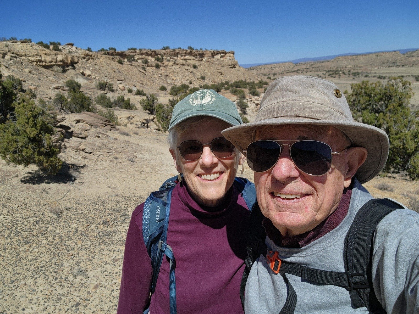
On a hike up Mount Taylor a few years ago we encountered a couple of through-hikers on the Continental Divide Trail. We had lunch with Jennifer atop Mt Taylor and subsequently followed here on her Video BLOG. I’m definitely not up to such an adventure, but since then I take any opportunity to hike a mile or two on the CDT. With it crossing this road in La Leña, we put on our -day- packs and followed the cairns SOBO (through hiker talk for southbound) for about a mile.
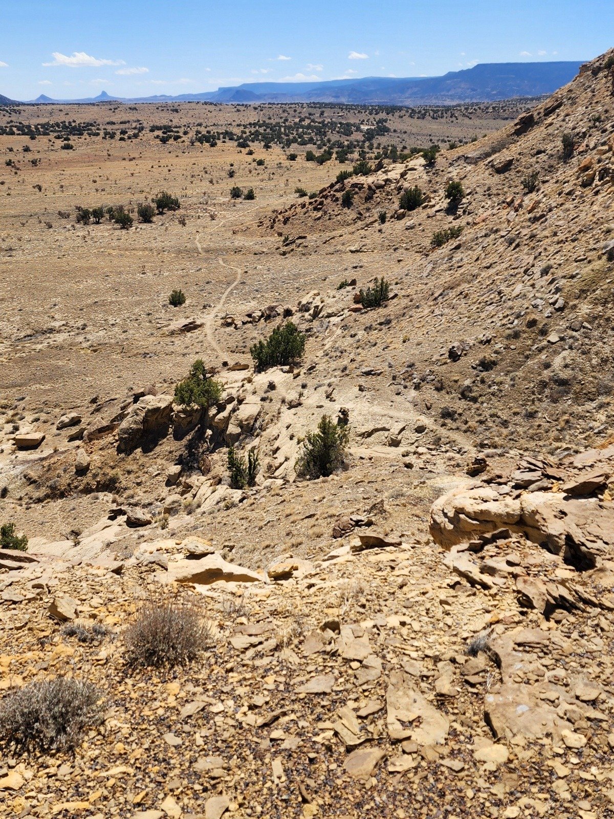 The trail is easy to follow – well used and marked by cairns and signs. It begins on flat terrain but soon climbs up onto a shelf of the adjoining mesa. ‘Tis great scenery with Cabezon and the other volcanic plugs in the Rio Puerco valley, and an easy trail until, that is, it descends down from the shelf to continue across typical New Mexico dry land towards Mesa Chivato and Mount Taylor. This made a very nice short hike, on a very nice day, in scenic New Mexico.
Highlight
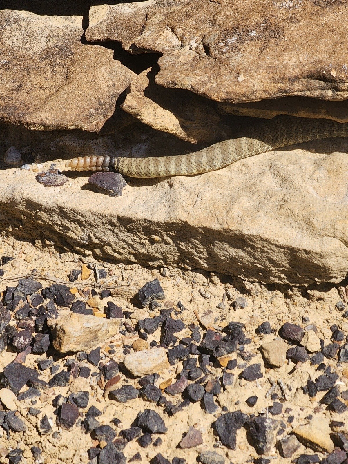
As noted above, the views of the arroyo, mesas, out the horizon are … spectacular. And closer at hand: Mother Nature can be quite a sculptor, and … the sound of a rattle got Pat’s attention – we were able to get a picture before he wiggled entirely into the cairn.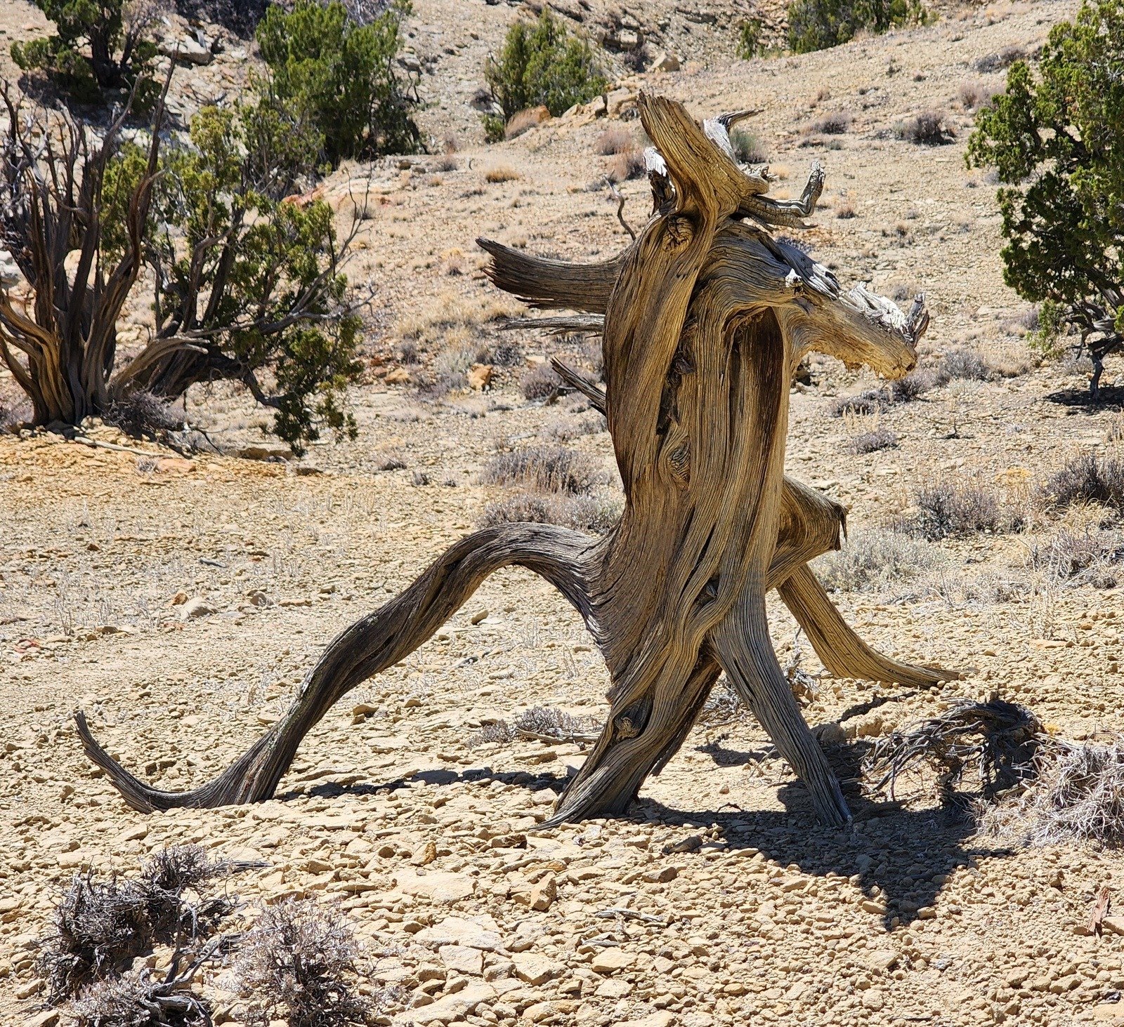
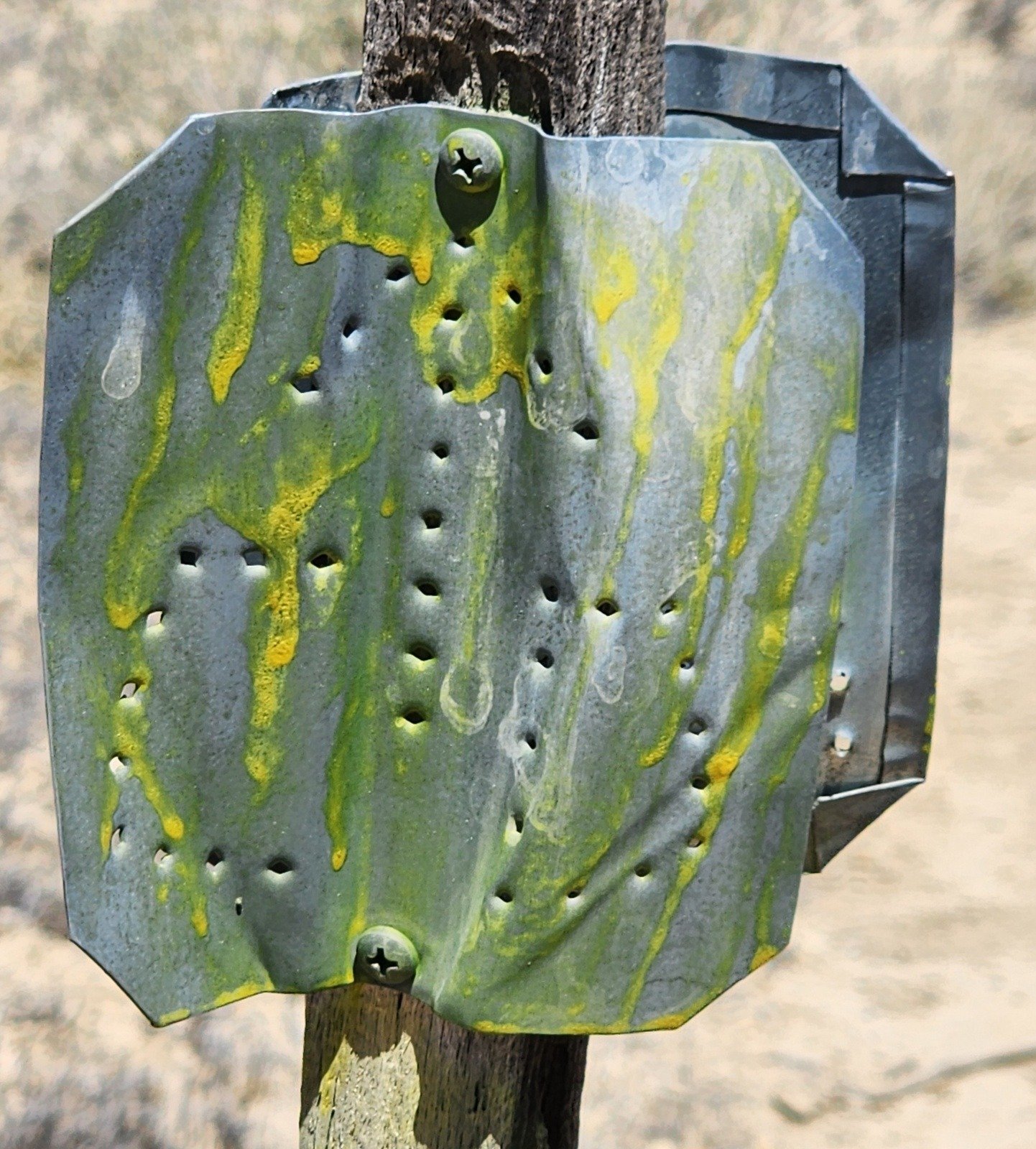
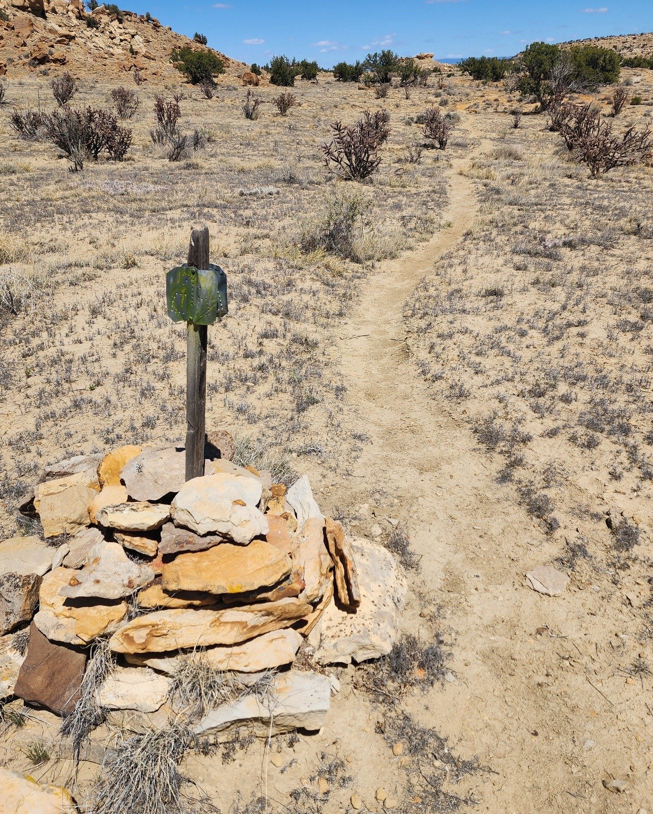
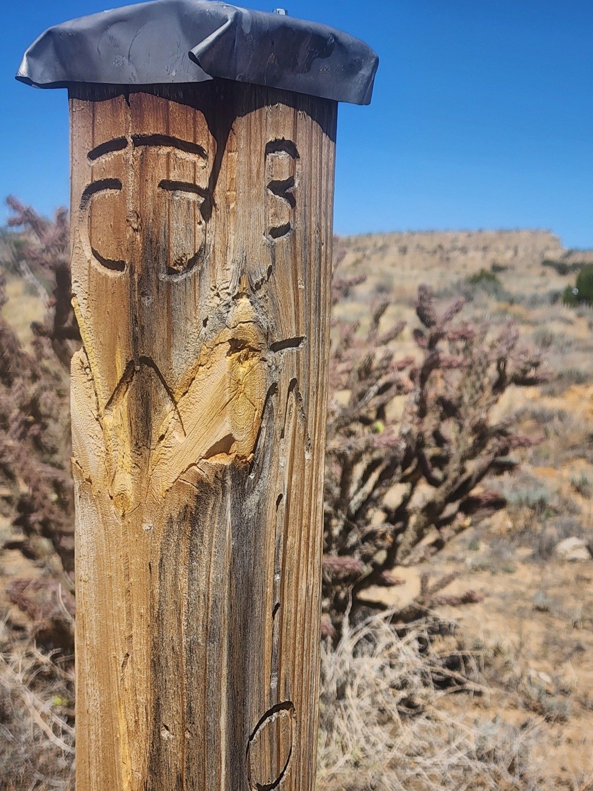 I mentioned signs marking the Trail – interesting and appear to have been marking the trail for many year
Statistics
La Leña WSA Canyon Hike
Total Distance: 1.15 miles
Elevation: start 6.221 ft, maximum 6,324 ft, minimum 6,219 ft
Gross gain: 105 ft. Aggregate ascending 240 ft, descending 240 ft
Maximum slope: 30% ascending, 29% descending, 5.9% average
Duration: 1:18, Average Speed: 0.9 mph, Shade: 10%
La Leña WSA CDT Hike
Total Distance: 1.55 miles
Elevation: start 6,430 ft, maximum 6,530 ft, minimum 6,423 ft
Gross gain: 107 ft. Aggregate ascending 244 ft, descending 242 ft
Maximum slope: 36% ascending, 33% descending, 05.0% average
Duration: 1:36, Average Speed: 2.0 mph, Shade: 0%
| GPS Track Files for Download | |
36 Downloads | |
|---|---|
36 Downloads | |
31 Downloads | |
36 Downloads | |
39 Downloads | |
32 Downloads | |
| If you haven’t explored these hiking tracks with Google Earth, give it a try. With the virtual 3-dimensional presentation, achieved by panning and tilting the view, you can get good idea of the hike and the terrain. For some ideas, check out Using Google Earth Track Files. | |
Related Posts
Cerro Cuate Expedition – 03/03/2020
Rio Puerco East Expedition – 02/14/2018
Cerro de Guadalupe Expedition – 02/03/2014
All Rio Puerco Posts
References and Resources
AllTrails: La Lena Canyon Trail
La Lena Wilderness Study Area
La Lena Wilderness Study Area (map)
Best trails in La Nena Wilderness Study Area
ASCHG: La Leña Southeast Loop Hike
NMHikes: La Leña Wilderness
Hike With Gravity: Day 30, La Lena Wilderness Study Area to Jones Canyon
(great report from “long distance hiker”)
solphoto.net: La Lena Wilderness Study Area Hike
BLM: La Lena Wilderness Study Area – New Mexico
Photos


Views to date: 20 views.
I miss being able to jump in my car and drive 30 minutes to the volcano field. When we hosted out of town guests we always took them for a tour of the mesas and volcanos. What a quiet, peaceful place to hike.